MP weather alert: Hailstorms, thunderstorms to lash 20+ districts through May 10
Synopsis
More than 20 Madhya Pradesh districts are under high alert as the IMD warns of hailstorms, thunderstorms, and 80 km/h wind gusts persisting through 10 May 2026. Hailstorms have already been confirmed in Morena, Shivpuri, and Chhatarpur, driven by a Western Disturbance over northwest Uttar Pradesh and a trough stretching deep into central India.
Key Takeaways
The IMD has issued a high-alert bulletin for Madhya Pradesh covering 8–10 May 2026 .
Hailstorms were confirmed in Morena , Shivpuri , and Chhatarpur ; wind gusts reached 80 km/h in Sagar .
Badarwas recorded the highest rainfall at 16 mm ; Patharia and Majhgaon each received 12 mm .
High-alert districts for 8–9 May include Datia , Bhind , Chhindwara , Tikamgarh , Niwari , and Pandhurna , with gusts of 50–60 km/h .
Warnings shift to Betul , Anuppur , Chhindwara , and Seoni for 9–10 May .
Farmers are advised to stake or harvest standing crops; residents urged to stay indoors during lightning.
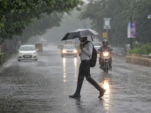
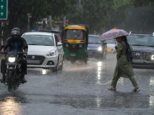
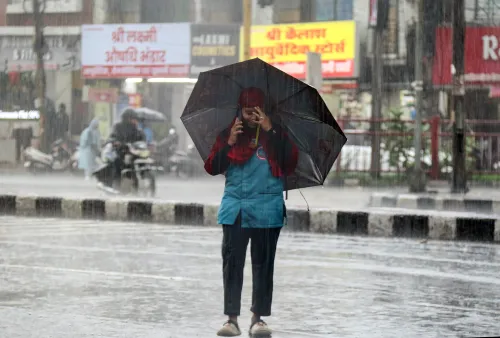
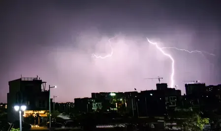
The India Meteorological Department (IMD) has issued a high-alert weather bulletin for Madhya Pradesh, warning of hailstorms, thunderstorms, and lightning expected to persist across more than 20 districts through 10 May 2026. The advisory, issued on 8 May 2026 from Bhopal, describes a complex atmospheric system driving intense wind gusts and heavy rainfall across the state's northern, central, and eastern belts.
Current Conditions and Rainfall Recorded
In the 24 hours leading up to the morning of 8 May, rainfall and thunderstorms were reported across a wide swathe of districts including Bhind, Morena, Gwalior, Datia, Shivpuri, Sheopur Kalan, Tikamgarh, Chhatarpur, Panna, Satna, Rewa, Sagar, Damoh, Katni, Jabalpur, Betul, Chhindwara, Pandhurna, Mandla, and Anuppur. Badarwas recorded the highest rainfall at 16 mm, followed by Patharia and Majhgaon at 12 mm each. Actual hailstorms were confirmed in Morena, Shivpuri, and Chhatarpur. Wind gusts reached 80 km/h in Sagar and 67 km/h in Ashoknagar.
High-Alert Districts: May 8–9
Between 8 May and 9 May, districts including Datia, Bhind, Chhindwara, Tikamgarh, Niwari, and Pandhurna face the highest risk, with thunderstorms, lightning, hailstorms, and wind gusts of 50 to 60 km/h forecast. Neighbouring districts — Gwalior, Morena, Rewa, Jabalpur, and Sagar — are also on alert, with slightly lower wind speeds of 40 to 50 km/h expected.
Forecast Shifts South and East: May 9–10
As the weather system moves, warnings for 9 to 10 May shift focus towards the southern and eastern belts, specifically affecting Betul, Anuppur, Chhindwara, and Seoni. This is consistent with how Western Disturbance-driven systems typically track eastward across central India before weakening. The current instability is being driven by a Western Disturbance persisting as a cyclonic circulation over northwest Uttar Pradesh and adjoining Uttarakhand, compounded by multiple troughs moving across central India — including one stretching from Comorin to southwest Madhya Pradesh — creating significant wind discontinuities at lower atmospheric levels.
Safety Guidelines and Advisories
Given the potential for damage to crops, livestock, and weak structures, authorities have issued detailed safety guidelines. Farmers are urged to monitor standing crops, provide staking where necessary, and prioritise harvesting if crops are ready for storage. The public is advised to remain indoors during lightning strikes, avoid sheltering under trees, and unplug electronic devices to prevent surge damage. A health advisory has also been issued, flagging an increased risk of seasonal illnesses such as influenza during erratic weather, and encouraging citizens to maintain immunity through vitamin-rich diets.
What to Watch
The IMD has indicated it will continue monitoring these synoptic systems closely and issue updated warnings as conditions evolve. Residents in high-alert districts are urged to stay tuned to official bulletins, particularly through the evening and overnight hours of 8–9 May, when storm activity is expected to peak.
Point of View
Specifying wind speeds by zone, and appending a health advisory — suggesting forecasters are treating this as a multi-day, high-impact event rather than a routine pre-monsoon squall. What the bulletin does not quantify is crop loss exposure, which in districts like Morena and Shivpuri — major wheat and soybean belts — could be significant if hailstorms coincide with late-harvest standing crops. The Western Disturbance-plus-trough combination driving this system is increasingly common in May as climate patterns shift the pre-monsoon storm window earlier. Authorities would do well to activate district-level disaster response teams proactively rather than waiting for damage reports to come in.
NationPress
22 Jun 2026
Frequently Asked Questions
Which Madhya Pradesh districts are under high alert for hailstorms in May 2026?
Districts under the highest alert for 8–9 May include Datia, Bhind, Chhindwara, Tikamgarh, Niwari, and Pandhurna, with wind gusts of 50–60 km/h forecast. Gwalior, Morena, Rewa, Jabalpur, and Sagar are also on alert with slightly lower wind speeds of 40–50 km/h.
What is causing the severe weather in Madhya Pradesh?
The severe weather is being driven by a Western Disturbance persisting as a cyclonic circulation over northwest Uttar Pradesh and adjoining Uttarakhand, combined with multiple troughs moving across central India, including one stretching from Comorin to southwest Madhya Pradesh.
How much rainfall has been recorded so far?
Badarwas recorded the highest rainfall at 16 mm in the 24 hours leading up to 8 May 2026, followed by Patharia and Majhgaon at 12 mm each. Hailstorms were confirmed in Morena, Shivpuri, and Chhatarpur.
What safety precautions has the IMD advised?
Residents are advised to stay indoors during lightning, avoid sheltering under trees, and unplug electronic devices to prevent surge damage. Farmers are urged to stake standing crops or prioritise harvesting if crops are ready for storage.
When will the severe weather in Madhya Pradesh end?
The IMD has issued warnings through 10 May 2026, with storm activity expected to shift to the southern and eastern districts — Betul, Anuppur, Chhindwara, and Seoni — between 9 and 10 May. The department has stated it will provide updated bulletins as conditions evolve.