MP thunderstorm alert: Bhopal, Jabalpur, Raisen brace for hail and 60 kmph winds

Synopsis
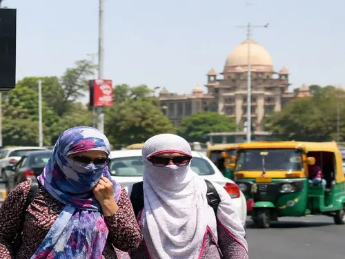
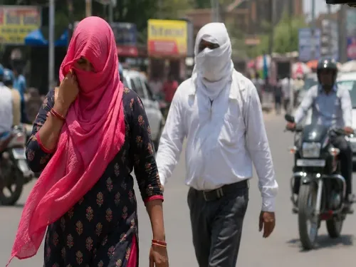
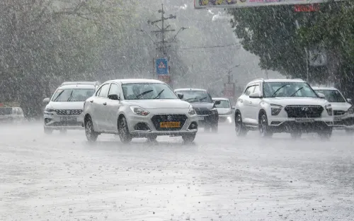
After days of scorching heatwave conditions, Madhya Pradesh is set for a dramatic weather reversal — with IMD issuing thunderstorm, lightning, and hail warnings for dozens of districts. Raisen, Sanchi, and Bhimbetka face the most intense activity, with gusts up to 60 kmph expected, even as temperatures briefly climb before a multi-day cooling begins.
Key Takeaways
IMD Bhopal issued a thunderstorm watch on 2 May for several Madhya Pradesh districts, signalling a break from the recent heatwave.
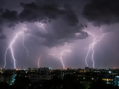
Raisen , Sanchi , and Bhimbetka face moderate to intense thunderstorms with hail and wind speeds up to 60 kmph .
Light thunderstorm alerts cover Bhopal , Gwalior , Jabalpur , Rewa , and over 20 other districts .
Maximum temperature hit 43.2°C in Raisen ; rainfall of 8.6 mm already recorded in Panagar .
Temperatures expected to rise 2°C in 48 hours before dropping 2–3°C over the following three days.
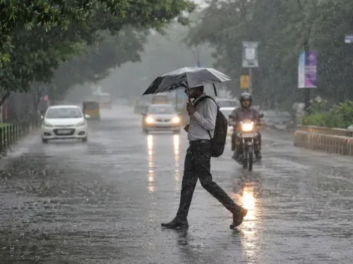
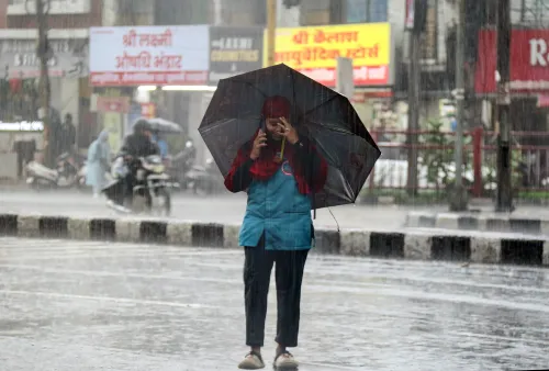
Residents advised to stay indoors during lightning and secure loose structures against wind damage.
Several districts of Madhya Pradesh are bracing for thunderstorms, lightning, hail, and gusty winds over the coming days, as the state transitions away from a prolonged dry spell and heatwave, the India Meteorological Department (IMD)'s Bhopal centre said on 2 May. The shift is being driven by multiple cyclonic circulations and troughs extending from Rajasthan to the northeast.
Key Weather Drivers
According to IMD Bhopal, significant atmospheric changes are now influencing the region. Multiple cyclonic circulations and an active trough stretching from Rajasthan toward the northeast are the primary triggers behind the anticipated weather shift. These systems are expected to bring unsettled conditions across a wide swathe of the state, particularly during afternoon and evening hours.
Districts Under Thunderstorm Watch
A light thunderstorm watch with wind speeds up to 40 kmph has been issued for Bhopal, Bairagarh, Gwalior, Datia, Ratangarh, Shajapur, Sehore, and Damoh. In the eastern and southern belts, Jabalpur, Bhedaghat, Katni, Umaria, Bandhavgarh, Seoni, Balaghat, Mandla, Kanha, and Anuppur are also included. Additionally, Rewa, Mauganj, Sidhi, Niwari, Orchha, and Tikamgarh are likely to witness light thunderstorm activity accompanied by lightning.
More intense conditions are forecast for Raisen, Sanchi, and Bhimbetka, where moderate to intense thunderstorms with lightning, hail, and wind speeds reaching up to 60 kmph are expected. Guna, Vidisha, Udayagiri, Ashoknagar, Sagar, Rajgarh, and Narsinghpur could see moderate to light thunderstorms with lightning, hail, and gusts peaking at around 50 kmph.
Current Temperature and Rainfall Data
Maximum temperatures have already reached 43.2 degrees Celsius in Raisen, while the lowest minimum temperature of 15.8 degrees Celsius was recorded in Damoh. Over the past 24 hours, rainfall has been recorded at isolated locations across the Shahdol, Chambal, Jabalpur, and Sagar divisions. Notable totals include 8.6 mm in Panagar and 8 mm in Sleemanabad.
Temperature Outlook and Safety Advisory
Looking ahead, maximum temperatures are forecast to rise by approximately 2 degrees Celsius over the next 48 hours, before a gradual cooling trend sets in. Temperatures are then expected to drop by 2 to 3 degrees Celsius over the subsequent three days. Authorities have advised residents to remain indoors during lightning activity and to secure loose structures to prevent wind damage. This pattern of a brief heat spike followed by a thunderstorm break is consistent with pre-monsoon weather behaviour seen across central India in May.
Point of View
Suggesting a state-wide atmospheric reset rather than localised convection. The hail risk in Raisen and surrounding areas is worth watching closely — unseasonal hail at this stage can damage standing wheat and other rabi crops yet to be harvested in parts of MP, a dimension the weather advisory does not explicitly address but farmers will feel acutely.
NationPress
20 Jun 2026
Frequently Asked Questions
Which Madhya Pradesh districts are under thunderstorm alert on 2 May 2025?
IMD Bhopal has placed dozens of districts under alert, including Bhopal, Gwalior, Jabalpur, Raisen, Sagar, Rewa, Datia, Seoni, Balaghat, and Tikamgarh, among others. The most intense activity — with hail and winds up to 60 kmph — is forecast for Raisen, Sanchi, and Bhimbetka.
What is causing the thunderstorms in Madhya Pradesh?
Multiple cyclonic circulations and a trough extending from Rajasthan to the northeast are driving the atmospheric change, according to IMD Bhopal. These systems are disrupting the dry, heatwave conditions that prevailed across the state in recent days.
How severe is the weather expected to be in MP?
Severity varies by district. Raisen, Sanchi, and Bhimbetka face moderate to intense thunderstorms with hail and gusts up to 60 kmph. Guna, Vidisha, and Sagar may see moderate to light storms with winds around 50 kmph, while Bhopal, Gwalior, and Jabalpur are under a lighter 40 kmph watch.
What is the temperature forecast for Madhya Pradesh in the coming days?
Maximum temperatures are expected to rise by about 2 degrees Celsius over the next 48 hours before a gradual cooling sets in, with temperatures likely to fall by 2 to 3 degrees Celsius over the three days that follow.
What precautions have authorities advised for MP residents?
Authorities have advised residents to remain indoors during lightning activity and to secure loose structures to prevent wind damage, particularly in districts facing moderate to intense thunderstorm conditions.