Severe Winds and Thunderstorms Strike Madhya Pradesh; IMD Issues Yellow Alert

Synopsis
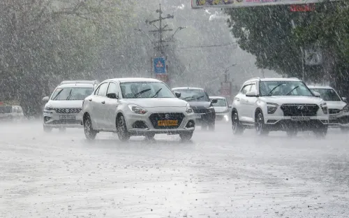
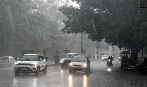
On March 20, strong gusty winds and thunderstorms impacted Madhya Pradesh, leading to crop damage and prompting the IMD to issue a yellow alert. Residents are advised to stay indoors as unstable weather conditions persist.
Key Takeaways
74 km/h wind speed recorded in Agar district.
Thunderstorms may cause damage to crops.
IMD warns residents to stay indoors.
Cyclonic circulation linked to weather activity.
Forecast includes possible light to moderate rainfall.
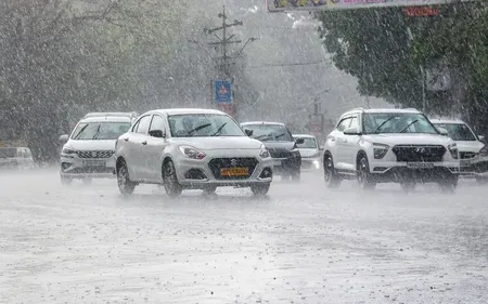
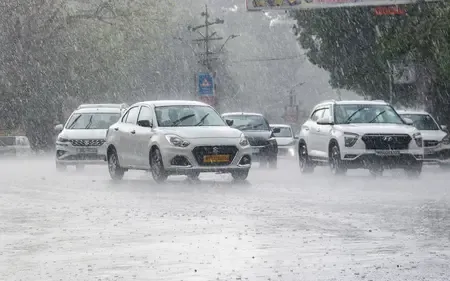
Bhopal, March 20 (NationPress) Intense gusty winds swept through various regions of Madhya Pradesh on Friday, with the India Meteorological Department (IMD) Bhopal center measuring a peak wind speed of 74 km/h in Agar district.
These winds and accompanying thunderstorms have reportedly caused damage to wheat crops in multiple areas across the state.
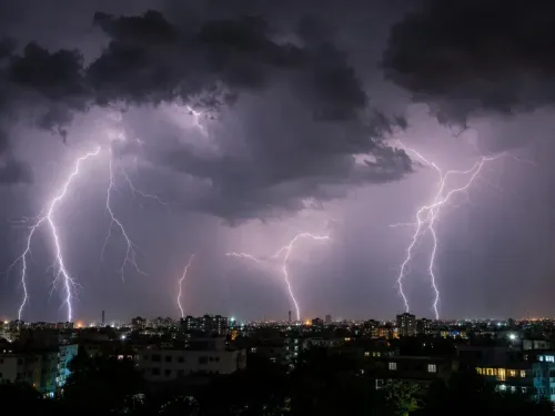
The IMD's Meteorological Centre in Bhopal has issued a new alert warning of thunderstorms, along with lightning and potential hailstorms, affecting various parts of Madhya Pradesh in the next 24 hours.
On Friday, the IMD Bhopal center indicated that unstable weather conditions are likely to result in isolated to scattered thunderstorms and lightning, with hail expected in some areas.
Sehore reported wind speeds of 54 km/h, while Badwani recorded 46 km/h. Alirajpur saw 43 km/h, Indore airport 41 km/h, Bhopal city 39 km/h, Pachmarhi 37 km/h, and both Dhar and Ujjain at 35 km/h each. Ashoknagar registered 33 km/h, Rajgarh 31 km/h, and Vidisha 26 km/h.
In eastern Madhya Pradesh, Narsinghpur recorded 46 km/h, with Jabalpur airport and Katni both at 41 km/h. Sagar noted 39 km/h, while Chitrakoot recorded 30 km/h.
These strong winds coincided with a new thunderstorm alert from the Meteorological Centre, Bhopal.
The department has indicated that moderate thunderstorms with lightning and hail are expected in Seoni and Sheopur Kalan districts.
Light thunderstorms with lightning activity are anticipated over Guna, southern Gwalior, eastern Rajgarh, Ashoknagar, Mandla, Raisen (including Sanchi and Bhimbetka), Shivpuri, Morena, Jabalpur (including the airport and Bhedaghat), Katni, Vidisha (including Udayagiri), Bhopal (including Bairagarh airport), northern Sagar, and Mauganj during the evening hours.
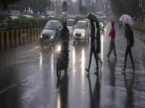
Farmers are advised to safeguard their livestock and delay outdoor activities.
The weather changes are attributed to a persistent cyclonic circulation and trough in the region, which is expected to induce scattered thunderstorm activity across central and eastern Madhya Pradesh in the approaching hours.
The IMD has encouraged the public to follow safety protocols and stay informed through official updates.
While no significant rainfall is predicted at this stage, the combination of gusty winds and lightning poses an immediate threat in the affected districts.
The situation is under close observation, with further updates to be provided as the weather system develops.
A cyclonic circulation over southwestern Rajasthan and nearby areas, along with an associated trough, is primarily responsible for the expected weather activity.
The IMD center has placed districts including Bhopal, Sehore, Raisen, Vidisha, Guna, Ashoknagar, Shivpuri, among others in central and western Madhya Pradesh under a yellow warning.
Officials have urged residents to refrain from going outdoors during severe weather conditions.
The five-day forecast from March 20 to 24 indicates a continued likelihood of light to moderate rainfall at isolated to scattered locations across many districts.
A new, weak Western Disturbance is anticipated to approach northwest India starting March 22, potentially bringing additional moisture and altering the weather conditions further.
Point of View
It is evident that the recent weather events in Madhya Pradesh pose substantial risks to both agriculture and public safety. The IMD's proactive alerts are crucial for minimizing potential harm and ensuring that residents are well-informed.
NationPress
24 Jun 2026
Frequently Asked Questions
What regions in Madhya Pradesh were affected by the winds?
Several regions, including Agar, Sehore, Badwani, and Bhopal, experienced strong gusty winds.
What precautions should residents take during this weather?
Residents are advised to stay indoors, protect livestock, and postpone outdoor activities.
Is any significant rainfall expected in the coming days?
While no major rainfall is forecasted, light to moderate rainfall may occur in isolated areas.
What is the cause of this severe weather?
The severe weather is linked to a cyclonic circulation and trough over the region.
What alerts have been issued by the IMD?
The IMD has issued a yellow alert for multiple districts, warning of thunderstorms and possible hail.