Is Predictive Technology Vital for Disaster Preparedness in the Northeast?
Synopsis
Mizoram's Governor, General Vijay Kumar Singh (Retd), asserted the critical role of predictive technology in addressing the Northeast's unique climatic challenges. With innovations in remote sensing and IoT, the region can enhance disaster preparedness and bolster economic growth through sustainable practices.
Key Takeaways
Predictive technology is essential for disaster preparedness in the Northeast.
Modern tools can forecast landslides and monitor river levels.
The region has immense potential in renewable energy and agro-forestry.
Enhanced civil-military collaboration is crucial for security and disaster response.
A unified geospatial platform can drive sustainable growth.
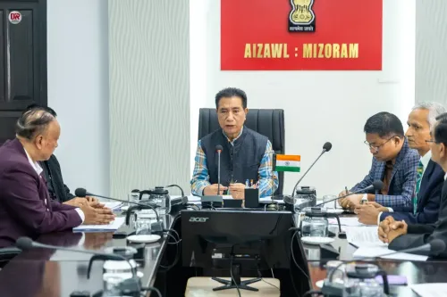
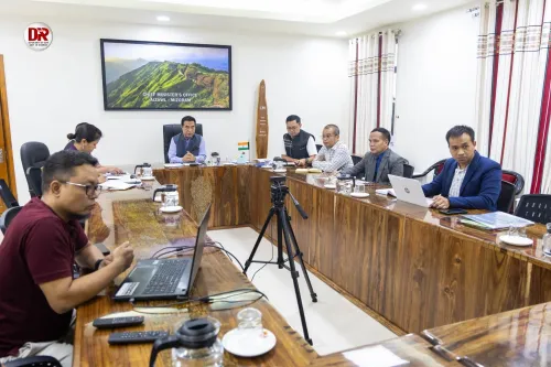
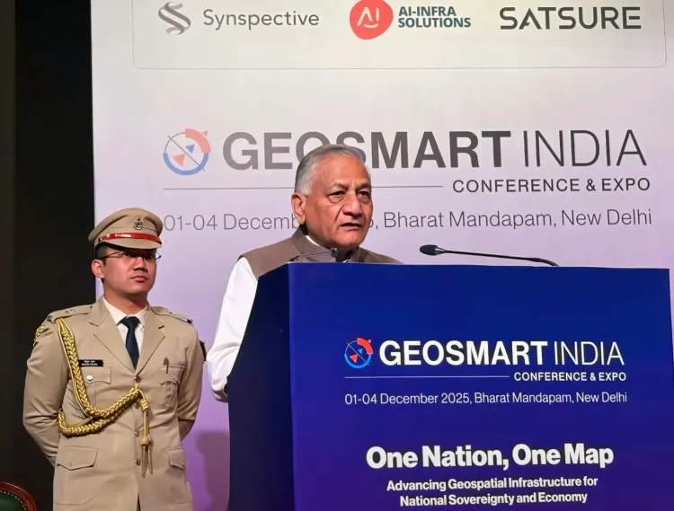
New Delhi, Dec 3 (NationPress) The Governor of Mizoram, General Vijay Kumar Singh (Retd), emphasized that the unique climatic conditions of the Northeast, characterized by frequent landslides, cloudbursts, prolonged monsoon seasons, and significant seismic activity, render predictive technology essential.
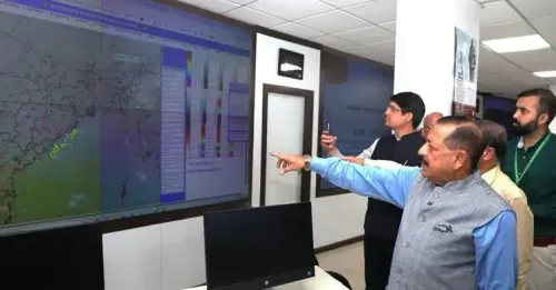
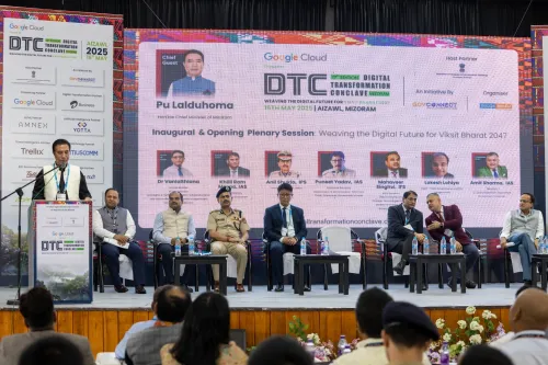
During his speech at the North East Conclave held in New Delhi as part of the GeoSmart World Conference & Expo 2025, the Governor highlighted that utilizing modern remote sensing satellites, Doppler radars, hydrological models, and IoT sensors can enable the region to predict landslides up to 72 hours in advance, monitor river levels instantaneously, and provide early warnings that effectively reach the public and security personnel.
"Technology has transcended from being a luxury to becoming the cornerstone of a climate-resilient future for the Northeast," he stated.
General Singh (Retd) also drew attention to the strategic significance of Mizoram's borders with Bangladesh and Myanmar, emphasizing that advanced connectivity and secure border management through drones, sensors, integrated surveillance, and robust communication systems are vital for tackling illegal activities, enhancing disaster response, and aiding security forces in challenging terrains.
He pointed out Mizoram's immense potential in sectors such as agro-forestry, bamboo processing, renewable energy, ecotourism, horticulture, and traditional crafts, asserting that technology can be a catalyst for sustainable economic advancement.
The Governor noted that precision agriculture, soil health mapping, yield forecasting, and spatial planning can mitigate reliance on shifting cultivation and bolster long-term ecological stability.
He outlined prospective pathways for the region, stressing the requirement for a collective geospatial platform across the Northeast, the development of a robust indigenous drone ecosystem, and extensive skill development in GIS, remote sensing, AI-driven terrain analytics, UAV operations, and climate modeling.
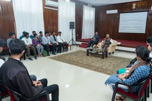
General Singh (Retd) urged for enhanced civil-military partnerships, greater engagement from academic institutions and startups, and encouragement for the youth to pursue technology-focused careers.
With a heartfelt sentiment, he remarked that professionals from all over India should invest time in the Northeast, "a region where the air is pure, the skies are clear, and opportunities abound."
"Mizoram and the Northeast are not merely landscapes of hills and valleys; they represent realms of vast potential. With wisdom, compassion, and a visionary approach to technology, we can forge a future that is resilient, sustainable, secure, and prosperous for generations to come," he affirmed.
He noted that the past 11-12 years have witnessed a significant transformation, with unprecedented efforts aimed at bridging infrastructural deficits and integrating the region into India's broader development narrative.
To illustrate the scale of progress, the Governor recounted the story of Mizoram's railway project, initiated in 2015, which successfully established railway connectivity to Aizawl, showcasing the complexity of the terrain and the determination behind transformative change.
"Such engineering feats were previously unimaginable and reflect our commitment to ensure that the Northeast evolves beyond its historical limitations," he remarked.
General Singh (Retd) highlighted Mizoram's distinctive role within India's national framework—a region rich in biodiversity, cultural heritage, and strategic significance, yet challenged by fragile slopes, seismic risks, and dispersed settlements.
These challenges emphasize the necessity for embedding advanced geospatial and digital technologies throughout the planning stages.
He characterized geospatial intelligence as a force multiplier for development, explaining how terrain-informed governance, remote sensing, digital twins, and GIS-based modeling can inform various aspects from road alignments and service delivery to environmental conservation and disaster preparedness.
For a state like Mizoram, where linear settlements extend along narrow hill ridges and ecological sensitivity is paramount, these tools are crucial for protecting both livelihoods and landscapes.
The North East Conclave at the GeoSmart World Conference & Expo 2025 spotlighted the broader North-Eastern region, highlighting how technology-led development is reshaping one of India's most biodiverse and strategically vital areas.
Point of View
The integration of predictive technology in the Northeast is not just beneficial but essential. It underscores India's commitment to leveraging innovation for disaster preparedness while ensuring sustainable economic growth. This approach aligns with national goals of development and security.
NationPress
29 Jun 2026
Frequently Asked Questions
What role does predictive technology play in disaster preparedness?
Predictive technology helps forecast natural disasters like landslides, enabling timely warnings and effective response strategies, thereby reducing risks and enhancing safety.
How can technology boost economic growth in Mizoram?
By utilizing advanced technologies in sectors such as agriculture, renewable energy, and ecotourism, Mizoram can achieve sustainable economic growth while preserving its ecological balance.
What are the key technological advancements mentioned?
Technological advancements include remote sensing satellites, Doppler radars, IoT sensors, and geospatial intelligence which can greatly enhance disaster preparedness and resource management.
Why is civil-military collaboration important in this context?
Civil-military collaboration enhances security measures, improves disaster response, and ensures effective management of resources in challenging terrains.
What future pathways does the Governor suggest for Mizoram?
The Governor suggests creating a unified geospatial platform, developing a drone ecosystem, and promoting skill development in technology-related fields to advance the region.