What Measures Are Being Taken in Tamil Nadu Due to Heavy Rain?
Synopsis
Amidst the heavy rains in Tamil Nadu, the Water Resources Department is proactively releasing water from key reservoirs to prevent flooding and manage inflow. This article explores the impact of rainfall, reservoir levels, and government warnings in affected areas.
Key Takeaways
Tamil Nadu's WRD releases water from key reservoirs.
Poondi reservoir level exceeds safe limits.
Flood warnings issued for vulnerable areas.
Heavy rainfall attributed to Bay of Bengal weather system.
Northeast monsoon expected to arrive shortly.
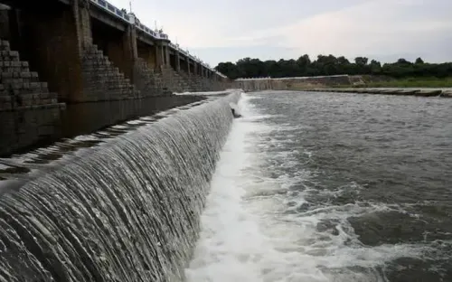
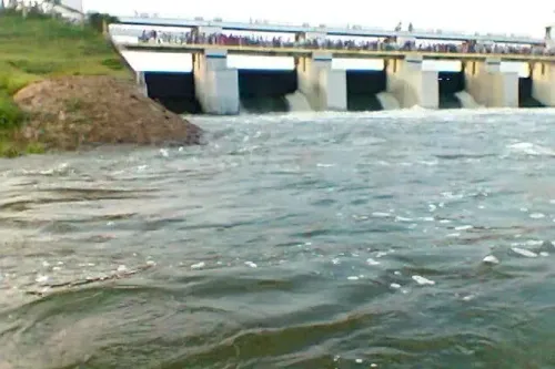
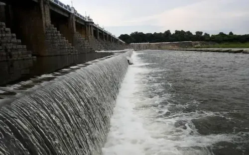
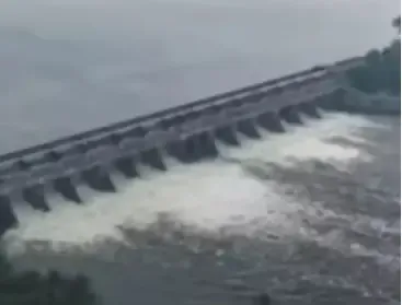
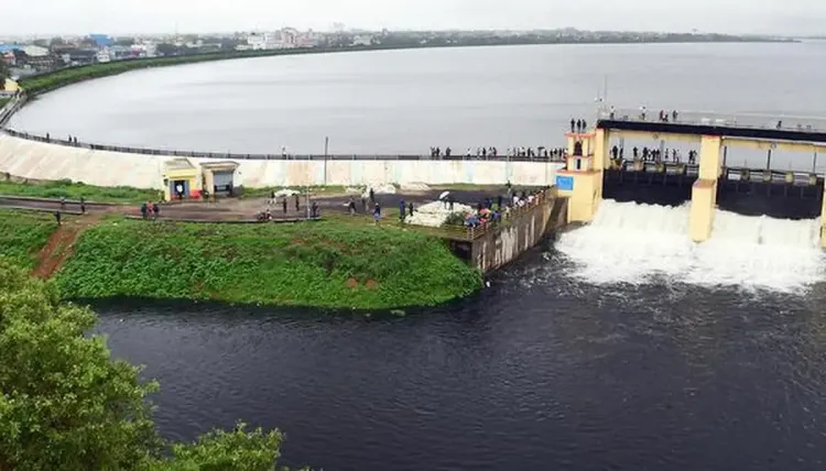
Chennai, Oct 15 (NationPress) In response to the heavy rainfall affecting the state, the Tamil Nadu Water Resources Department (WRD) is set to discharge approximately 700 cubic feet per second (cusecs) from the Poondi reservoir and 200 cusecs from the Red Hills reservoir on Wednesday. This action aims to address the escalating inflow due to the recent downpour.
WRD officials have indicated that water from Poondi will flow into the Kosasthalaiyar River and subsequently reach the Tamaraipakkam anicut, where it will be redirected to the Cholavaram tank for storage.
The decision comes after a notable inflow of 2,260 cusecs from various catchment areas, including the Kesavaram anicut, Illupur check dam, and the Kandaleru–Poondi canal.
According to the WRD’s regulations, the water level in the Poondi reservoir should ideally be maintained at 33 feet during the month of October. Currently, the level is at 34.30 feet, prompting the release of excess water as a precautionary measure to avert overflow and to ensure adequate storage in the Cholavaram tank.
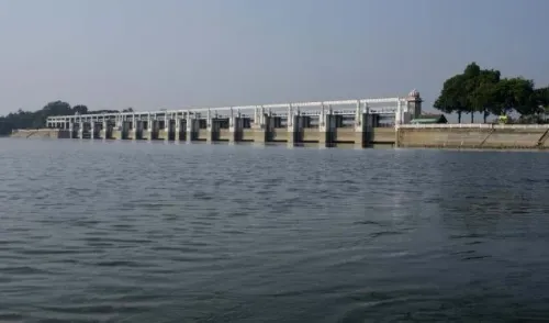
Officials reported that the Red Hills reservoir, a crucial drinking water source for Chennai, is also nearing capacity. The department will decide on water release based on daily inflow and rainfall intensity.
Additionally, the Tiruvallur district administration has issued a flood warning for low-lying areas such as Vadakarai, Naravarikuppam, Sadayankuppam, and Kosapur, which are situated along the reservoirs' excess flow paths.
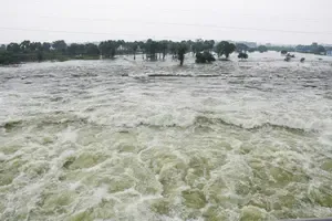
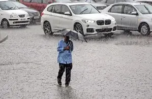
Widespread rainfall impacted several regions in Tamil Nadu during the early hours of Wednesday due to a weather system over the Bay of Bengal.
Chennai experienced substantial rainfall as strengthening easterly winds indicated the arrival of the Northeast monsoon.
The Regional Meteorological Centre (RMC) forecasted that the simultaneous withdrawal of the Southwest monsoon and the onset of the Northeast monsoon are expected by Thursday, October 16. More updates on the monsoon’s arrival will be provided soon.
In the 24 hours leading up to 8:30 a.m. on Wednesday, Ennore in Chennai recorded 14 cm of rainfall, while Kathivakkam received 10 cm. Manali New Town and Kodanad (Nilgiris) reported 9 cm each.
Wimco Nagar in Chennai witnessed 8 cm, and Sembanarkoil in Mayiladuthurai recorded 7 cm. Light to moderate showers were also documented in Thanjavur, Thiruvarur, Vellore, Kallakurichi, Villupuram, Tirunelveli, Pudukottai, Cuddalore, Thoothukudi, Ramanathapuram, Nagapattinam, Ranipet, and Tiruvallur.
The ongoing wet spell is attributed to an upper air cyclonic circulation over the southwest Bay of Bengal, progressing toward the Comorin area.
Point of View
The ongoing rainfall in Tamil Nadu highlights the importance of proactive measures in water management. The timely release of water from reservoirs illustrates the authorities' commitment to safeguarding communities while effectively managing resources. Our focus remains on ensuring public safety and preparedness during this wet spell.
NationPress
24 Jun 2026
Frequently Asked Questions
Why is water being released from the Poondi and Red Hills reservoirs?
Water is being released to manage the rising inflow caused by heavy rainfall and to prevent overflow.
What is the current water level in the Poondi reservoir?
The current water level in the Poondi reservoir is at 34.30 feet, above the recommended 33 feet.
Which areas have been warned about potential flooding?
Flood warnings have been issued for low-lying areas including Vadakarai, Naravarikuppam, Sadayankuppam, and Kosapur.
What is the expected weather forecast for Tamil Nadu?
The Northeast monsoon is expected to begin soon, with further updates anticipated from the Regional Meteorological Centre.
How much rainfall did Chennai receive recently?
Chennai recorded varying rainfall amounts, with Ennore receiving 14 cm and Kathivakkam receiving 10 cm within a 24-hour period.