Active tectonic fault confirmed under China's Brahmaputra dam project
Synopsis
Chinese government-backed geologists have confirmed an active tectonic fault runs directly under the Medog dam site on the Brahmaputra — the world's most ambitious hydropower project. For India, which has warned of downstream risks for years, the validation has come from Beijing's own researchers, exposing a governance vacuum on one of Asia's most strategically loaded river systems.
Key Takeaways
Researchers from Chengdu University of Technology and the China Geological Survey confirmed the Paizhen Fault — an active tectonic fault — runs beneath the Medog hydropower project .
Surrounding rock is described as loose, weakly bonded, and prone to slope failure under water immersion and seismic stress.
The fault triggered a magnitude 6.9 earthquake at its northern edge in 2017 and has been active since the Pleistocene epoch .
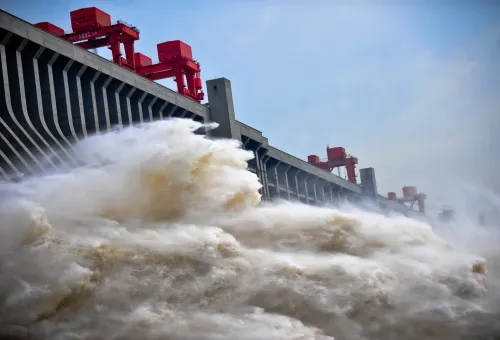
The USD 137 billion project sits approximately 50 kilometres from the Indian border and is designed to generate more than three times the power of the Three Gorges Dam .
No comprehensive water-sharing or basin management framework exists between China and downstream states on the Brahmaputra .
Beijing has not publicly disclosed independent safety assessments, emergency protocols, or long-term monitoring arrangements for the project.
Researchers from Chengdu University of Technology and the China Geological Survey have confirmed that the Paizhen Fault, an active tectonic fault, runs directly beneath China's Medog hydropower project on the Brahmaputra River, according to a report by Myanmar-based media outlet Mizzima News. The finding, drawn from a Chinese government-backed study, raises serious questions about the structural safety of the USD 137 billion project located approximately 50 kilometres from the Indian border.
What the Geological Study Found
The research team describes the rock formations surrounding the fault zone as loose, weakly bonded, and vulnerable to slope failures under prolonged water immersion and sustained tectonic stress. The Paizhen Fault has reportedly remained active since the Pleistocene epoch and continues to generate seismic events — including a magnitude 6.9 earthquake that struck its northern edge in 2017.
Crucially, these concerns originate not from external critics but from Chinese geologists working within a Beijing-backed research framework. That internal acknowledgement, analysts argue, lends the geological risk assessment a credibility that previous external warnings lacked.
Scale and Strategic Ambition of the Medog Project
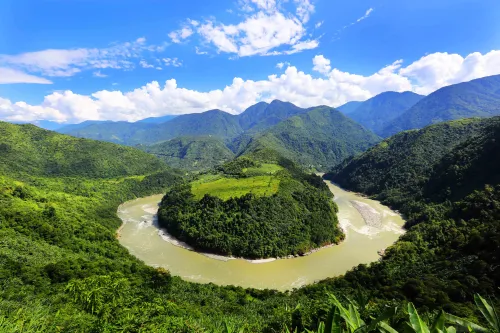
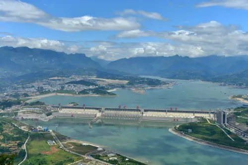
The Medog hydropower project on the Yarlung Tsangpo — the upper course of the Brahmaputra — is designed to generate more than three times the electricity of the Three Gorges Dam, positioning it as the world's largest hydropower facility. Beijing has framed the project as central to its twin goals of energy security and carbon neutrality.
Critics, however, argue that reducing the project to a renewable energy milestone obscures a larger strategic reality. The dam represents an engineering intervention of unprecedented scale on one of Asia's most geopolitically significant river systems — one that flows through India and Bangladesh before reaching the sea.
India's Long-Standing Concerns
For years, India has maintained that China's plans on the Yarlung Tsangpo posed not merely engineering challenges but strategic and environmental risks to downstream nations. Beijing consistently dismissed those concerns, asserting that the project was scientifically planned and would not significantly affect downstream flows.
According to the Mizzima News report, the strongest validation of India's position has now come from within China itself. The confirmation of an active fault beneath the project site, the report argues, justifies downstream countries in demanding clarity on contingency planning, independent safety assessments, and emergency preparedness mechanisms — none of which Beijing has publicly detailed.
The Governance Gap on Transboundary Waters
A structural problem compounds the geological risk: the Brahmaputra has no comprehensive water-sharing or basin management framework between China and downstream states, unlike many internationally managed river basins governed by legally binding agreements. Hydrological data sharing between China and its downstream neighbours has remained limited, largely seasonal, and vulnerable to disruptions.
This leaves countries like India and Bangladesh dependent on unilateral assurances rather than institutional guarantees — a vulnerability that the fault confirmation only deepens. As the project advances, pressure is likely to grow on Beijing to engage in multilateral dialogue on transboundary river governance.
Point of View
Pleistocene-era seismic activity, and slope failure risk at the Medog site, it becomes impossible for China to retreat to its standard position that downstream concerns are exaggerated or politically motivated. India has raised these alarms for years and been dismissed; the dismissal is now harder to sustain. The deeper problem is structural: the Brahmaputra remains one of the few major transboundary river systems in Asia with no binding governance framework, which means geological risk and geopolitical risk compound each other. If a structural failure or controlled release were to occur, downstream states would have no institutional mechanism to seek redress or even advance warning. That is the accountability gap that this confirmation should force onto the diplomatic agenda.
NationPress
26 Oct 2026
Frequently Asked Questions
What is the Paizhen Fault and why does it matter for the Medog dam?
The Paizhen Fault is an active tectonic fault confirmed by Chinese government-backed researchers to run directly beneath the Medog hydropower project on the Brahmaputra River. It has been seismically active since the Pleistocene epoch and generated a magnitude 6.9 earthquake at its northern edge in 2017, raising serious questions about the structural safety of the USD 137 billion dam.
What is the Medog hydropower project?
The Medog hydropower project is China's planned dam on the Yarlung Tsangpo — the upper course of the Brahmaputra River. Estimated at USD 137 billion, it is designed to produce more than three times the electricity of the Three Gorges Dam, making it the world's largest hydropower facility if completed.
How does this affect India?
The Medog project sits approximately 50 kilometres from the Indian border, and the Brahmaputra flows downstream through India and Bangladesh. A structural failure or unregulated water release could have severe consequences for millions of people in Assam and other northeastern states. India has long warned of downstream risks, and the fault confirmation from Chinese researchers strengthens those concerns.
Is there a water-sharing agreement between China and India on the Brahmaputra?
No. The Brahmaputra has no comprehensive water-sharing or basin management framework between China and downstream states. Hydrological data sharing has remained limited and seasonal, leaving India and Bangladesh dependent on unilateral Chinese assurances rather than any binding institutional arrangement.
Has China responded to the geological findings?
According to the Mizzima News report, Beijing has not publicly disclosed independent safety assessments, emergency preparedness mechanisms, or long-term monitoring arrangements for the Medog project in response to the fault confirmation.