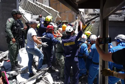
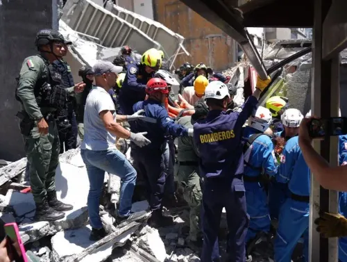
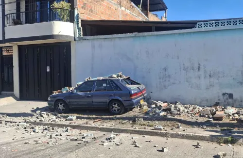
Colombia earthquake kills 18 in Pereira; 7.4-magnitude tremor strikes western region
Synopsis
A 7.4-magnitude earthquake tore through western Colombia on Monday, killing at least 18 people in Pereira alone — with the true toll still emerging. President De La Espriella has activated a national emergency command and is personally heading to the disaster zone, signalling the scale of destruction across Chocó and the Coffee-Growers' Axis.
Key Takeaways
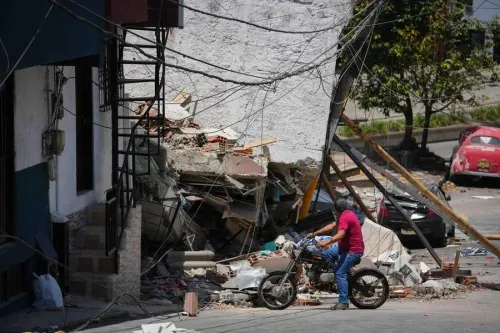
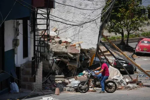
A 7.4-magnitude earthquake struck western Colombia on Monday, 10 August , killing at least 18 people in Pereira .
Mayor Mauricio Salazar confirmed the death toll in an interview with Caracol Radio .
The epicentre was located at approximately 4.85°N, 76.15°W , at a depth of 80 km .
President Abelardo De La Espriella activated a Unified Command Post at the UNGRD and pledged to travel personally to Pereira.
Affected areas include Pereira , Chocó , and the Coffee-Growers' Axis region.
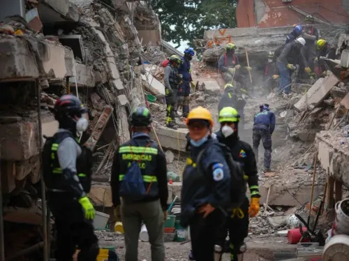
Rescue operations were ongoing as of Monday evening, with a full damage assessment expected in the hours ahead.
A powerful 7.4-magnitude earthquake struck western Colombia on Monday, 10 August, killing at least 18 people in the city of Pereira, according to Mayor Mauricio Salazar, who confirmed the toll in an interview with Caracol Radio. The disaster has prompted a full-scale national emergency response led by Colombian President Abelardo De La Espriella.
Key Details of the Earthquake
The tremor struck at 8:34 p.m. local time on Monday, with its epicentre recorded at 4.85 degrees north latitude and 76.15 degrees west longitude, according to seismic monitoring agencies. The quake originated at a depth of approximately 80 km, a factor that influenced the spread of shaking across a wide area.
Magnitude readings varied slightly across international agencies. The GFZ German Research Centre for Geosciences recorded the event at magnitude 6.8, with the epicentre depth measured at 93.7 km and coordinates of 4.86 degrees north latitude and 76.19 degrees west longitude — consistent in location with other readings, though differing in intensity estimates.
Government Response and Emergency Command
President De La Espriella assumed direct leadership of the emergency response, ordering the establishment of a Unified Command Post at the National Unit for Disaster Risk Management (UNGRD) to coordinate relief efforts. He also requested a detailed situational report from the UNGRD director on damages and the most urgent needs on the ground.
In a post on X, the President addressed affected citizens directly: 'I will also be personally in Pereira to accompany the affected people and verify the Government's response. You are not alone. The State is present and acting.'
He also confirmed he was heading to Bogota to oversee the national emergency from the Unified Command Post, pledging to personally lead relief operations for communities in Chocó, the Coffee-Growers' Axis, and all other affected areas.
Affected Regions Beyond Pereira
While Pereira bore the brunt of reported casualties, the President's response encompassed a broader geography — including the Chocó department and the Coffee-Growers' Axis (Eje Cafetero) region, which spans Risaralda, Quindío, and Caldas departments. This area is historically vulnerable to seismic activity given its proximity to active fault lines in the Colombian Andes.
The President also noted that emergency response was being coordinated from San Jose del Palmar, a municipality in Chocó, suggesting the quake's impact extended well beyond Pereira's city limits.
What Happens Next
Rescue and assessment operations were ongoing as of Monday evening. The UNGRD was tasked with compiling a comprehensive damage report, and President De La Espriella pledged to commit all necessary government resources to support rebuilding. As aftershock risk remains elevated following a tremor of this magnitude, authorities were urging residents in affected zones to exercise caution. The full scale of casualties and structural damage is expected to become clearer in the coming hours.
Point of View
6.8 from GFZ — is not unusual in the immediate aftermath of a major tremor, but it matters for casualty projections and structural damage assessments. What is already clear is that the Coffee-Growers' Axis, one of Colombia's most densely populated and economically vital interior corridors, has taken a significant hit. President De La Espriella's decision to personally lead the response is politically notable, but the real test will be the speed of UNGRD's ground deployment — Colombia's 2023 Cauca flooding response drew criticism for logistical delays in the first 48 hours. With aftershock risk elevated, the window for effective search-and-rescue is narrow.
NationPress
25 Sept 2026
Frequently Asked Questions
How many people died in the Colombia earthquake on 10 August?
At least 18 people were killed in the city of Pereira in western Colombia, according to Mayor Mauricio Salazar, who confirmed the toll in an interview with Caracol Radio. The death count was still being verified as rescue operations continued.
What was the magnitude of the earthquake that struck Colombia?
The earthquake was recorded at a magnitude of 7.4 by local and some international agencies, while the GFZ German Research Centre for Geosciences measured it at 6.8. The quake struck at a depth of approximately 80 km, with its epicentre in western Colombia near Pereira.
Which areas of Colombia were affected by the earthquake?
The city of Pereira in the Risaralda department reported the highest confirmed casualties. The broader Coffee-Growers' Axis region and the Chocó department were also identified as affected areas, with the Colombian government coordinating relief across all of them.
How is the Colombian government responding to the earthquake?
President Abelardo De La Espriella activated a Unified Command Post at the National Unit for Disaster Risk Management (UNGRD) and pledged to travel personally to Pereira. He also requested a detailed damage and needs report from the UNGRD director to guide the emergency response.
Where exactly was the earthquake's epicentre?
The epicentre was recorded at approximately 4.85 degrees north latitude and 76.15 degrees west longitude in western Colombia, at a depth of 80 km, according to seismic monitoring data. The GFZ placed it at nearly identical coordinates — 4.86°N, 76.19°W — at a depth of 93.7 km.