Tropical Cyclone Rae Set to Impact Fiji Waters
Synopsis
Tropical Cyclone Rae is set to make its entrance into Fiji waters, with expectations of intensifying winds and heavy rainfall starting Sunday night. The Fiji Meteorological Service warns of significant weather impacts across various regions, including potential localized flooding and school closures.
Key Takeaways
Tropical Cyclone Rae to enter Fiji waters on Sunday night.
Intensification expected, with strong winds and heavy rains.
Gale and heavy rain warnings issued for multiple regions.
Local flooding and school closures anticipated on Monday.
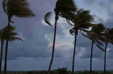
Strong winds and rough seas expected in affected areas.
Suva, Feb 23 (NationPress) Tropical Cyclone Rae is poised to enter the waters of Fiji beginning Sunday night.
According to the Fiji Meteorological Service, Tropical Cyclone Rae is moving towards the eastern regions of the country, impacting areas such as the Northern Division, Lomaiviti, and Lau Group, along with the windward side of the main island, as reported by the Xinhua news agency.
The cyclone is anticipated to grow stronger in the coming hours, with intense winds and significant rainfall likely starting later Sunday night.
The Nadi Weather Office has indicated that intensification will occur from Sunday night into Monday.
Currently, the center of Cyclone Rae is situated approximately 160 km East-Northeast of Cikobia or about 180 km Northeast of Udu Point.
It is advancing in a South-southwest direction towards the Lau Group at a speed of 15 km/hr.
A gale warning is active for the eastern sections of Vanua Levu, Cakaudrove province, and Southern Bua, as well as Cikobia, Naqele Levu, Taveuni, Lau, and the Lomaiviti Group.
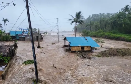
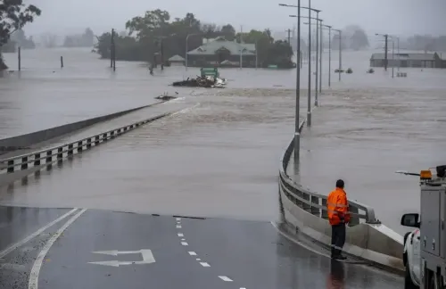
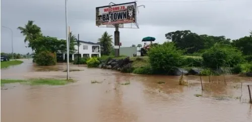
Low-lying areas and major rivers are also at risk of flooding.
All educational institutions in the Lau Group, Lomaiviti, and Vanua Levu will be closed on Monday.
The Meteorological Service forecasts that Tropical Cyclone Rae will drift away from Fiji later on Monday.
A strong wind warning is still in effect for the remainder of Vanua Levu and for the northeastern regions of Viti Levu, extending from Tailevu North through Ra-Rakiraki up to Tavua, Yasawa, Mamanuca, Kadavu, and surrounding smaller islands.
A heavy rain warning persists for the Northern division, Lau and Lomaiviti groups, as well as the interior and eastern parts of Viti Levu, spanning from Sigatoka through Navua, up to Suva and Tailevu North, now also affecting the rest of Fiji.
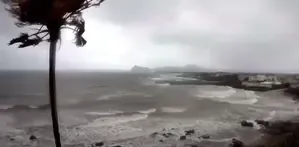
In the land areas of the Eastern sections of Vanua Levu, Cakaudrove Province, and Southern Bua, Cikobia, Naqele Levu, Taveuni, Lau, and Lomaiviti group: anticipate strong southeasterly winds with speeds reaching up to 50 km/hr and gusts potentially hitting 65 km/hr.
Wind speeds may escalate to 65 km/hr with gusts reaching 90 km/hr later on Sunday.
Prepare for intermittent rain, particularly heavy at times, as well as squally thunderstorms.
Rainfall is expected to become frequent starting Sunday.
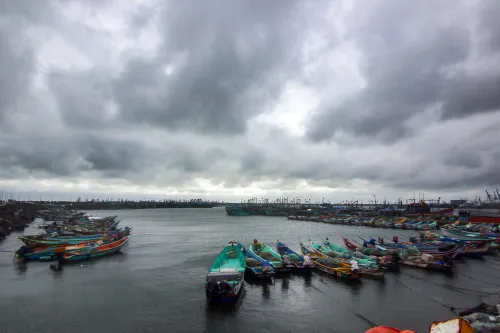
Rough to very rough seas and heightened water conditions are anticipated from later on Sunday.
In the Eastern and Northern sections of Viti Levu, from Sigatoka through Suva to Tailevu North and extending to Rakiraki/Tavua, Yasawa, Mamanuca, Kadavu, and adjacent smaller islands: expect strong southeasterly winds with speeds up to 50 km/hr and gusts reaching 65 km/hr.
Occasional showers will increase, leading to heavy and frequent rainfall from later on Sunday.
For the remainder of the Fiji Group, expect cloudy conditions with occasional showers, which will intensify into frequent and heavy rain accompanied by squally thunderstorms starting Monday.
Potential impacts from heavy rain include localized flooding of vulnerable communities, businesses, and low-lying areas.
Minor roads, Irish crossings, and bridges may experience localized flooding, causing some traffic disruptions.
Severe flooding could occur in major rivers, potentially inundating towns and properties. Drivers and mariners should exercise caution due to poor visibility.