Is Mount Lewotobi's Eruption Raising Concerns in Indonesia?
Synopsis
Mount Lewotobi's recent eruptions have prompted Indonesia to heighten its alert level. With ash clouds soaring high and expanded danger zones, authorities are urging local residents and tourists to stay vigilant amidst these volcanic threats. Explore the unfolding situation and its implications for the community.
Key Takeaways
Mount Lewotobi's alert level is elevated due to eruptions.
Danger zone expanded to 7 km in specific directions.
Residents advised to stay vigilant for lava floods.
Ash clouds reaching significant heights disrupt aviation.
Indonesia's volcanic activity poses ongoing risks.
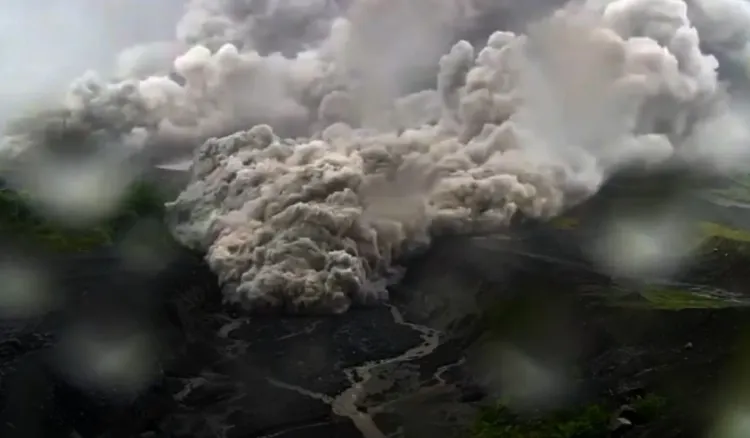
Jakarta, May 19 (NationPress) Indonesia's Centre for Volcanology and Geological Disaster Mitigation has increased the alert level for Mount Lewotobi located in East Nusa Tenggara Province and has broadened the danger zone following ongoing volcanic eruptions.
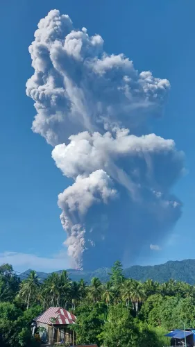
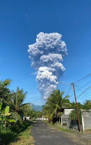
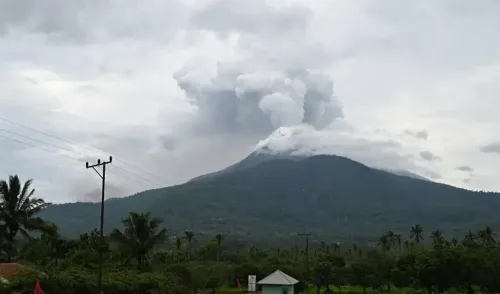
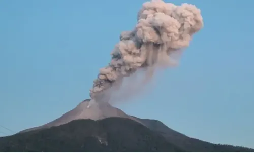
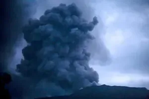
The alert level was heightened on Sunday evening due to a series of eruptions, with the most significant releasing an ash column soaring 6 km into the atmosphere.
Officials have expanded the danger zone from 6 km to 7 km in the northwest, north, and northeast sectors of the crater, while the 6-km restriction is still active in other directions.
On Monday, at 15:47 local time, Mount Lewotobi erupted again, ejecting an ash plume reaching 5 km high. Dense gray clouds are now flowing northward and northwestward from the volcano.
The Volcano Observatory Notice for Aviation maintains a red-level warning, the highest alert level, as reported by Xinhua news agency. This prohibits flights below 6 km in proximity to the volcano and cautions against volcanic ash, which poses risks to aircraft operations.
Local communities, as well as tourists, are restricted from engaging in any activities within a 7-km radius of the crater in the west, north, and northeast areas, while the 6-km restriction remains beyond these zones.
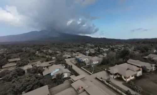
Residents in proximity to the volcano are advised to stay alert for possible lava floods due to rainfall in rivers stemming from the summit. Those in ash-affected regions should wear masks or coverings for safety.
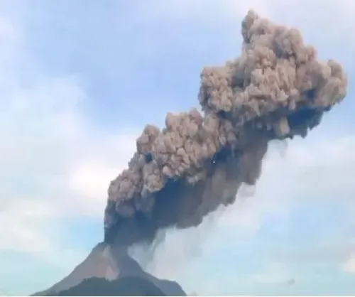
Previously in April, flight warnings and safety notices were issued by the Volcanology and Geological Disaster Mitigation Centre after Mount Lewotobi erupted, producing an ash column of up to 3,500 meters.
On April 16, it was suggested that nearby communities should be aware of the risk of lava floods triggered by rivers originating from the volcano during heavy rains.
A similar eruption occurred on March 20, which released an ash column rising to 8,000 meters.
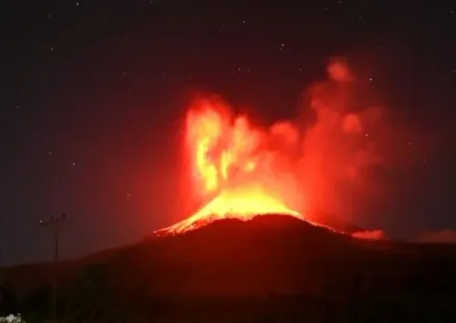
Mount Lewotobi, standing tall at 1,584 meters, is one of Indonesia's 127 active volcanoes. The nation, home to 270 million people, frequently experiences seismic activity. Indonesia is situated along the 'Ring of Fire', a horseshoe-shaped zone of seismic fault lines encircling the Pacific Basin.
Located at the junction of several significant tectonic plates—the Eurasian, Australian, and Pacific plates—Indonesia has witnessed some of the world's most deadly and powerful eruptions, such as the catastrophic Mount Tambora eruption in 1815, underscoring the nation's vulnerability to volcanic threats.
Point of View
Our commitment lies in delivering accurate and timely information. The situation surrounding Mount Lewotobi is a critical matter of public safety that impacts both local residents and the aviation industry. We stand with the community, urging vigilance and preparedness as they navigate the challenges posed by volcanic activity.
NationPress
3 Jul 2026
Frequently Asked Questions
What is the current alert level for Mount Lewotobi?
The current alert level for Mount Lewotobi has been raised by Indonesia's Centre for Volcanology and Geological Disaster Mitigation due to ongoing eruptions.
What areas are affected by the danger zone?
The danger zone has been expanded to 7 km in the northwest, north, and northeast sectors of the crater, while a 6-km restriction remains in place in other directions.
What safety measures should residents take?
Residents near Mount Lewotobi should stay vigilant for potential lava floods during heavy rains and wear masks in ash-affected areas for protection.
How high did the ash columns reach during eruptions?
The ash columns from recent eruptions have reached heights of 6 km and 5 km , with previous eruptions going as high as 8,000 meters .
What should travelers know about flights near the volcano?
A red-level warning is in effect for aviation, prohibiting flights below 6 km near Mount Lewotobi due to the risk of volcanic ash.