How is Sri Lanka Planning to Revive Tourism After Cyclone Ditwah?
Synopsis
As Sri Lanka grapples with the aftermath of Cyclone Ditwah, officials are mobilizing efforts to revive the tourism industry just in time for the peak season. With the reopening of attractions and new marketing campaigns, Sri Lanka aims to reassure travelers of its readiness to welcome them back.
Key Takeaways
Tourist destinations are reopening as recovery efforts begin.
New campaigns aim to attract international travelers.
Visa-free entry for 40 countries set for 2026.
Satellite imagery will assist in assessing cyclone damage.
Safety measures are being implemented for tourist sites.
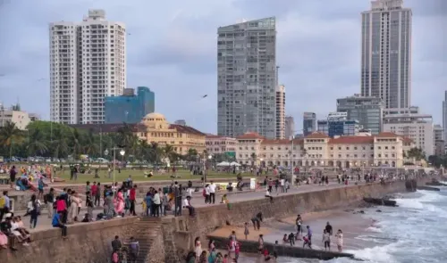
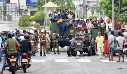
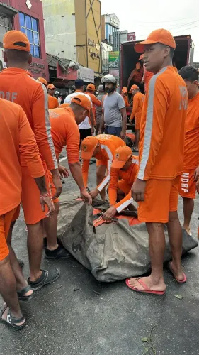
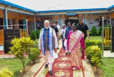
Colombo, Dec 14 (NationPress) In light of the devastating impact from Cyclone Ditwah, Sri Lankan authorities are set to reopen numerous tourist attractions and initiate a comprehensive recovery plan to rejuvenate the tourism sector as the peak travel season draws near, according to official statements.
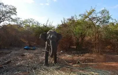
Deputy Minister of Environment Anton Jayakody informed reporters that the botanical gardens, previously shut down due to landslides and safety hazards caused by the cyclone, will soon welcome visitors again. He has instructed relevant agencies to take action to mitigate landslide threats in these locales, as reported by Xinhua News Agency.
Meanwhile, officials from Sri Lanka’s tourism sector have launched a promotional campaign themed “Sri Lanka is ready,” aimed at attracting tourists from the 10 primary source markets via digital channels.
On December 8, Buddhika Hewawasam, Chairman of the Sri Lanka Tourism Development Authority, disclosed that a long-awaited visa exemption for visitors from 40 nations is anticipated to take effect in January 2026. This initiative is part of broader strategies to boost recovery post-disaster and ensure a successful winter tourism season.
Earlier this week, N.K.U. Rohana, Sri Lanka's Surveyor General, noted that the upcountry landscape has undergone significant transformations in various areas due to the landslides instigated by Cyclone Ditwah, as reported by Daily Mirror on Friday.
He emphasized the necessity for an update to the national land-use map series, revealing that the Survey Department aims to acquire high-resolution satellite images from orbiting satellites to facilitate an accurate re-mapping process. This new imagery is expected to assist in identifying landslide-affected regions and evaluating damage to river basins, agricultural land, and other areas.
Rohana mentioned that high-quality satellite images will be requested once the disaster situation stabilizes and repair work on water bodies and roads progresses. The department has already collected several low-resolution images from impacted provinces and initiated preliminary studies.
The Survey Department is also seeking international support for high-resolution imaging and has reached out to China, India, Japan, the United States, and Russia through diplomatic channels. China has already provided several detailed images showcasing areas affected by flooding and landslides.
Point of View
Our commitment remains with the nation and its resilience in times of adversity. The recovery of Sri Lanka's tourism sector post-Cyclone Ditwah reflects not only our adaptability but also our determination to welcome the world back to our shores.
NationPress
20 Jun 2026
Frequently Asked Questions
What measures is Sri Lanka taking to recover tourism?
Sri Lanka is reopening tourist destinations, launching marketing campaigns, and implementing safety measures to ensure a secure travel environment.
When will the visa-free entry come into effect?
The long-delayed visa-free entry for travelers from 40 countries is expected to be implemented in January 2026.
How has Cyclone Ditwah affected the landscape?
The cyclone has caused significant changes in the upcountry landscape, necessitating updates to national land-use maps.
Is international assistance being sought for recovery?
Yes, the Survey Department is seeking international help for high-resolution satellite images to aid in damage assessment.
What is the theme of the new marketing campaign?
The campaign is themed 'Sri Lanka is ready' and targets travelers from the top 10 source markets.