

Assam CM Office Reviews Silchar Elevated Corridor Alignments
Synopsis
Assam's Chief Minister's Office has confirmed that alternative alignments for Silchar's planned 2.5-km four-lane elevated corridor — featuring two flyovers of 542 m and 500 m — have been evaluated in Cachar, incorporating feedback from local commercial and social organisations.
Key Takeaways
The proposed elevated corridor runs 2.5 kilometres on a four-lane configuration between Capital Point and Rangirkhari in Silchar .
The project includes two flyovers measuring 542 metres and 500 metres respectively.
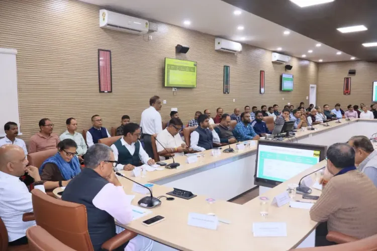
Alternative alignments were evaluated in Cachar district after suggestions were received from local commercial and social organisations.
Silchar is the principal commercial town of Barak Valley in southern Assam and headquarters of Cachar district .
Final alignment, tendering timeline, and funding allocation remain to be announced.
The project is part of Assam's broader push to extend urban-infrastructure upgrades to secondary cities beyond Guwahati.
A 2.5-kilometre, four-lane elevated corridor connecting Capital Point to Rangirkhari in Silchar moved a step closer to reality on Friday, 20 November 2026, as the Chief Minister's Office of Assam confirmed that alternative alignments for the project — including two flyovers spanning 542 metres and 500 metres — have been evaluated in Cachar district after incorporating feedback from local commercial and social organisations.
What the Silchar corridor actually proposes
The planned intervention is not a minor road patch. A four-lane elevated roadway stretching 2.5 km, anchored by two flyovers, is designed to cut through one of Barak Valley's most congested urban stretches. The corridor runs between Capital Point — a busy commercial node — and Rangirkhari, threading through the dense commercial fabric that makes Silchar both economically vital and chronically gridlocked. The evaluation of alternative alignments signals that the project has cleared an important design-review hurdle before tendering begins.
Why local organisations got a seat at the table
Silchar is the administrative and commercial heart of Cachar district and the de facto capital of southern Assam's Barak Valley — a region that has historically argued it receives less infrastructure investment than the Brahmaputra Valley. Elevated structures in dense urban cores inevitably displace street-level commerce and alter pedestrian access patterns, which is why input from local commercial and social bodies matters. The Assam government's decision to fold those suggestions into alternative alignment studies before finalising the route is a procedural step aimed at reducing post-award disputes — a lesson drawn from stalled urban flyover projects elsewhere in the northeast.
Silchar's congestion problem and the Barak Valley stakes
Silchar town sits at the confluence of several national and state highways feeding the broader Barak Valley hinterland, making its choke-points a bottleneck for goods movement across three districts. Assam's broader push to extend urban-infrastructure upgrades beyond Guwahati to secondary cities has picked up pace, with elevated structures and ring-road interventions appearing in state budget allocations over successive years. For Silchar specifically, improved traffic dispersal is not just a commuter quality-of-life issue — it has direct implications for the town's role as a regional logistics and healthcare hub.
The final alignment decision, tendering timeline, and funding allocation are still to be announced. What Friday's disclosure establishes is that the project has moved from conceptual discussion into active engineering and stakeholder-review phase — the last major gateway before a design is locked and procurement begins. Silchar has waited long for an infrastructure intervention of this scale. The corridor, when built, will rewrite how the town moves.
Frequently Asked Questions
What is the Silchar elevated corridor project?
It is a planned 2.5-kilometre, four-lane elevated roadway connecting Capital Point to Rangirkhari in Silchar, Assam, that will include two flyovers of 542 metres and 500 metres to ease traffic congestion in the town.
Where is Silchar located and why is it important?
Silchar is the headquarters of Cachar district in southern Assam and the main commercial, logistics, and healthcare hub of the Barak Valley region.
Why were alternative alignments evaluated for the Silchar corridor?
The Assam government evaluated multiple alignment options to incorporate suggestions from local commercial and social organisations, aiming to minimise disruption to existing businesses and improve the project's design before finalising it.
When will the Silchar elevated corridor be built?
The final alignment, tendering timeline, and funding allocation have not yet been announced. The project is currently in the alignment-review phase as of November 2026 .
Is this part of a larger Assam infrastructure plan?
Yes. Assam has been progressively extending urban road and elevated-structure projects to secondary cities beyond Guwahati, with the Barak Valley receiving increased focus in recent state infrastructure drives.