

CM Himanta tables Assam Flood Plain Zoning Bill, 2026
Synopsis
Assam Chief Minister Himanta Biswa Sarma has announced the Assam Flood Plain Zoning Bill, 2026, which proposes statutory scientific mapping of the Brahmaputra and Barak river basins to define flood zones and guide safer development — marking a shift from decades of purely structural flood control.
Key Takeaways
Assam CM Himanta Biswa Sarma announced the Assam Flood Plain Zoning Bill, 2026 on 15 November 2026 .
The bill proposes scientific mapping of both the Brahmaputra and Barak river basins to establish legally defined flood zones.
The legislation shifts Assam's flood strategy from structural measures like embankments toward regulatory land-use zoning.
Assam has relied on embankment construction since the 1950s to manage Brahmaputra flooding, with limited long-term success.
The state records some of India 's highest annual flood losses each monsoon season, with millions displaced and large areas of farmland submerged.
Key next steps include passage of the bill in the Assam Legislative Assembly and publication of official flood-zone maps.
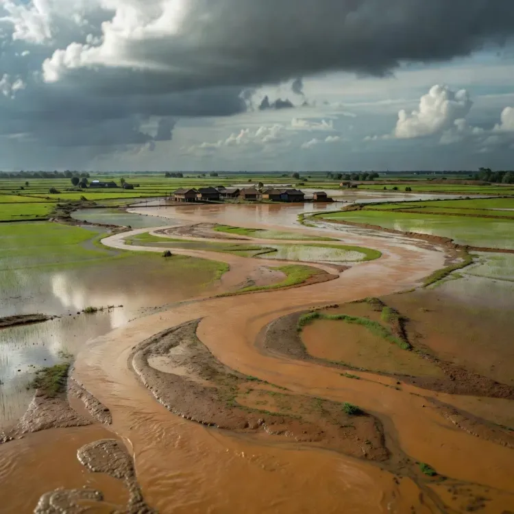
Every monsoon, the Brahmaputra swallows farmland, flattens homes, and displaces millions across Assam — and for decades, the state's answer was embankments and dredging. Assam Chief Minister Himanta Biswa Sarma is now signalling a fundamental shift in that logic, announcing the Assam Flood Plain Zoning Bill, 2026, which would replace reactive engineering with something far more durable: a statutory map that tells planners, developers, and communities exactly where the river intends to go.
What the Bill proposes: zones, basins, and boundaries
The legislation, as described by CM Sarma, provides for 'scientific mapping of the Brahmaputra and Barak basins' and the creation of clearly defined flood zones. The Brahmaputra drains Assam's vast central valley, while the Barak river system shapes the southern districts — together, they define the state's flood geography. By giving both basins statutory recognition, the bill lays the groundwork for land-use regulation: deciding not just how to respond to floods, but what should be built where floods are inevitable.
The core logic is preventive. Rather than waiting for the annual inundation and tallying losses, the 2026 Bill would establish legal boundaries that guide safer development before construction begins. That is a marked departure from Assam's post-independence flood-control model, which leaned almost entirely on physical infrastructure managed by the state's Flood Control Department.
Decades of embankments — and their limits
Since the 1950s, Assam has built hundreds of kilometres of embankments along the Brahmaputra and its tributaries. The engineering has bought time and protected some areas, but it has not broken the cycle. Assam routinely records some of India's highest annual flood losses — millions displaced, vast tracts of cropland submerged, and livestock and infrastructure washed away each year between June and September. The cumulative cost runs into thousands of crores over decades, and the embankments themselves require constant, expensive maintenance.
The shift toward regulatory tools — zoning laws, land-use frameworks, development restrictions in high-risk corridors — mirrors approaches adopted in flood-prone jurisdictions globally. Assam's bill, if passed, would make it one of the first Indian states to anchor this approach in legislation specific to major river basins.
What comes next: Assembly passage and the map timeline
The critical milestones now are the bill's introduction and passage in the Assam Legislative Assembly, followed by the methodology and schedule for publishing official flood-zone maps. Those maps will determine precisely which parcels of land fall into restricted or regulated zones — and that is where the legislation's real-world impact will be felt by developers, urban planners, and the farming communities who have lived alongside these rivers for generations.
Flood management, as CM Sarma put it, 'begins with understanding our rivers.' Getting that understanding enshrined in law — and then translated into ground-level maps — is the work that remains.
Point of View
2026 represents a meaningful evolution in how Indian states approach chronic flood risk — from infrastructure-led response to legally enforceable land-use prevention. For CM Sarma, it also signals a governance posture that is science-forward and long-horizon, which carries political weight in a state where annual flood devastation has historically defined voter anxiety. The harder test will be enforcement: flood-zone maps that restrict lucrative riverine development will face pushback from builders and local interests, and implementation fidelity will determine whether the bill becomes landmark policy or a symbolic gesture. If the maps are published on schedule and regulations are upheld, Assam could offer a replicable model for other flood-stressed Indian states.
NationPress
15 Nov 2026
Frequently Asked Questions
What is the Assam Flood Plain Zoning Bill, 2026?
The Assam Flood Plain Zoning Bill, 2026 is proposed legislation announced by Chief Minister Himanta Biswa Sarma that would mandate scientific mapping of the Brahmaputra and Barak river basins to define flood zones and regulate land use and development in high-risk areas.
Why does Assam need a flood plain zoning law?
Assam records some of India's highest annual flood losses, with millions displaced each monsoon. Existing flood control has relied on embankments since the 1950s; the new bill aims to prevent exposure by restricting development in flood-prone corridors through statutory zoning.
Which rivers are covered under the Assam Flood Plain Zoning Bill?
The bill covers both the Brahmaputra basin, which dominates Assam's central valley, and the Barak basin, which drains the southern districts of the state.
How is flood plain zoning different from embankments?
Embankments are physical structures built to hold back floodwater after a river swells. Flood plain zoning is a preventive regulatory tool that restricts what can be built in areas the river is likely to inundate, reducing exposure before a flood occurs.
What happens after the Assam Flood Plain Zoning Bill is passed?
After passage in the Assam Legislative Assembly, the key next step is publishing official flood-zone maps for the Brahmaputra and Barak basins, which will specify which areas face development restrictions based on scientific flood-risk assessments.