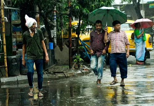
Bay of Bengal depression to lash south Bengal with heavy rain from Tuesday
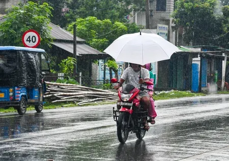
Synopsis
A strengthening Bay of Bengal depression is set to drench south Bengal from Tuesday, with South 24 Parganas, East Midnapore, and West Midnapore facing the worst of the heavy to very heavy rainfall. Fishermen have been told to stay off the deep sea, and Kolkata — already running 3.4 degrees below its normal maximum — braces for another wet spell after a brief Sunday lull.
Key Takeaways
A Bay of Bengal depression is expected to form over Gangetic West Bengal and adjoining Bangladesh on 8 August .
Heavy to very heavy rainfall is forecast in South 24 Parganas , East Midnapore , and West Midnapore over the next two days.
Kolkata , Howrah , Hooghly , Bankura , and Jhargram face heavy rain at isolated locations.
The IMD has advised fishermen not to venture into the deep sea for the next 24 hours .
North Bengal to see easing conditions — only scattered light to moderate rain expected over the next four days.
Kolkata recorded a maximum of 28°C on Friday, 3.4 degrees below normal , with humidity between 86% and 99% .
A fresh depression forming over the Bay of Bengal is set to trigger heavy to very heavy rainfall across several districts of south Bengal from Tuesday, 12 August, the India Meteorological Department (IMD) warned on Saturday, 8 August. The weather system is expected to sustain and intensify rainfall activity across the region over the coming days.
Weather Systems at Play
According to officials at the Regional Meteorological Centre (RMC), Alipore, a depression is expected to form over Gangetic West Bengal and adjoining Bangladesh later on Saturday. A cyclonic circulation already active over the region is simultaneously strengthening, and the combined impact of both systems is expected to keep rainfall elevated across south Bengal through the week.
Scattered rainfall is forecast to continue across the state through Tuesday, after which intensity is expected to rise further across western, coastal, and other parts of Gangetic south Bengal.
Districts on Alert
Coastal districts face the sharpest threat over the next two days. The IMD has forecast heavy to very heavy showers in parts of South 24 Parganas, East Midnapore, and West Midnapore. Heavy rainfall is also likely at isolated locations in Kolkata, Howrah, Hooghly, Bankura, and Jhargram districts.
In contrast, north Bengal is expected to see easing conditions, with only scattered light to moderate rain forecast across the five northern districts over the next four days. No major weather warning is currently in place for the northern region.
Fishermen Advisory Issued
The Met office has advised fishermen not to venture into the deep sea over the next 24 hours, citing rough sea conditions likely to prevail due to the depression. This is a standard precautionary measure issued whenever a depression or low-pressure system intensifies over the Bay, given the heightened risk of sudden squalls and high waves.
Kolkata Weather Outlook
Kolkata recorded a maximum temperature of 28 degrees Celsius on Friday — 3.4 degrees below normal — while the minimum stood at 26 degrees Celsius, marginally below normal. Relative humidity ranged between 86% and 99%. Saturday temperatures are expected to hover around 30 degrees Celsius (maximum) and 26 degrees Celsius (minimum), with showers likely under the influence of the low-pressure system.
Weather conditions are expected to offer a brief respite on Sunday before heavy rain returns to Kolkata and adjoining areas from Tuesday onward, as the depression consolidates and pushes inland.
Point of View
And the IMD's 'heavy to very heavy' tag for those districts warrants closer attention from district administrations than the headline forecast suggests. The brief Sunday respite in Kolkata may give false comfort: by Tuesday, the system's inland push could make conditions significantly worse than the current advisory conveys.
NationPress
22 Sept 2026
Frequently Asked Questions
Why is heavy rain expected in south Bengal from Tuesday?
A fresh depression forming over the Bay of Bengal, combined with a strengthening cyclonic circulation over Gangetic West Bengal and adjoining Bangladesh, is expected to intensify rainfall across south Bengal from Tuesday, 12 August, according to the IMD.
Which districts in south Bengal are most at risk?
South 24 Parganas, East Midnapore, and West Midnapore face heavy to very heavy showers over the next two days. Kolkata, Howrah, Hooghly, Bankura, and Jhargram are also likely to receive heavy rainfall at isolated locations.
What has the IMD advised fishermen?
The IMD has advised fishermen not to venture into the deep sea for the next 24 hours due to rough sea conditions expected from the Bay of Bengal depression.
Will north Bengal also be affected by the depression?
No. Rainfall activity in north Bengal is expected to ease, with only scattered light to moderate rain forecast across the five northern districts over the next four days. No major weather warning is currently in place for that region.
What is the current weather situation in Kolkata?
Kolkata recorded a maximum temperature of 28 degrees Celsius on Friday — 3.4 degrees below normal — with humidity between 86% and 99%. Showers are expected on Saturday, a brief improvement on Sunday, and heavy rain returning from Tuesday onward.