Will a Low-Pressure System Over the Bay of Bengal Bring Heavy Rain to Kolkata?

Synopsis
As a low-pressure system develops over the Bay of Bengal, Kolkata braces for heavy rainfall. The Met office warns of thunderstorms and rough sea conditions, advising fishermen to stay ashore. This weather change is part of a broader monsoon pattern affecting northern and southern Bengal.
Key Takeaways
Heavy rainfall expected in Kolkata from Wednesday.
Low-pressure system over Bay of Bengal is the cause.
Yellow warnings issued for thunderstorms.
Rough sea conditions along Bengal and Odisha coasts.
Fishermen should remain cautious and avoid deep waters.
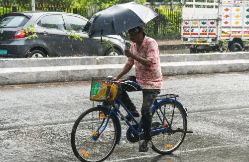
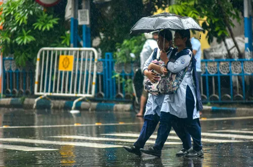
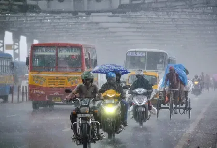
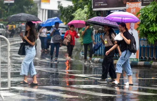
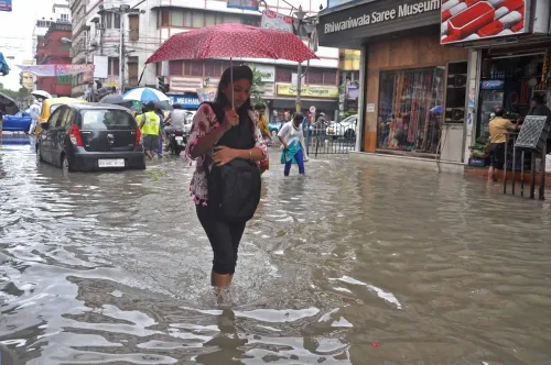
Kolkata, Aug 13 (NationPress) The meteorological department has predicted significant rainfall in Kolkata and nearby regions starting Wednesday, as a low-pressure system has developed over the central Bay of Bengal.
This system is pulling moisture from the ocean and is anticipated to strengthen over the next 48 hours before shifting toward the Bengal coastline.
As a result, heavy to very heavy rainfall is expected in various districts of South Bengal, especially in South 24 Parganas, North 24 Parganas, Howrah, and Hooghly. According to the Regional Meteorological Centre in Alipore, the current monsoon trough extends from Jalpaiguri in north Bengal through Haflong in Assam to Manipur.
“The low-pressure area will gain strength in the next 24 hours, resulting in heavy rain across both north and south Bengal,” stated a meteorology official.
The sea is expected to be rough along the coasts of Bengal and neighboring Odisha from Wednesday to Saturday, and fishermen are advised to refrain from going into deeper waters.
On Wednesday, light to moderate rain accompanied by thundershowers is forecast for Kolkata, Howrah, North 24 Parganas, South 24 Parganas, East and West Midnapore, and Jhargram.
On Thursday, further rainfall in coastal districts and thunderstorms are expected throughout south Bengal.
A yellow alert for thunderstorms has been issued for North 24 Parganas, West Midnapore, Purulia, Birbhum, Murshidabad, and Nadia.
In northern Bengal, rain is set to continue for the rest of the week. Very heavy precipitation is likely in Darjeeling, Jalpaiguri, Kalimpong, and Alipurduar on Wednesday, with heavy showers persisting in Jalpaiguri and Alipurduar on Thursday.
While no thunderstorm warnings are issued for Friday and Saturday, fresh heavy rain is anticipated starting Sunday, particularly in Jalpaiguri, Alipurduar, Cooch Behar, and later in Kalimpong from Monday.
In Kolkata, the minimum temperature on Wednesday recorded at 28.4 degrees Celsius, which is 1.6 degrees Celsius above the usual range, while Tuesday’s maximum reached 34.2 degrees Celsius, 1.8 degrees Celsius above normal.
Point of View
The unfolding weather patterns in Kolkata highlight the ongoing challenges posed by climate variability. The Met department's proactive warnings serve as a crucial reminder of the importance of timely information to safeguard lives and properties across the nation.
NationPress
11 Jul 2026
Frequently Asked Questions
What is causing the heavy rainfall in Kolkata?
A low-pressure area has formed over the central Bay of Bengal, drawing in moisture and resulting in heavy rainfall.
Which areas are expected to receive the most rain?
Heavy to very heavy rain is anticipated in South Bengal districts, particularly South 24 Parganas, North 24 Parganas, Howrah, and Hooghly.
Are there any warnings for thunderstorms?
Yes, a yellow warning for thunderstorms has been issued for several districts including North 24 Parganas and West Midnapore.
Is it safe for fishermen to go out to sea?
Fishermen are advised against venturing into deep waters due to rough sea conditions expected from Wednesday to Saturday.
What temperatures should we expect in Kolkata?
The minimum temperature is forecasted to be around 28.4 degrees Celsius, while the maximum can reach up to 34.2 degrees Celsius.