South Bengal heavy rain alert: Bay of Bengal low-pressure to deepen from July 3

Synopsis
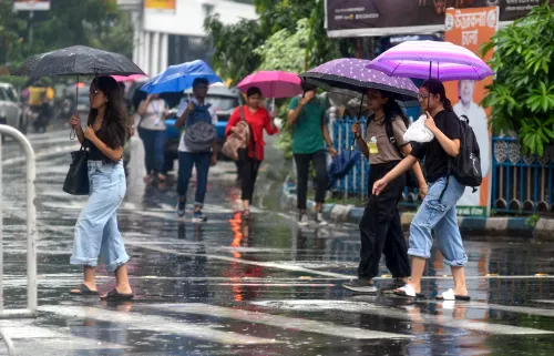
A deepening Bay of Bengal low-pressure system is set to drench south Bengal from Saturday, with Kolkata, Howrah, South 24 Parganas, and four other districts facing heavy to very heavy rain. North Bengal has already seen landslides and flooding — and the monsoon's worst for the south may still be days away.
Key Takeaways
The Regional Meteorological Centre (RMC), Kolkata has forecast heavy to very heavy rain in south Bengal from Saturday, 5 July onwards.
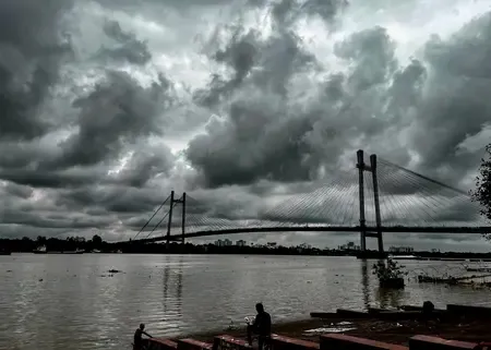
A low-pressure area is expected to form over the north-west Bay of Bengal around 3 July and deepen into a depression .
Kolkata , Howrah , South 24 Parganas , North 24 Parganas , Bankura , and Purulia are on alert for Sunday ; West Midnapore and Jhargram face very heavy rain on Monday .
North Bengal districts including Darjeeling , Jalpaiguri , and Alipurduar have already experienced landslides and flood-like conditions through the past week.
Kolkata recorded a maximum temperature of 31.2°C on Tuesday — 1.4°C above normal.
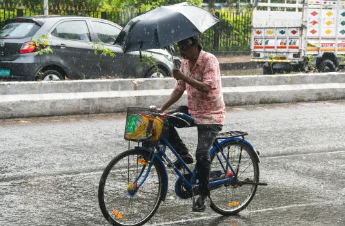
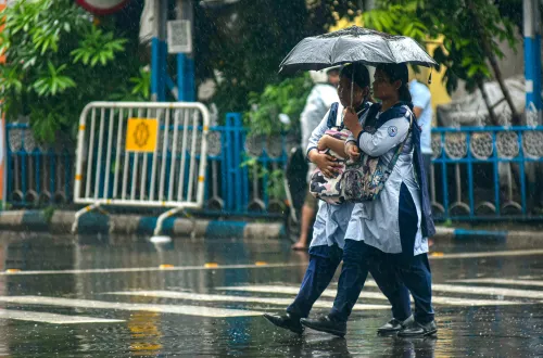
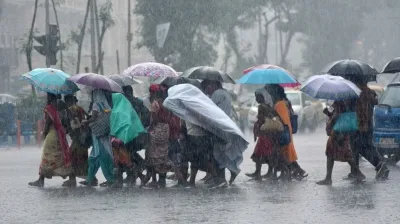
Districts across south Bengal, including Kolkata, are bracing for heavy to very heavy rainfall from Saturday, 5 July onwards, as a low-pressure system over the Bay of Bengal is expected to intensify into a depression, the Regional Meteorological Centre (RMC) in Kolkata's Alipore area warned on Wednesday, 1 July. Until then, scattered showers will continue across the city and adjoining districts.
The Weather System Taking Shape
A cyclonic circulation is currently active over the north Bay of Bengal and adjacent south Bangladesh. According to RMC officials, a low-pressure area is likely to form over the north-west Bay of Bengal around 3 July, after which it is expected to deepen into a depression. The southwest monsoon axis currently stretches from Punjab to the north Bay of Bengal, and large volumes of water vapour pushing in from the Bay have created favourable conditions for sustained rainfall, including thunderstorms, across the state.
'Heavy to very heavy rain will occur in south Bengal from Saturday onwards,' an official of the Met Department said, adding that rain will continue across various districts for the next few days.
Districts on Alert
On Sunday, Kolkata and the districts of South 24 Parganas, Howrah, North 24 Parganas, Bankura, and Purulia face the possibility of heavy to very heavy rain. By Monday, the RMC has forecast very heavy rainfall in West Midnapore, Jhargram, Purulia, and Bankura. In the interim, light to moderate rain will continue sporadically across south Bengal districts, with gusty winds of 30 to 40 km per hour and thunderstorms expected in most areas.
North Bengal Already Battered
While south Bengal prepares for the incoming system, north Bengal has already borne the brunt of incessant monsoon rain through the week ending Tuesday, 1 July. Landslides and flood-like conditions disrupted normal life across several districts. Weather conditions in the north have shown slight improvement, but three districts — Darjeeling, Jalpaiguri, and Alipurduar — are still likely to receive heavy rain on Wednesday. This marks a classic seasonal shift where the monsoon's intensity migrates southward as a Bay of Bengal system consolidates.
Kolkata Temperatures and Current Conditions
On Tuesday, the maximum temperature in Kolkata and surrounding areas was recorded at 31.2 degrees Celsius — 1.4 degrees above normal. The minimum temperature stood at 25.9 degrees Celsius, 1 degree below normal, reflecting the moisture-laden atmosphere ahead of the anticipated intensification. Residents and authorities across the affected districts have been advised to remain alert as the system develops over the coming days.
Point of View
Not merely log it. Kolkata's urban drainage, perennially overwhelmed by far lesser rainfall events, will be the real stress test.
NationPress
1 Jul 2026
Frequently Asked Questions
When will heavy rain hit south Bengal and Kolkata?
Heavy to very heavy rainfall is forecast for south Bengal, including Kolkata, from Saturday, 5 July onwards, according to the Regional Meteorological Centre (RMC) in Kolkata. The intensity is expected to peak on Sunday and Monday across multiple districts.
What is the Bay of Bengal weather system causing the rain?
A cyclonic circulation over the north Bay of Bengal and adjacent south Bangladesh is expected to form a low-pressure area around 3 July, which will then deepen into a depression. This system, combined with the southwest monsoon axis and high moisture inflow from the Bay, is driving the heavy rainfall forecast.
Which districts in south Bengal are most at risk?
On Sunday, Kolkata, South 24 Parganas, Howrah, North 24 Parganas, Bankura, and Purulia face heavy to very heavy rain. West Midnapore, Jhargram, Purulia, and Bankura are forecast to receive very heavy rainfall on Monday, according to the Met office.
What has happened in north Bengal due to the monsoon so far?
North Bengal has been hit by heavy rain through the week ending 1 July, leading to landslides and flood-like conditions in several districts. Normal life was severely disrupted, though weather conditions there have shown slight improvement as of Wednesday.
Is there a wind and thunderstorm risk alongside the rain?
Yes. Gusty winds of 30 to 40 km per hour and thunderstorms are expected across most districts of both north and south Bengal in the coming days. The RMC has advised residents to remain alert as the low-pressure system continues to develop.