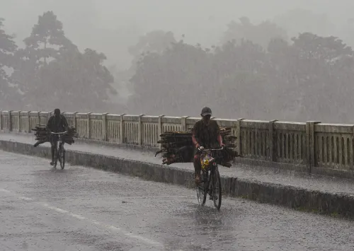
Bengal rain forecast: Heavy showers in north, more rain in south till Sunday

Synopsis
Even as the low-pressure system that drenched Bengal has weakened, the active southwest monsoon axis is keeping the rain tap open — heavy spells in East Midnapore and South 24 Parganas through Tuesday, and a fresh intensification across Darjeeling, Jalpaiguri, and Alipurduar next week. North Bengal is set for a wetter stretch ahead, not a drier one.
Key Takeaways
The IMD on 20 August forecast continued rain across south Bengal through Sunday , driven by an active southwest monsoon axis over Jharkhand-Bihar.
East Midnapore and South 24 Parganas face heavy rain warnings through Tuesday .
Darjeeling , Jalpaiguri , Alipurduar , and Cooch Behar are forecast to receive heavy rain on Thursday and Friday .
Heavy rain returns to Darjeeling , Kalimpong , Jalpaiguri , and Alipurduar in the first two days of next week.
Kolkata recorded a maximum of 32.02°C and minimum of 27.01°C on Wednesday, with humidity peaking at 97% .
The India Meteorological Department (IMD) on Thursday, 20 August forecast continued rainfall across south Bengal districts over the next several days, even as the low-pressure system that triggered the current wet spell has weakened and shifted toward the Jharkhand-Bihar region. The active southwest monsoon axis, now positioned over Jharkhand-Bihar and the western districts of West Bengal, is expected to sustain rain across most of the state through the coming week.
South Bengal Outlook
On Friday, light to moderate rain and thunderstorms are likely across all districts of south Bengal, with Jhargram, East Midnapore, West Midnapore, North 24 Parganas, South 24 Parganas, Howrah, Murshidabad, Birbhum, Nadia, and Kolkata among the districts most likely to see significant spells. Scattered light to moderate rain is forecast for all south Bengal districts through Sunday.
Heavy rain is expected to persist in East Midnapore and South 24 Parganas until at least Tuesday, the Met office said. Thursday's forecast also noted the possibility of a few spells of torrential rain in certain pockets, with maximum temperatures hovering around 33 degrees Celsius and minimum temperatures near 28 degrees Celsius.
North Bengal Faces Heavier Rain Ahead
Rainfall intensity is set to increase across north Bengal and is expected to continue throughout the next week. On Thursday and Friday, heavy rain is forecast for four of the five upper districts — Darjeeling, Jalpaiguri, Alipurduar, and Cooch Behar — while the remaining districts are likely to see light to moderate rain accompanied by thunderstorms, lightning, and gusty winds.
Moderate rain is forecast across most north Bengal districts through Monday. Heavy rain is expected to return to Darjeeling, Kalimpong, Jalpaiguri, and Alipurduar in the first two days of next week, according to the Met office.
Kolkata Temperature and Humidity
On Wednesday, Kolkata recorded a maximum temperature of 32.02 degrees Celsius — marginally 0.02 degrees above normal — and a minimum of 27.01 degrees Celsius, which was 0.07 degrees above normal. Relative humidity ranged between 66% and 97%, reflecting the moisture-laden conditions associated with the active monsoon.
Why the Rain Continues
Although the low-pressure system has dissipated in strength and moved inland, the southwest monsoon axis remains active over the region. Meteorologists note that such residual circulation patterns can sustain prolonged wet spells even after the primary system weakens — a pattern seen repeatedly during Bengal's monsoon season. This comes amid a broader active monsoon phase across eastern India, with Jharkhand and Bihar also recording above-normal rainfall in recent days.
Residents in low-lying coastal and riverine areas of East Midnapore and South 24 Parganas, in particular, should remain alert through Tuesday given the heavy-rain forecast for those districts.
Point of View
But the real story is the sustained monsoon axis — and that is what mainstream coverage often misses. When the axis stays anchored over Jharkhand-Bihar and western West Bengal, it acts as a conveyor belt of moisture regardless of whether a named system exists. The persistent heavy-rain warning for coastal East Midnapore and South 24 Parganas through Tuesday is the detail that matters most for disaster preparedness, given those districts' vulnerability to flooding and storm-surge events. North Bengal's escalating forecast through next week also deserves closer attention: Darjeeling and Jalpaiguri hillsides remain susceptible to landslides under sustained heavy rain, and the back-to-back warnings suggest the risk window is far from closed.
NationPress
5 Oct 2026
Frequently Asked Questions
Will it rain in Kolkata this week?
Yes, light to moderate rain and thunderstorms are forecast for Kolkata through Sunday, with the active southwest monsoon axis sustaining wet conditions. Temperatures are expected to hover around 33°C maximum and 28°C minimum.
Which south Bengal districts face the heaviest rain?
East Midnapore and South 24 Parganas are under a heavy rain warning through Tuesday, 26 August. Other districts including Jhargram, West Midnapore, Howrah, Murshidabad, Birbhum, Nadia, and North 24 Parganas are also likely to see significant spells through the weekend.
What is the weather forecast for north Bengal this week?
North Bengal is set for intensifying rain through the coming week. Darjeeling, Jalpaiguri, Alipurduar, and Cooch Behar face heavy rain on Thursday and Friday, with moderate rain across most north Bengal districts through Monday. Heavy rain is forecast again for Darjeeling, Kalimpong, Jalpaiguri, and Alipurduar in the first two days of next week.
Why is it still raining in Bengal even though the low pressure has weakened?
Although the low-pressure system has dissipated and moved toward Jharkhand-Bihar, the southwest monsoon axis remains active over the region. This axis continues to channel moisture into West Bengal, sustaining rainfall even without a named weather system.
What temperatures is Kolkata experiencing during this monsoon spell?
On Wednesday, Kolkata recorded a maximum temperature of 32.02°C — marginally above normal — and a minimum of 27.01°C, also slightly above normal. Relative humidity ranged between 66% and 97%.