CM Himanta targets 5 lakh bigha forest land clearance in Assam

Synopsis
Assam CM Himanta Biswa Sarma has set a target of freeing 5 lakh bigha of land from encroachment, ordering the Forest Department to enforce a zero-tolerance policy using satellite surveillance against illegal occupation, mining, and encroachment on forest land.
Key Takeaways
Assam CM Himanta Biswa Sarma announced a target of clearing 5 lakh bigha of land from encroachment.
The Assam Forest Department has been directed to use satellite surveillance for monitoring forest land violations.
The drive targets three categories of violation: illegal settlement, unauthorised mining, and general encroachment on forest land.
The CM cited decisive anti-encroachment action in his previous term as the foundation for the current, scaled-up push.
Progress on the 5 lakh bigha target and rollout of satellite-based monitoring will be the key metrics to watch.
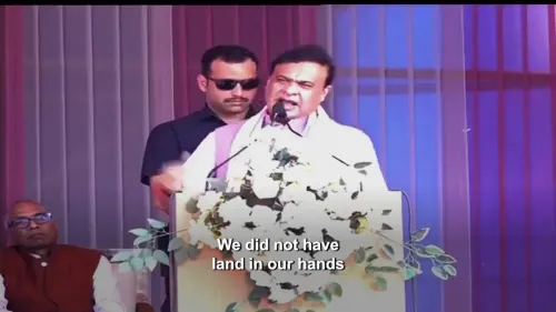
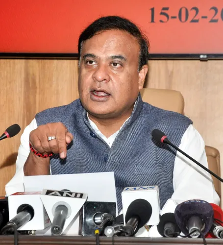
Assam's forests are getting a new line of defence — and this time, satellites are watching. Assam Chief Minister Himanta Biswa Sarma announced on Friday, October 23, 2026, that his government has set a target of freeing 5 lakh bigha of land from encroachment, directing the Assam Forest Department to deploy satellite surveillance and take strict action against illegal occupation, mining, and encroachment on forest land.
In his post, CM Sarma wrote: 'पिछले कार्यकाल में हमारी सरकार ने अतिक्रमण के विरुद्ध निर्णायक कार्रवाई की थी' — 'In the previous term, our government took decisive action against encroachment' — positioning the current push as an escalation of that effort, not a fresh start. The stated goal: zero tolerance for illegal occupation of forest land, whether through settlement, extraction, or mining.
The 5 lakh bigha mission and what it demands
Five lakh bigha is a significant area — roughly equivalent to over 66,000 hectares of land that the state government says needs to be reclaimed and protected. Anti-encroachment drives on forest and government land in Assam have been a recurring feature of recent administrations, but the explicit numerical target and the instruction to pair ground enforcement with satellite-based monitoring marks a sharper, more measurable commitment.
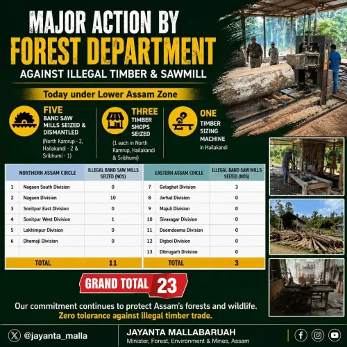
The directive to the Forest Department covers three distinct threats: illegal settlement on forest land, unauthorised mining, and general encroachment. Satellite surveillance — already used in various conservation and land-management contexts across India — would allow real-time detection of fresh encroachments and reduce dependence solely on ground-level inspection, which has historically been difficult to sustain across Assam's large and often remote forest tracts.
From the previous term's evictions to a technology-backed push
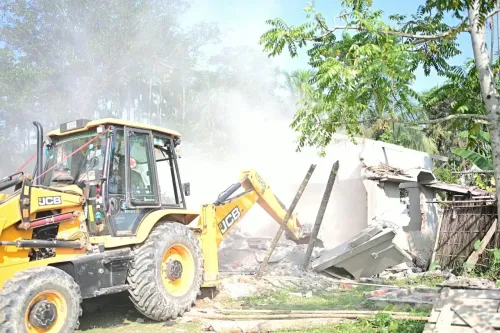
The Sarma government's reference to its prior term is pointed. Assam saw high-profile eviction drives in earlier years — operations that drew both commendation for forest protection and controversy over their human impact on forest-fringe communities. The current announcement frames satellite monitoring as the mechanism that can make enforcement both more precise and more consistent, reducing the need for large, disruptive one-time operations.
For forest communities and land administrators, the practical rollout will be the real test. The Assam Forest Department will need to translate political direction into operational capacity — mapping encroached zones, coordinating with revenue authorities, and building a surveillance grid capable of flagging violations as they happen rather than after the fact.
What comes next for Assam's forests
The immediate questions are operational: how quickly can satellite monitoring be operationalised across notified forest areas, and what is the timeline attached to the 5 lakh bigha target? Progress reports from the Forest Department will be the clearest indicator of whether this drive moves at the pace its framing promises.
Assam's forest cover and biodiversity corridors — including areas adjacent to national parks and wildlife sanctuaries — have faced long-standing pressure from encroachment. A credible, technology-backed enforcement framework could change the baseline. The satellite, it turns out, is now part of Assam's forest guard.
Point of View
Technology-backed enforcement as a political and administrative differentiator ahead of what will inevitably be scrutiny of delivery on the target. Satellite surveillance as a tool for forest protection reflects a broader national trend of deploying remote-sensing technology to supplement ground enforcement — but the Assam version is notable for its explicit linkage to a specific acreage target, making accountability harder to deflect. The drive also sits at the intersection of two perennial Assam tensions: the state's ecological imperatives around its forest corridors and the politically sensitive question of who occupies forest-fringe land. How the Forest Department operationalises the directive — and whether it is accompanied by due-process safeguards — will determine whether this is transformative policy or a political signal.
NationPress
23 Oct 2026
Frequently Asked Questions
What is the 5 lakh bigha encroachment target announced by Assam CM Himanta Biswa Sarma?
CM Himanta Biswa Sarma has set a target of freeing 5 lakh bigha of land from illegal encroachment in Assam, directing the Forest Department to enforce a zero-tolerance policy against illegal occupation, mining, and encroachment on forest land.
How will Assam use satellite surveillance to protect forest land?
The Assam Forest Department has been directed to use satellite-based monitoring to detect and track illegal encroachments, mining, and occupation of forest land in real time, reducing reliance on ground-only inspections.
What anti-encroachment actions did the Assam government take in its previous term?
CM Sarma stated that in the preceding government term, his administration took 'decisive action' against encroachments. Assam saw high-profile eviction drives on forest and government land during that period.
Who is responsible for implementing the forest land protection drive in Assam?
The Assam Forest Department is the primary agency tasked with carrying out strict enforcement, deploying satellite surveillance, and working towards the 5 lakh bigha target set by CM Himanta Biswa Sarma.
Why is forest encroachment a major issue in Assam?
Assam's forest areas, including land adjacent to national parks and wildlife corridors, face sustained pressure from illegal settlement, encroachment, and unauthorised mining, making enforcement a recurring priority for successive state governments.