

CM Naidu Surveys Cyclone Murasu Flood Zones From Air
Synopsis
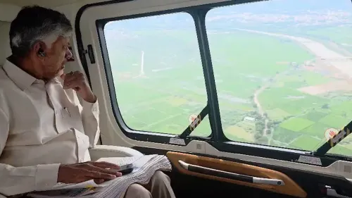
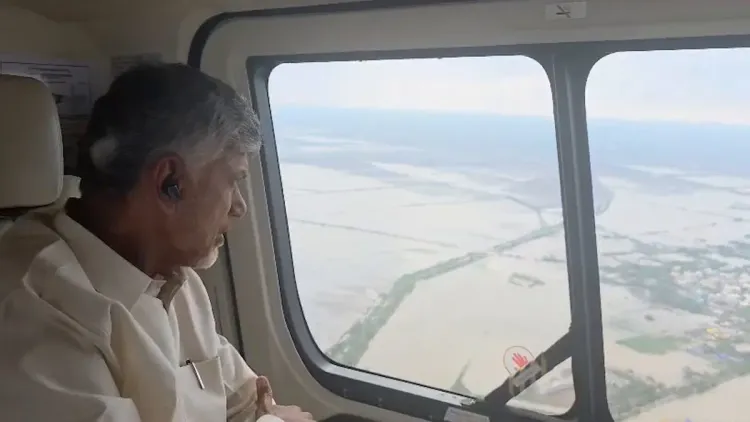
Andhra Pradesh CM N. Chandrababu Naidu conducted an aerial survey of Cyclone Murasu-affected Guntur, Prakasam, and Bapatla districts on 4 November 2026, observing submerged crops and marooned villages, before chairing an emergency relief review at the RTG Centre.
Key Takeaways
Chandrababu Naidu conducted an aerial survey of Cyclone Murasu -affected areas on 4 November 2026 .
Three coastal districts — Guntur, Prakasam, and Bapatla — are the worst-hit zones.
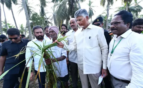
Agricultural fields in Chilakaluripet, Ongole, Kothapatnam, Chinaganjam, Chirala, and Bapatla are submerged.
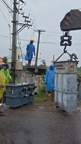
Multiple villages remain cut off by floodwaters; road infrastructure has been damaged.
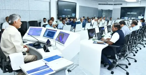
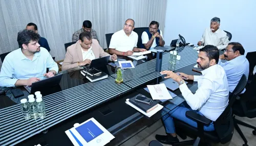
Naidu chaired a post-survey review at the RTG Centre in the state secretariat to assess ongoing relief operations.
Crop-loss compensation and central assistance requests are expected in the coming weeks.
Andhra Pradesh Chief Minister N. Chandrababu Naidu took to the skies on Wednesday, 4 November 2026 to personally assess the scale of destruction left by Cyclone Murasu across three battered coastal districts — Guntur, Prakasam, and Bapatla — before convening an emergency review with officials at the RTG Centre in the state secretariat.
Crops Under Water, Villages Cut Off Across Six Towns
The aerial survey painted a grim picture. Agricultural fields across Chilakaluripet, Ongole, Kothapatnam, Chinaganjam, Chirala, and Bapatla lie submerged, with standing crops lost to inundation. Several villages remain marooned, cut off by floodwaters, while roads across the region have sustained significant damage. In his own words: 'Panta nīṭa munigāyi... anēka grāmālu jaladiga' — 'Crops have drowned... many villages are surrounded by water.'
The three districts bear the brunt of Andhra Pradesh's coastline vulnerability. Bapatla, carved out as a separate district only in 2022, is facing one of its first major cyclonic tests as an administrative unit. Prakasam and Guntur, meanwhile, have a long history of Bay of Bengal cyclones ripping through their farmland and fishing communities.
From the Air to the War Room: Naidu's RTG Centre Review
After completing the aerial assessment, Naidu moved directly to the RTG (Real-Time Governance) Centre at the state secretariat in Amaravati — the nerve centre for disaster coordination — and chaired a review meeting on the relief operations currently underway in the affected zones. The RTG Centre, a flagship governance tool of the Telugu Desam Party administration, allows live monitoring of field-level relief work across districts.
Andhra Pradesh institutionalised this model of aerial damage assessment followed by secretariat-level coordination in the wake of Cyclone Hudhud in 2014, which devastated the Visakhapatnam coast. That disaster accelerated the state's investment in rapid-response infrastructure, and successive governments have embedded aerial surveys and centralised war-room reviews into standard operating procedure.
Farmers, Roads, and the Compensation Clock
For flood-affected farmers across the six towns, the survey's real consequence is what comes next: damage enumeration, crop-loss assessment, and compensation notifications. Broken roads threaten to slow the delivery of relief materials into marooned villages, adding urgency to repair timelines. All eyes now turn to whether the state will seek central disaster relief funds and how swiftly ex-gratia payments reach farmers who have lost their standing crops.
The hashtag #TogetherAgainstCycloneMurasu anchors the state government's public communication around the response — a signal that the administration is treating visibility and accountability as integral to its relief effort, not an afterthought.
Point of View
Technology-backed oversight to signal administrative seriousness during crises. With three districts simultaneously affected and crop losses already visible from the air, the pressure on state machinery for rapid damage enumeration and compensation is acute. Bapatla district, still a relatively new administrative unit, adds complexity to relief coordination. The speed of compensation disbursal and any formal request for central disaster funds will ultimately define the political and administrative verdict on this response.
NationPress
4 Nov 2026
Frequently Asked Questions
Which districts did CM Naidu survey after Cyclone Murasu?
CM Naidu conducted an aerial survey of Guntur, Prakasam, and Bapatla districts, the three coastal Andhra Pradesh districts most affected by Cyclone Murasu.
What areas are flooded due to Cyclone Murasu in Andhra Pradesh?
Agricultural fields and villages in Chilakaluripet, Ongole, Kothapatnam, Chinaganjam, Chirala, and Bapatla are reported to be submerged, with crops lost and roads damaged.
What is the RTG Centre and why did Naidu hold a review there?
The RTG (Real-Time Governance) Centre in the Andhra Pradesh secretariat is a live monitoring hub for state administration. Naidu used it to review the status of ongoing cyclone relief operations after his aerial survey.
Will cyclone-affected farmers in Andhra Pradesh get compensation?
Following damage enumeration and crop-loss assessment after Naidu's aerial survey, the state government is expected to announce compensation for farmers. Central disaster relief funds may also be sought.
How has Andhra Pradesh responded to past cyclones like Hudhud?
After Cyclone Hudhud in 2014 , Andhra Pradesh expanded its disaster management framework to include aerial damage surveys and centralised secretariat-level coordination, a model that remains in use today.