

Cyclone alert: IMD warns of storm near TN coast by Monday evening
Synopsis
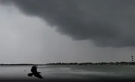
A Bay of Bengal weather system is on track to become a cyclonic storm by Monday evening, with the north Tamil Nadu coast squarely in its projected path. Nine ports have been placed on alert and fishermen warned off the sea — the clearest sign yet that the system is being taken seriously before a single drop of rain has fallen on the shore.
Key Takeaways
A weather system in the southeast Bay of Bengal is forecast to intensify into a cyclonic storm by Monday evening .
The IMD has projected a possible crossing of the north Tamil Nadu coast , though exact landfall location and timing are yet to be confirmed.
Storm Warning Signal Number 1 has been hoisted at nine ports , including Chennai , Nagapattinam , Rameswaram , and Thoothukudi .
The system is expected to form a depression by Sunday before strengthening further.
Fishermen have been advised to avoid deep-sea fishing and secure their vessels along the shore.
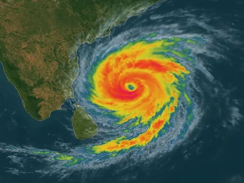
A weather system over the southeast Bay of Bengal is expected to intensify into a cyclonic storm by Monday evening, with the India Meteorological Department (IMD) forecasting a possible crossing of the north Tamil Nadu coast. As a precautionary measure, Storm Warning Signal Number 1 has been hoisted at nine ports across Tamil Nadu and Puducherry.
How the System Is Developing
The weather system, which began as a low-pressure area over the southeast Bay of Bengal, has already strengthened into a well-marked low-pressure area. According to the IMD, it is expected to move northwestwards and concentrate into a depression over the same region by Sunday. It will subsequently track north-northwestwards, gaining further intensity before emerging as a cyclonic storm over the central and adjoining west-central Bay of Bengal by Monday evening.
The projected trajectory points the storm towards the north Tamil Nadu coast. However, the IMD has not yet specified the precise location or timing of a potential landfall, nor the wind speeds expected as the system approaches land.
Ports Put on Alert
Warning signals have been raised at nine ports across the region. The locations identified include Chennai, Cuddalore, Nagapattinam, Rameswaram, and Thoothukudi in Tamil Nadu, along with Puducherry and Karaikal. The hoisting of Signal Number 1 marks the beginning of a formal warning sequence, indicating that the system poses a potential threat to coastal areas.
Advisory for Fishermen
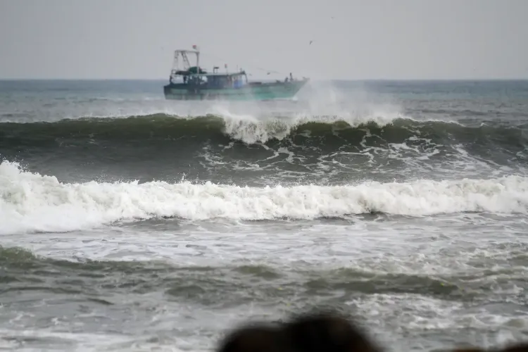
Fishermen have been strongly advised against venturing into the deep sea in view of the rapidly developing weather system. Authorities have also instructed fishing communities to anchor their boats securely along the shore as a precaution against adverse sea conditions. The advisory places particular emphasis on vessel safety as the system is expected to strengthen significantly over the next two days.
What to Watch
The system is progressing through successive stages — from a low-pressure area to a well-marked low-pressure area, then a depression, and ultimately a cyclonic storm — a trajectory consistent with Bay of Bengal weather patterns during the northeast monsoon season, which typically peaks between October and December. The Tamil Nadu coast is historically among the most cyclone-exposed stretches of India's eastern seaboard during this period. Detailed landfall advisories, evacuation directives, and rainfall warnings from the IMD are expected to follow as the system matures over the weekend.
Point of View
Which means coastal administrators from Chennai to Thoothukudi must prepare simultaneously rather than concentrate resources. Tamil Nadu's cyclone preparedness infrastructure has improved markedly since the devastation of Cyclone Vardah in 2016 and Gaja in 2018, but the absence of precise landfall data in the critical 48-hour window remains a persistent challenge. The real test will be how quickly the state machinery mobilises evacuation and shelter protocols once the IMD upgrades its advisory — historically, the gap between a depression and a destructive landfall can be under 36 hours.
NationPress
15 Nov 2026
Frequently Asked Questions
When is the cyclone expected to form and where is it headed?
The IMD has forecast that the weather system over the southeast Bay of Bengal will intensify into a cyclonic storm by Monday evening. Its projected path points towards the north Tamil Nadu coast, though the precise landfall location and timing have not yet been confirmed.
Which ports have been put on alert due to the cyclone warning?
Storm Warning Signal Number 1 has been hoisted at nine ports. The identified locations include Chennai, Cuddalore, Nagapattinam, Rameswaram, and Thoothukudi in Tamil Nadu, as well as Puducherry and Karaikal.
What advisory has been issued for fishermen?
Fishermen have been advised not to venture into deep-sea waters and to anchor their boats securely along the shore. The advisory is in place due to the expected strengthening of the system over the next two days.
What stage of development is the weather system at right now?
As of 15 November 2026, the system has strengthened from a low-pressure area into a well-marked low-pressure area. It is expected to become a depression by Sunday before intensifying into a cyclonic storm by Monday evening.
Is this cyclone likely to make landfall in Tamil Nadu?
The IMD forecast indicates the storm is moving towards the north Tamil Nadu coast, suggesting a possible landfall in the region. However, the department has not yet specified the exact location or timing of any landfall, and further updates are expected as the system develops.