Cyclone threat over Bay of Bengal: Heavy rain alert for south Bengal from Wednesday

Synopsis
A low-pressure system over the Bay of Bengal is on track to become a cyclone by Monday — and its outer bands are forecast to drench South 24 Parganas, East Midnapore, Kolkata, and a dozen other south Bengal districts with heavy rain and 60 kmph gusts from Wednesday. Fishermen face a red-warning ban from Tuesday. If intensification accelerates, the impact on Bengal's coastal belt could be significantly worse than current forecasts suggest.
Key Takeaways
A low-pressure area formed over the Bay of Bengal on Friday and is expected to intensify into a cyclone by Monday morning .
The system is tracking towards north Andhra Pradesh and south Odisha coasts, bringing heavy rain to south Bengal from Wednesday .
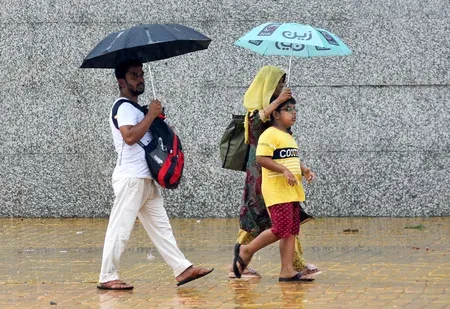
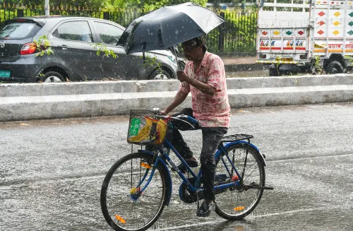
South 24 Parganas and East Midnapore face continuous heavy rain from Wednesday to Friday ; Kolkata braces for thunderstorms and winds of 30–40 kmph .
A red warning for the West Bengal coast takes effect from Tuesday ; fishermen advised not to go to sea.
Coastal wind gusts could reach 60 kmph ; seas are expected to remain rough.
Darjeeling , Jalpaiguri , and Alipurduar in north Bengal also likely to receive heavy rain on Thursday and Friday .
A cyclone is likely to develop over the Bay of Bengal within days, the Regional Meteorological Centre in Kolkata warned on Saturday, 24 October 2026, triggering advance weather alerts for several districts of West Bengal beginning Wednesday. The developing system is expected to bring heavy rainfall, thunderstorms, and gusty winds across large parts of south Bengal through the coming week.
How the System Is Developing
A low-pressure area formed over the east-central and adjoining southeast Bay of Bengal on Friday, accompanied by a cyclonic circulation extending up to 5.8 km above mean sea level. Meteorologists project the system will intensify into a depression by Saturday, moving west-northwestwards, before strengthening into a deep depression by Sunday. A full cyclone may develop over the sea by Monday morning, according to the meteorological department.
The system is then expected to gain further strength over two days and track towards the coastal areas of north Andhra Pradesh and south Odisha — a trajectory that historically channels heavy rainfall and rough seas into Bengal's coastal belt. This is a pattern meteorologists have seen repeatedly during the northeast monsoon withdrawal period in October.
District-Wise Weather Warnings
Kolkata is forecast to experience scattered light rain, thunderstorms, and gusty winds from Wednesday to Friday, with wind speeds ranging between 30 and 40 kmph. The same conditions are expected across Howrah, Hooghly, North 24 Parganas, East Burdwan, West Burdwan, Birbhum, Murshidabad, and Nadia districts.
The most severe rainfall is expected in the coastal and southern districts. South 24 Parganas and East Midnapore may face continuous heavy rain from Wednesday to Friday. Purulia and Bankura are likely to receive heavy rainfall on Thursday and Friday. Scattered rain has also been forecast for South 24 Parganas, East Midnapore, and West Midnapore from Tuesday onwards.
Fishermen Advisory and Coastal Warning
There is currently no weather warning for the West Bengal coast until Monday. However, fishermen have been strongly advised against venturing into the sea from Tuesday, when a red warning comes into effect. Coastal wind speeds are expected to range between 40 and 50 kmph, with gusts reaching up to 60 kmph. Sea conditions are projected to remain rough throughout the alert period.
Notably, fishing communities along the Bengal coast are among the most directly exposed to cyclonic systems in the Bay of Bengal, which has historically produced some of India's deadliest storms — including Cyclone Amphan (2020) and Cyclone Yaas (2021). Authorities are watching whether landfall timing aligns with high tide cycles, which can amplify storm surge impact.
North Bengal and Temperature Readings
Unsettled weather is expected to spread to north Bengal later in the week. Darjeeling, Jalpaiguri, and Alipurduar districts are likely to receive heavy rainfall on Thursday and Friday, with other northern districts facing scattered rain and gusts of 30 to 40 kmph on both days.
Meanwhile, Kolkata recorded a minimum temperature of 23.1 degrees Celsius on Saturday morning, marginally above the seasonal norm by 0.1 degrees. The maximum temperature on Friday stood at 32.2 degrees Celsius, 0.5 degrees above normal.
What to Watch Next
The critical variable in the coming days is the speed and direction of the system's intensification. If the cyclone strengthens faster than projected, landfall timing and affected zones could shift. The meteorological department is expected to issue updated bulletins as the system tracks closer to the coast. Residents across south Bengal's coastal and low-lying districts are urged to monitor official advisories closely.
Point of View
But the speed of intensification projected here — from low-pressure to potential cyclone in under three days — leaves little buffer for preparedness, especially in Bengal's coastal districts that are still rebuilding from Amphan and Yaas. The red warning and fishermen advisory are the right calls, but the window between the advisory and landfall is narrow. What this also highlights is a structural issue: south Bengal's coastal belt remains among the most cyclone-exposed regions in Asia, with evacuation infrastructure that has improved but is not fully stress-tested. If the system accelerates, the 48-hour notice currently on offer may prove inadequate.
NationPress
24 Oct 2026
Frequently Asked Questions
When is the cyclone expected to form over the Bay of Bengal?
The system is projected to intensify into a cyclone over the Bay of Bengal by Monday morning, according to the Regional Meteorological Centre in Kolkata. It began as a low-pressure area on Friday and is expected to pass through depression and deep depression stages before reaching cyclone intensity.
Which districts of West Bengal are under heavy rain alert?
South 24 Parganas and East Midnapore face the most severe rainfall, with continuous heavy rain expected from Wednesday to Friday. Kolkata, Howrah, Hooghly, North 24 Parganas, East and West Burdwan, Birbhum, Murshidabad, Nadia, Purulia, and Bankura are also under alert for thunderstorms and gusty winds.
Why have fishermen been warned not to go to sea?
A red warning takes effect for the West Bengal coast from Tuesday, with wind speeds projected at 40–50 kmph and gusts up to 60 kmph. The sea is expected to remain rough, making conditions dangerous for fishing vessels. Fishermen have been formally advised to stay ashore until the warning is lifted.
Where is the cyclone expected to make landfall?
The system is currently tracking towards the coastal areas of north Andhra Pradesh and south Odisha, according to the meteorological department. Its influence, even without a direct Bengal landfall, is forecast to bring heavy rain and thunderstorms across much of south Bengal.
Will north Bengal also be affected?
Yes. Darjeeling, Jalpaiguri, and Alipurduar are likely to receive heavy rainfall on Thursday and Friday. Other northern districts may also experience scattered rain and gusty winds reaching 30–40 kmph on both days.