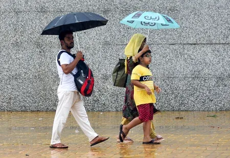
Bay low pressure intensifies: Heavy rain alert for 5 south Bengal districts

Synopsis
A strengthening low-pressure system over the northwest Bay of Bengal has triggered heavy rain alerts for seven south Bengal districts across two days, with the cyclonic circulation reaching 7.6 km above sea level. Fishermen across West Bengal, Odisha and Bangladesh coasts have been ordered to stay ashore — a signal of how seriously meteorologists are tracking this system's westward march.
Key Takeaways
The IMD issued a heavy rain alert for East Midnapore , West Midnapore , Jhargram , Purulia , and Bankura on 31 August .
West Burdwan and Birbhum are under a heavy rain alert for Tuesday .
A low-pressure area over the northwest Bay of Bengal has intensified, with cyclonic circulation up to 7.6 km above mean sea level.
Fishermen advised not to venture into coastal waters off West Bengal , Odisha , and Bangladesh until Monday.
North Bengal districts including Darjeeling and Jalpaiguri remain under heavy rain watch through Wednesday ; Jalpaiguri and Alipurduar on alert through Thursday .
Rainfall intensity expected to ease from Wednesday in south Bengal, with no warnings currently issued thereafter.
The India Meteorological Department (IMD) on Monday, 31 August issued a heavy rainfall forecast for five districts of south Bengal over the next 24 hours, as a low-pressure area over the northwest Bay of Bengal intensified into a more marked system. Two additional districts are expected to receive heavy rain on Tuesday under the same weather influence.
The Weather System Behind the Alert
According to the Met Office, the low-pressure area over the northwest Bay of Bengal has strengthened considerably, with its associated cyclonic circulation extending up to 7.6 km above mean sea level. The system is expected to move in a west-northwestward direction.
Compounding the situation is an active monsoon trough currently stretching across Punjab, Haryana, Uttar Pradesh, Bihar, and West Bengal before extending into the Bay of Bengal. As a result, intermittent rainfall is likely to persist across the state over the coming days.
District-Wise Rain Alerts
Heavy rainfall is expected on Monday in East Midnapore, West Midnapore, Jhargram, Purulia, and Bankura districts. On Tuesday, a heavy rain alert has been issued for West Burdwan and Birbhum districts.
Other parts of south Bengal are likely to witness scattered thunderstorms with light to moderate rainfall. Kolkata may also receive light to moderate showers during this period. The IMD indicated that rainfall intensity is expected to ease from Wednesday, with no weather warnings currently in place for south Bengal thereafter.
Fishermen Advisory and Sea Conditions
The Met Office warned of strong winds over the sea, with speeds ranging between 40 and 50 kmph and gusts reaching up to 60 kmph at places. Fishermen have been advised not to venture into coastal waters off West Bengal, Odisha, and Bangladesh until Monday.
North Bengal Also Under Heavy Rain Watch
Darjeeling, Jalpaiguri, Kalimpong, Alipurduar, and Cooch Behar districts in north Bengal are expected to record heavy showers through Wednesday. Jalpaiguri and Alipurduar will remain under a rain alert on Thursday as well. North Dinajpur, South Dinajpur, and Malda are likely to receive scattered light to moderate rainfall.
In Kolkata, the minimum temperature on Monday was recorded at 27.7 degrees Celsius, 1.1 degrees above normal, while Sunday's maximum temperature settled at 31.8 degrees Celsius, 0.7 degrees below normal. With the system expected to weaken by mid-week, residents across affected districts should remain alert through Tuesday night.
Point of View
Where a Bay low-pressure system and an active trough reinforce each other across the breadth of the subcontinent. What deserves scrutiny is the fishermen advisory: a 40-60 kmph wind warning covering three national coastlines simultaneously signals a system with meaningful intensity, even if it stops short of a depression. The easing forecast from Wednesday offers relief, but West Bengal's flood-prone districts — particularly East and West Midnapore, which have seen repeated inundation in recent monsoon seasons — will need district administrations to act on the 24-hour window, not wait for it to pass.
NationPress
15 Oct 2026
Frequently Asked Questions
Which districts in south Bengal are under heavy rain alert on 31 August?
The IMD has issued a heavy rain alert for East Midnapore, West Midnapore, Jhargram, Purulia, and Bankura on 31 August. On Tuesday, the alert extends to West Burdwan and Birbhum districts.
What is causing heavy rainfall in West Bengal right now?
A low-pressure area over the northwest Bay of Bengal has intensified and become more marked, with its cyclonic circulation extending up to 7.6 km above mean sea level. This system, combined with an active monsoon trough stretching from Punjab to the Bay of Bengal, is driving sustained and heavy rainfall across the state.
Are fishermen safe to go out to sea?
No. The IMD has advised fishermen not to venture into coastal waters off West Bengal, Odisha, and Bangladesh until Monday, citing strong winds of 40-50 kmph with gusts up to 60 kmph.
When will the heavy rain ease in south Bengal?
According to the IMD, rainfall intensity is expected to ease from Wednesday. No weather warnings are currently in place for south Bengal beyond Tuesday.
Is north Bengal also affected by this weather system?
Yes. Darjeeling, Jalpaiguri, Kalimpong, Alipurduar, and Cooch Behar are expected to receive heavy rainfall through Wednesday. Jalpaiguri and Alipurduar remain under a rain alert on Thursday as well.