Delhi temperature drops 9°C in 48 hours after heatwave above 45°C

Synopsis
Delhi went from a 45°C-plus heatwave to near-normal temperatures in under 48 hours — a 7 to 9 degree swing confirmed by the IMD. The trigger was a Western Disturbance, but meteorologists warn the relief is temporary, with June heat still ahead and the city's power and health infrastructure already tested to its limits.
Key Takeaways
Delhi recorded a temperature drop of 7 to 9°C within 24 hours by 29 May , ending a severe heatwave.
On 27 May , the Ridge station peaked at 45.6°C ; by 29 May it had fallen to 36.8°C .
The cooling was triggered by a Western Disturbance bringing strong winds, cloud cover, and light rain to northwest India.
Heatstroke hospital admissions and record power demand are both expected to ease following the temperature reversal.
IMD forecasts maximum temperatures of 35–38°C over the next few days before a gradual rise.
Meteorologists warn that May–June in Delhi remains unpredictable and the relief is temporary.
New Delhi recorded a sharp temperature drop of 7 to 9 degrees Celsius within 24 hours by 29 May, ending a punishing heatwave that had pushed readings above 45°C across multiple stations in the national capital. The India Meteorological Department (IMD) confirmed the abrupt cooling, attributing it to a Western Disturbance sweeping across northwest India.
How Severe the Heatwave Was
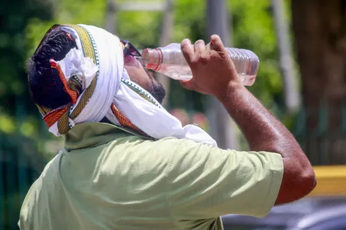
On 27 May, Delhi was in the grip of severe heat. The Ridge station logged 45.6°C, Aya Nagar recorded 45.4°C, while Palam and Lodhi Road each touched 44.6°C. Safdarjung, the city's primary reference station, registered 44.3°C. Hospitals reported a surge in heatstroke cases, and power demand hit record levels as residents relied heavily on air conditioners.
The Dramatic Temperature Reversal
By 29 May, the same stations painted a starkly different picture. Ridge cooled to 36.8°C, Aya Nagar to 36.0°C, Palam to 35.2°C, Lodhi Road to 35.7°C, and Safdarjung to 36.8°C — a decline of nearly 8 to 9 degrees at most monitoring points in under two days.
What Triggered the Cooling
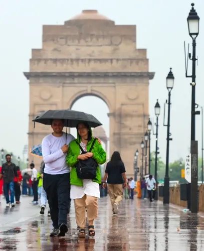
According to IMD officials, the Western Disturbance brought strong winds, increased cloud cover, and light rainfall to parts of the city. These combined factors helped dissipate the heatwave by suppressing daytime heating and lowering both maximum and minimum temperatures. A senior IMD scientist noted that this kind of rapid cooling provides critical relief to vulnerable groups — particularly the elderly, children, and outdoor workers who had been most exposed to heat-related health risks.
Impact on Health, Air Quality and Power
The cooling has marginally improved air quality across the capital. Heatstroke admissions, which had surged during the peak heatwave days, are expected to ease. Power demand — which had climbed to record highs driven by air-conditioning load — is also likely to moderate in the near term. This comes amid growing concern about Delhi's infrastructure capacity during extreme heat events, a pattern that has intensified in recent summers.
What the Forecast Says
The IMD has forecast relatively comfortable weather for the next few days, with maximum temperatures expected to remain between 35°C and 38°C before any gradual rise. Meteorologists caution, however, that May and June in Delhi remain climatically unpredictable, and the Western Disturbance's relief is temporary in nature. Residents have been advised to stay hydrated and limit direct sun exposure during peak afternoon hours even as conditions remain cooler than earlier in the week.
Point of View
But the real story is structural: Delhi's heatwave intensity has been climbing year on year, and a single Western Disturbance now qualifies as 'relief.' The city's power grid and public health system were already at the edge during this episode — that vulnerability does not disappear with cooler days. With June still ahead and the Western Disturbance's effect temporary, the question is not whether the heat returns but whether Delhi's infrastructure will be any more resilient when it does.
NationPress
13 Oct 2026
Frequently Asked Questions
Why did Delhi's temperature drop so sharply in May 2025?
Delhi's temperature fell by 7 to 9 degrees Celsius within 24 hours due to a Western Disturbance affecting northwest India. The system brought strong winds, cloud cover, and light rainfall that together broke the heatwave that had pushed temperatures above 45°C.
Which areas of Delhi were worst affected by the heatwave?
The Ridge station recorded the highest temperature at 45.6°C on 27 May, followed by Aya Nagar at 45.4°C, Palam and Lodhi Road at 44.6°C each, and Safdarjung at 44.3°C. These same stations saw drops of nearly 8 to 9 degrees by 29 May.
What is the IMD weather forecast for Delhi after the cooling?
The India Meteorological Department has forecast maximum temperatures of 35°C to 38°C for the next few days, after which a gradual rise is expected. Meteorologists caution that May and June remain unpredictable in Delhi.
Who is most at risk during Delhi heatwaves?
According to IMD scientists, the elderly, children, and outdoor workers face the highest risk of heat-related illness during heatwave conditions. Hospitals had reported a surge in heatstroke cases during the peak heat days before the Western Disturbance brought relief.
How did the heatwave affect power demand and air quality in Delhi?
Power demand hit record levels during the heatwave due to heavy air-conditioning use. The subsequent cooling is expected to ease that load. Air quality also improved marginally following the light rainfall and wind activity associated with the Western Disturbance.