Is Delhi-NCR Air Quality Still Poor with AQI at 214?
Synopsis
The air quality in Delhi-NCR continues to be alarming with an AQI of 214. Amidst rising pollution and high temperatures, residents are left to wonder about the health implications and potential weather changes ahead. Will relief come soon or should residents brace for more challenges?
Key Takeaways
Delhi-NCR is experiencing poor air quality with an AQI of 214.
Weather conditions may provide minimal relief soon.
High temperatures are expected to persist, nearing 30 degrees Celsius.
Uttar Pradesh claims better air quality compared to Delhi.
Health risks are a significant concern for residents.
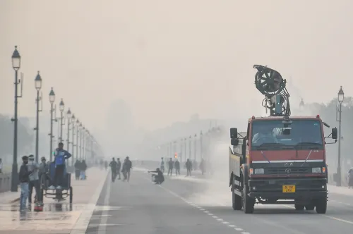
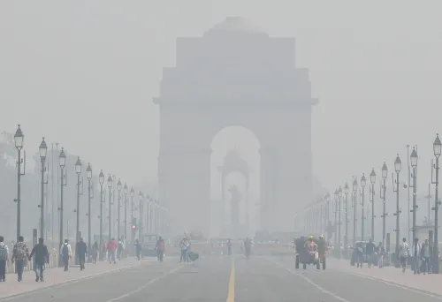
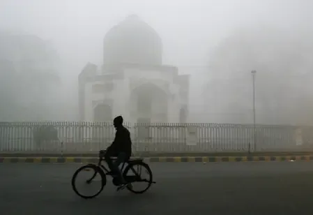
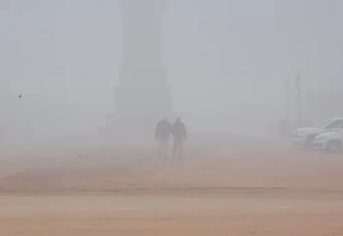
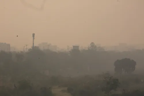
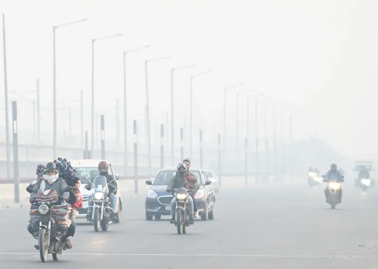
New Delhi, Feb 16 (NationPress) Residents in the Delhi-NCR region are set to endure poor air quality once more, as sluggish wind speeds have caused pollution levels to fall into the ‘poor’ category. The Air Quality Index (AQI) was measured at 214 around 7 a.m. on Monday, as reported by the Central Pollution Control Board (CPCB).
On Sunday, the national capital's air quality had also dropped into the ‘poor’ category, with an AQI of 221 recorded at the same hour. This figure represented a slight decline from the AQI of 197 observed on Saturday.
According to data from the CPCB, multiple monitoring stations indicated elevated AQI levels on Monday morning. Notable readings included Anand Vihar at 300, Ashok Vihar at 266, Burari Crossing at 240, DTU at 205, and more. Other areas such as Dwarka Sector-8 reported AQI levels of 237, while Jahangiripuri saw 288.
In related news, Uttar Pradesh Chief Minister Yogi Adityanath remarked on Saturday that the air quality in Delhi resembled a 'gas chamber', asserting that residents of his state were benefiting from a cleaner environment, unhindered by development activities.
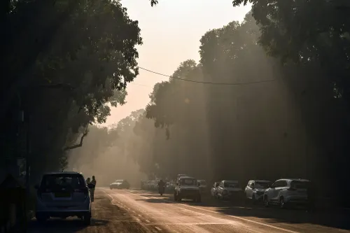
Weather patterns might provide minimal relief in the upcoming days. The India Meteorological Department (IMD) has predicted rain and thunderstorms across parts of northern India on February 16 and subsequent days. However, temperatures in Delhi are expected to stay elevated, with maximums nearing 30 degrees Celsius.
The national capital has experienced above-average warmth in early February, with the average maximum temperature recorded at 25 degrees Celsius, which is 1.9 degrees Celsius higher than the long-term average for this period.
Despite forecasts indicating an active western disturbance in the coming days, a notable temperature drop appears unlikely. The maximum temperature is predicted to gradually rise to 30 degrees Celsius.
On Sunday, Delhi's maximum temperature reached 28.5 degrees Celsius, approximately four degrees above the norm for this time of year. Forecasts suggest that Monday and Tuesday will see similar maximums of around 29 degrees Celsius.
Throughout the first half of February, temperatures exceeded normal levels for 14 days, dipping below 20 degrees only once. The highest temperature recorded this month has been 28.6 degrees Celsius on February 10.
The IMD also predicts that a weak western disturbance may bring isolated drizzles to the city on Wednesday. However, significant temperature drops are not anticipated, with maximums likely hovering around 28 degrees Celsius by the weekend.
These potential drizzles may result in a minor temperature decrease, yet this will only be temporary, likely dropping by 1-2 degrees Celsius. Following February 19, temperatures are expected to rise again.
Point of View
It's critical to address the ongoing air quality crisis in Delhi-NCR. The situation demands immediate attention from authorities, and the health of residents is at stake. While weather forecasts suggest possible relief, it is essential to recognize the underlying issues contributing to persistent pollution levels and advocate for sustainable solutions.
NationPress
27 Jul 2026
Frequently Asked Questions
What is the current air quality index in Delhi-NCR?
The current Air Quality Index (AQI) in Delhi-NCR is 214, indicating poor air quality.
What are the health implications of poor air quality?
Poor air quality can lead to respiratory issues, heart problems, and other serious health conditions, particularly for vulnerable populations.
Are there any weather changes expected soon?
Yes, the India Meteorological Department has forecasted rain and thunderstorms in the region in the coming days.
How is the air quality in Uttar Pradesh compared to Delhi?
Uttar Pradesh's Chief Minister has claimed that the air quality in his state is cleaner than that of Delhi, which he likened to a 'gas chamber'.
What is the average temperature in Delhi this February?
The average maximum temperature in Delhi during the first half of February has been recorded at 25 degrees Celsius, above the long-term average.