Delhi-NCR drenched by heavy showers; IMD issues Orange Alert, more rain ahead

Synopsis
A deep depression crossing the West Bengal–Odisha coast supercharged Delhi-NCR's monsoon on 28 July, triggering an IMD Orange Alert and pushing rainfall totals past 37 mm at some stations. With temperatures set to fall 2–3°C and wet conditions forecast through the week, the city's relief from a brutal heat spell has arrived — but waterlogging and traffic disruptions are already following close behind.
Key Takeaways
IMD issued an Orange Alert for parts of Delhi on 28 July , signalling heavy rainfall and strong winds ahead.
Safdarjung recorded 32.4 mm of rain by 8:30 am ; Ridge station topped stations at 37.6 mm .
A deep depression near the West Bengal–North Odisha coast is driving intensified monsoon activity across northern India.
Daytime temperatures are expected to fall by 2–3 degrees Celsius over the next several days from Monday's high of 38.1°C .
Delhi's AQI stood at 77 ('satisfactory') at 9 am , according to CPCB data.
Rainfall also hit Punjab and Haryana , with waterlogging and traffic disruptions reported in parts of both states.
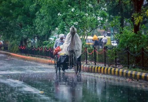
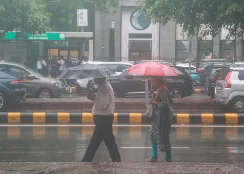
Heavy rainfall swept across Delhi-NCR on Tuesday, 28 July, as thick cloud cover blanketed the region and showers brought long-awaited relief from days of oppressive heat and humidity. The India Meteorological Department (IMD) has issued an Orange Alert for parts of the national capital, warning of further rainfall accompanied by strong winds in the hours ahead.
Rainfall Figures Across Stations
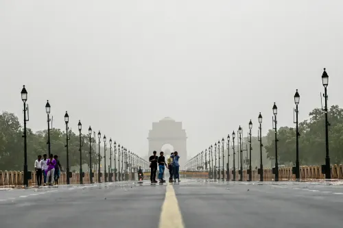
According to IMD data, Safdarjung — the city's primary weather observatory — logged 32.4 mm of rainfall until 8:30 am. Other monitoring stations recorded notable precipitation as well: Ridge received 37.6 mm, Lodhi Road 36.7 mm, Ayanagar 4 mm, and Palam 0.8 mm. The Kartavya Path vicinity and several other parts of Delhi experienced continuous morning showers, visibly transforming conditions across the city.
Civic Advisory and Commuter Impact
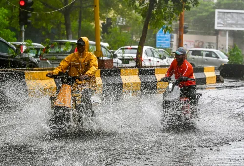
Civic authorities have urged residents to exercise caution, as intense spells of rain could trigger waterlogging in low-lying areas and slow traffic on major arterial roads. Commuters are likely to face delays due to reduced visibility and rainwater accumulation at vulnerable stretches. The weather department expects generally cloudy skies to persist through the day, with light to moderate showers at most locations during the morning and afternoon, and another round of rainfall probable by evening or night.
What Is Driving the Monsoon Surge
Meteorologists attribute the intensified rainfall activity to a deep depression that formed near the West Bengal coast and crossed the West Bengal–North Odisha coastline near Digha and west of Haldia on Tuesday morning. This system has strengthened monsoon currents across northern India, with wet conditions forecast to persist through the week. Moderate rainfall is expected on Wednesday, with intermittent showers and thunderstorms likely over the coming days.
Temperature Drop and Air Quality
The sustained rainfall is expected to pull daytime temperatures down by approximately 2–3 degrees Celsius over the next several days. On Monday, Safdarjung had recorded a maximum of 38.1 degrees Celsius. Meanwhile, air quality improved markedly: data from the Central Pollution Control Board (CPCB) showed the Air Quality Index (AQI) at 77 as of 9 am — firmly in the 'satisfactory' category.
Impact on Punjab and Haryana
The weather system's reach extended well beyond Delhi. Several districts in Punjab — including Shaheed Bhagat Singh Nagar, Bathinda, Ludhiana, Pathankot, Hoshiarpur, Jalandhar, and Mohali — recorded measurable rainfall. In Haryana, districts such as Bhiwani, Karnal, Mahendragarh, Sonipat, and Ambala also received showers, bringing relief from heat but causing localised waterlogging and traffic disruptions. As monsoon activity remains elevated, authorities across the region are monitoring low-lying areas for flood risk through the remainder of the week.
Point of View
But the city's chronic infrastructure deficit means every heavy spell doubles as a stress test it routinely fails. Waterlogging on arterial roads and low-lying colony flooding are not weather events — they are governance outcomes. The IMD's Orange Alert is timely, but the deeper question is whether civic agencies have cleared drains and pre-positioned pumps, or whether residents will once again be left navigating knee-deep water on roads that flood every July. The West Bengal deep depression driving this surge also signals that the 2025 monsoon season is tracking above-normal for the north — a pattern worth watching as August approaches.
NationPress
26 Oct 2026
Frequently Asked Questions
Why has IMD issued an Orange Alert for Delhi on 28 July?
The IMD issued an Orange Alert for parts of Delhi on 28 July to warn of heavy rainfall and strong winds expected in the coming hours. The alert follows a deep depression near the West Bengal–North Odisha coast that has intensified monsoon activity across northern India.
How much rainfall did Delhi record on 28 July?
Safdarjung, Delhi's primary weather observatory, recorded 32.4 mm of rainfall until 8:30 am on 28 July. The Ridge station recorded the highest at 37.6 mm, followed by Lodhi Road at 36.7 mm.
What is causing the heavy rain in Delhi-NCR?
A deep depression that developed near the West Bengal coast and crossed the West Bengal–North Odisha coastline near Digha and west of Haldia on Tuesday morning is responsible for strengthening monsoon currents across northern India, including Delhi-NCR.
Will temperatures drop in Delhi due to the rain?
Yes. Weather experts anticipate a drop of approximately 2–3 degrees Celsius over the next several days. Safdarjung had recorded a maximum of 38.1 degrees Celsius on Monday before the showers intensified.
Is Delhi's air quality affected by the monsoon rains?
Delhi's air quality improved during the rainy spell. CPCB data showed the AQI at 77 as of 9 am on 28 July, placing it in the 'satisfactory' category — a marked improvement from pre-monsoon levels.