Delhi-NCR orange alert: IMD warns of heavy rain through July 10
Synopsis
An IMD Orange Alert is in force for Delhi as monsoon rains drench the capital, with Mehrauli recording 83 mm in under 24 hours and waterlogging reported at the New Delhi Railway Station. The wet spell is set to continue across Delhi, Haryana, and western UP through 10 July — keeping disruption risk elevated for millions of commuters.
Key Takeaways
IMD has issued an Orange Alert for Delhi on 9 July , warning of heavy rainfall through most of the day.
Waterlogging reported at New Delhi Railway Station , Munirka , and other city localities, disrupting normal movement.
Mehrauli recorded the highest rainfall at 83 mm between 8:30 am on 8 July and 5:30 am on 9 July ; Jafarpur the lowest at 6 mm .
Widespread rainfall forecast to continue over Delhi , Haryana , Chandigarh , and western Uttar Pradesh until 10 July .
Northeastern Uttar Pradesh under a fresh rain spell forecast through 13 July ; eastern Rajasthan also likely to see activity on 9 July .
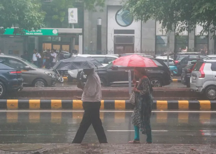
The India Meteorological Department (IMD) has issued an Orange Alert for Delhi on 9 July, warning of heavy to very heavy rainfall through most of the day and urging residents to exercise caution. Fresh spells of rain lashed Delhi-NCR in the early hours of Thursday, extending an active monsoon wet spell that has gripped the National Capital region for several days.
Waterlogging and Disruptions Across the City
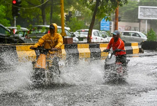
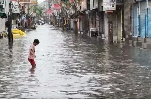
The overnight and early-morning showers brought temperatures down but also triggered localised waterlogging at multiple points across the city. Affected areas include the New Delhi Railway Station, Munirka, and several other localities, causing disruptions to normal movement on city roads. While residents welcomed relief from days of oppressive humidity, the accumulation of rainwater on roads created pockets of congestion.
Rainfall Data: Station-Wise Breakdown
According to IMD data, rainfall recorded between 8:30 am on 8 July and 5:30 am on 9 July varied significantly across Delhi-NCR. Mehrauli logged the highest rainfall at 83 mm, followed by Lodi Road at 79 mm, Pusa at 73 mm, Chhatarpur at 68 mm, and Mayur Vihar at 66 mm. Janakpuri recorded 62 mm, Narayana 57 mm, Pragati Maidan 46 mm, Najafgarh 42 mm, and Mungeshpur 40 mm. Jharoda Kalan received 33 mm, while Jafarpur recorded the least at just 6 mm.
What IMD Has Forecast for the Coming Days
The weather department has forecast fairly widespread to widespread rainfall activity over Haryana, Chandigarh, Delhi, and western Uttar Pradesh continuing through 10 July. A fresh spell of rain is also expected across northeastern Uttar Pradesh until 13 July, while eastern Rajasthan is likely to see similar activity on 9 July. This comes on the back of an active monsoon sweep across large parts of North India on Wednesday, which had already delivered widespread relief from intense heat.
Context: Monsoon Intensity This Season
The ongoing spell is part of a broader active monsoon phase over northern India. The wide variation in rainfall — from 83 mm at Mehrauli to just 6 mm at Jafarpur within the same city — underscores the hyper-localised nature of monsoon distribution in urban areas. Authorities have been put on standby as the Orange Alert signals a continued risk of waterlogging and traffic disruption through the day. Residents have been advised to avoid unnecessary travel and stay updated on IMD advisories.
Point of View
Not seasonal. Year after year, the same choke points — underpasses, low-lying rail stations, arterial roads — succumb to waterlogging within hours of a moderate rain event. With Mehrauli recording 83 mm in under 24 hours, this is not an extraordinary rainfall event by monsoon standards; it is an ordinary event exposing extraordinary drainage failure. The real story is not the rain — it is why the capital's infrastructure still cannot absorb it.
NationPress
8 Oct 2026
Frequently Asked Questions
What does the IMD Orange Alert for Delhi mean?
An IMD Orange Alert for Delhi on 9 July means heavy to very heavy rainfall is expected through most of the day, and residents are advised to stay cautious and avoid unnecessary travel. It is the second-highest alert level, signalling significant risk of waterlogging and disruption.
Which areas in Delhi recorded the most rainfall on 9 July?
Mehrauli recorded the highest rainfall at 83 mm between 8:30 am on 8 July and 5:30 am on 9 July, followed by Lodi Road at 79 mm and Pusa at 73 mm. Jafarpur recorded the least, at just 6 mm, highlighting the hyper-localised nature of monsoon distribution across the city.
Where has waterlogging been reported in Delhi-NCR?
Waterlogging has been reported at the New Delhi Railway Station, Munirka, and several other parts of the city, causing disruptions to normal road movement. Authorities have been placed on standby as rain is expected to continue through the day.
How long will the rain continue in Delhi and surrounding areas?
According to the IMD, fairly widespread to widespread rainfall is expected over Delhi, Haryana, Chandigarh, and western Uttar Pradesh through 10 July. Northeastern Uttar Pradesh is under a fresh rain forecast until 13 July, and eastern Rajasthan is also likely to see activity on 9 July.
Is this monsoon spell unusual for Delhi in July?
An active monsoon spell in early-to-mid July is within the normal seasonal range for Delhi. However, the wide variation in rainfall across stations — from 83 mm in Mehrauli to 6 mm in Jafarpur — reflects the uneven, localised nature of urban monsoon distribution that regularly strains city drainage systems.