CM Fadnavis Clears Special Package for Flood-Hit Palghar
Synopsis
Chief Minister Devendra Fadnavis chaired a flood review for Palghar at Mantralaya on 28 July 2026, approving a special above-norm relief package, holding ponds for Vasai-Virar, MITRA-led resilience planning linked to World Bank funding, and a ₹584.45 crore infrastructure reconstruction proposal.
Key Takeaways
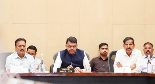
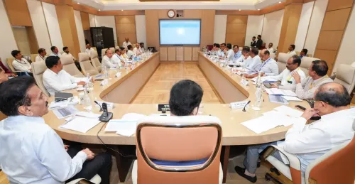
CM Devendra Fadnavis chaired a detailed flood-relief review for Palghar district at Mantralaya, Mumbai on 28 July 2026 .
A special assistance package exceeding standard relief norms will be approved for flood-affected families in Palghar and Nashik, modelled on the Kolhapur flood precedent.
Approximately 4,197 families in Palghar, Dahanu, and Talasari talukas had already received food grain and financial aid at the time of the meeting. 'Holding ponds' will be developed in the Vasai-Virar area on expired-lease land to manage drainage during heavy rainfall.
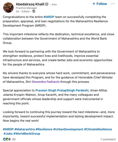
MITRA will prepare a Palghar district plan under the Maharashtra Resilient Development Programme (MRDP) , enabling access to World Bank funding.
A ₹584.45 crore proposal covering road reconstruction, bridge upgrades, drain construction, and WTP repairs was discussed and fast-tracked.
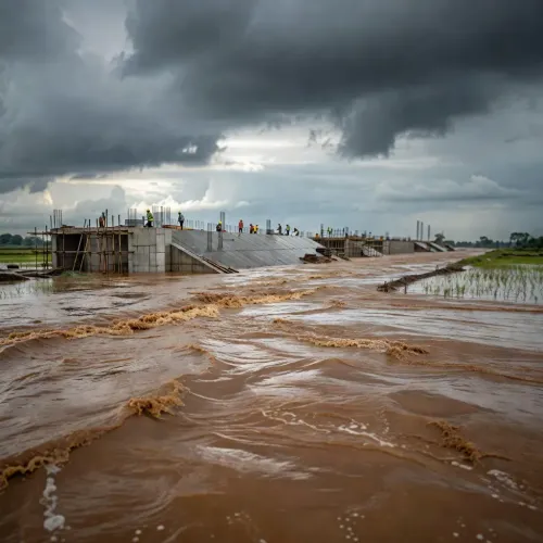
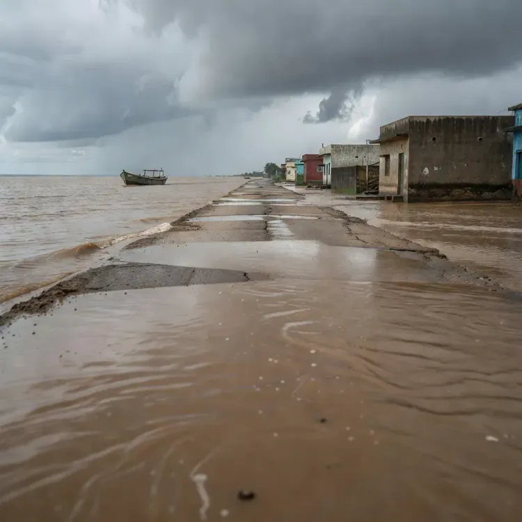
Floodwaters in Palghar district lingered for more than 48 hours around the Surya river, Kavadsa, and Surya dam catchment areas — long enough to submerge thousands of homes and sever entire communities. On Tuesday, 28 July 2026, Chief Minister Devendra Fadnavis convened a detailed review meeting at Mantralaya, Mumbai, and emerged with a two-track response: immediate special relief beyond standard norms, and a permanent infrastructure overhaul designed to make Palghar flood-proof.
A Special Package — and Why Palghar Needed One
The scale of damage made a standard-formula response inadequate. The meeting was told that roughly 4,197 families across the Palghar, Dahanu, and Talasari talukas had already received food grain and financial assistance, but losses ran far deeper. CM Fadnavis directed that an integrated relief framework covering both Palghar and Nashik districts be prepared immediately, with a special package that exceeds the aid ceilings normally permitted under existing rules.
The precedent is Kolhapur. When that city faced catastrophic flooding, Maharashtra approved an above-norm assistance package — and Fadnavis cited that model explicitly as the benchmark for what Palghar's families should receive. Panchanamas (damage assessments) for destroyed homes and shops, he directed, must be completed at speed.
Holding Ponds for Vasai-Virar and the Drainage Problem
One of the sharpest interventions announced targets Vasai-Virar, where geography slows drainage dramatically during heavy rain. CM Fadnavis ordered the development of 'holding ponds' — large retention basins that absorb excess water until natural drainage can cope. Land on expired leases is to be identified and repurposed for this infrastructure.
The meeting also flagged the chronic problem of connectivity blackouts in the Vasai Link and Nalasopara areas during downpours, and directed that permanent road and communication infrastructure be built to end that vulnerability.
MITRA, the World Bank, and the Samruddhi Blueprint
The longer-term architecture draws on a framework already tested in Raigad and Ratnagiri in the Konkan division. Maharashtra Institution for Transformation (MITRA) has been tasked with preparing a district plan for Palghar under the Maharashtra Resilient Development Programme (MRDP) — a structure that also opens the door to World Bank funding for resilient infrastructure.
Fadnavis pointed to the Samruddhi Mahamarg expressway project as proof of concept: detailed terrain mapping and drainage planning during that project produced measurable gains, and the same methodology — base maps of waterbodies, flow channels, and topography — will now underpin all future development approvals in Palghar.
The ₹584.45 Crore Proposal on the Table
The meeting examined a detailed proposal worth ₹584.45 crore covering road reconstruction, repair of protective embankments, raising the height of culverts and bridges, rebuilding damaged water treatment plants (WTPs), and construction of covered drains. CM Fadnavis directed the Public Works Department, Rural Development Department, Mahavitaran and associated power companies to work on a 'war footing' — a phrase that signals the state expects visible progress, not paperwork.
Power infrastructure got its own directive: the three electricity distribution companies must restructure their grid to ensure uninterrupted supply even during disasters, with mandatory upgrades to physical infrastructure.
Ministers Girish Mahajan, Ganesh Naik, Shivendra Sinharajay Bhosale, Minister of State Adv. Ashish Jaiswal, other MLAs, and senior officials were present at the meeting. A joint review meeting of all central and state departments involved in Palghar's relief and rehabilitation is to follow shortly.
Palghar has long absorbed punishing monsoons while absorbing one of Maharashtra's fastest-growing urban populations — a combination that turns every cloudburst into a compounding crisis. The question now is whether the ₹584.45 crore framework, the holding ponds, and the MRDP mapping can break that cycle before the next monsoon arrives.
Point of View
Power-grid design, and development frameworks. By routing Palghar's reconstruction through MRDP and MITRA, the state government is also positioning itself to access multilateral funding, a pattern it has refined in Raigad and Ratnagiri. The Kolhapur precedent invoked by CM Fadnavis is politically significant: it sets an expectation of above-norm compensation that will be scrutinised closely by opposition and affected communities alike. Whether the ₹584.45 crore proposal and the holding-pond plan translate into contracted, completed work before the 2027 monsoon is the real test of this announcement.
NationPress
29 Jul 2026
Frequently Asked Questions
What is the special package announced for Palghar flood victims?
CM Devendra Fadnavis announced that an integrated relief package for Palghar and Nashik districts will be approved, providing assistance to flood-affected families beyond what standard government rules normally permit — similar to the above-norm aid given to Kolhapur during its major flood.
How many families were affected by the Palghar floods?
The review meeting was informed that approximately 4,197 families across Palghar, Dahanu, and Talasari talukas had been affected and had received food grain and financial assistance.
What are holding ponds and why are they being built in Vasai-Virar?
Holding ponds are large water-retention basins that store excess rainwater until natural drainage systems can handle it. CM Fadnavis directed their construction in Vasai-Virar because the area's geography slows drainage significantly during heavy rainfall, causing prolonged flooding.
What is MRDP and how does it relate to Palghar?
The Maharashtra Resilient Development Programme (MRDP) is a state resilience framework implemented through MITRA (Maharashtra Institution for Transformation). CM Fadnavis directed that a Palghar district plan be prepared under MRDP — the same model used for Raigad and Ratnagiri — which also enables the state to access World Bank funding.
What is the total cost of Palghar's flood infrastructure repairs?
A proposal of ₹584.45 crore was discussed at the meeting, covering road reconstruction, raising the height of culverts and bridges, repairing water treatment plants, building covered drains, and restoring protective embankments.