Gujarat Revenue Dept bets on AI, blockchain and GIS to reform land governance
Synopsis
Gujarat's Revenue Department is moving beyond incremental fixes — at its Chintan Shibir in Adalaj, officials and experts from IIT Gandhinagar and ISRO laid out a roadmap where blockchain makes land records tamper-proof, AI detects fraud before it happens, and satellite data from ISRO resolves disputes scientifically. It is one of the more substantive state-level digital governance pushes in recent memory.
Key Takeaways
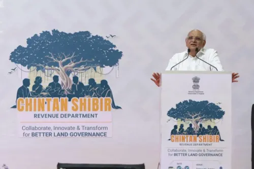
The Gujarat Revenue Department's Chintan Shibir was held at Amba Business Park, Adalaj on 7 May 2025 , with seven thematic groups examining land administration reforms.
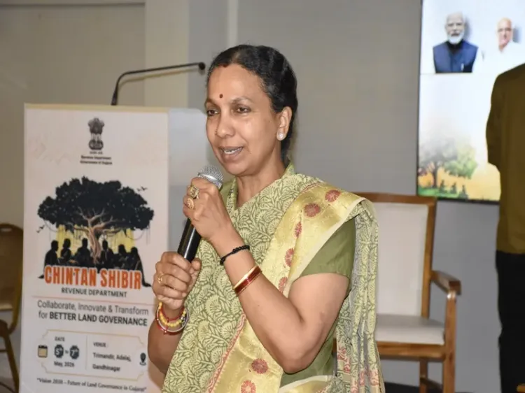
Additional Chief Secretary Dr Jayanti Ravi presided over deliberations on transparency and accountability in revenue operations.
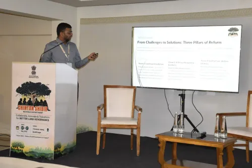
IIT Gandhinagar's Sameer Kulkarni outlined how blockchain can make land records tamper-proof and how AI can automate document verification, fraud detection and dispute pattern analysis.
ISRO's Pankaj Bodani presented on GIS and remote sensing for accurate land use mapping, dispute reduction and data-driven development planning.
Implementation challenges flagged include data security , algorithmic bias , staff training , and the need for robust governance frameworks during digital transition.
Shibir outcomes are expected to shape future reforms in Gujarat's revenue and land administration services.
The Gujarat Revenue Department's Chintan Shibir on Wednesday, 7 May 2025, placed strong emphasis on modernising land governance through digital technologies, with senior officials and domain experts deliberating on artificial intelligence (AI), blockchain, and geographic information systems (GIS) as tools to improve transparency, efficiency and citizen-centric service delivery across the state's revenue administration.
Key Deliberations at the Shibir
Held at Amba Business Park in Adalaj, Gandhinagar, the second day of the Shibir brought together officials divided into seven thematic groups to examine critical areas of land administration and revenue services. Additional Chief Secretary Dr Jayanti Ravi was present during the deliberations, where participants reviewed procedures and accountability mechanisms in revenue operations.
The group discussions spanned a wide range of subjects — from optimising land use change permissions through ILA and mutation procedures, to expanding paperless and faceless property registration systems and strengthening the RCCMS (Revenue Case and Court Management System). Separate groups addressed urban land record management, ethics and integrity in revenue administration, modernisation of survey and re-survey processes, disaster preparedness among government personnel, and challenges associated with land acquisition and allocation.
AI and Blockchain: Transforming Revenue Systems
A major technical session was led by Sameer Kulkarni, Assistant Professor at IIT Gandhinagar, who outlined the transformative potential of AI and blockchain in revenue administration. He explained that blockchain technology can make land records tamper-proof — once data is recorded, it cannot be altered without authorisation, thereby reducing the scope for manipulation and fraud while strengthening ownership clarity and reducing reliance on intermediaries.
Kulkarni further detailed how AI could be deployed for document verification, automatic survey number matching, pattern detection in disputed cases, fraud prediction, and faster processing of citizen services. He also highlighted the use of optical character recognition (OCR) and natural language processing (NLP) to digitise and interpret historical and legal land documents, enabling systems to flag anomalies and assist officials in identifying irregularities in records.
The session also examined implementation challenges, including data security, privacy safeguards, avoidance of algorithmic bias, auditability of digital systems, and the need to maintain human oversight in administrative decision-making. The importance of staff training and adherence to legal and ethical standards was underscored.
ISRO's GIS and Remote Sensing in Land Management
In a separate technical presentation, Pankaj Bodani, Deputy Head of VEDAS (Web Services and Analytics Division) at the Space Applications Centre of ISRO in Ahmedabad, explained how GIS and remote sensing technologies enable accurate land use mapping, continuous monitoring of land conditions, classification of agricultural and forest areas, assessment of water resources, and more precise urban development planning.
Bodani noted that integrating ISRO satellite data with GIS platforms can reduce land-related disputes, support timely updating of revenue records, and provide a scientific basis for development planning — marking a significant step toward data-driven governance in land administration.
What Comes Next
Officials stated that the discussions collectively aimed at combining policy reforms with technological solutions to improve land administration systems. The outcomes of the Shibir are expected to inform future efforts to enhance efficiency, transparency, and reliability in revenue services across Gujarat. With AI, blockchain, and satellite-linked GIS now formally on the reform agenda, the department's digital transition appears set to accelerate in the months ahead.
Point of View
How legacy paper records get digitised without error, and whether frontline revenue officials will actually be retrained — were flagged but not resolved. Whether this becomes a genuine reform or a well-documented aspiration will depend on what Gujarat's revenue bureaucracy does in the next 12 months.
NationPress
26 Jun 2026
Frequently Asked Questions
What is the Gujarat Revenue Department's Chintan Shibir?
The Chintan Shibir is a structured deliberation forum where senior revenue officials and domain experts review existing administrative processes and propose reforms. The latest edition, held at Amba Business Park in Adalaj on 7 May 2025, focused on digitising land governance using AI, blockchain, and GIS technologies.
How can blockchain improve land records in Gujarat?
According to IIT Gandhinagar's Sameer Kulkarni, blockchain can make land records tamper-proof by ensuring that once data is entered, it cannot be altered without authorisation. This reduces fraud, strengthens ownership clarity, and limits the role of intermediaries in property transactions.
What role does ISRO play in Gujarat's land governance reform?
ISRO's Space Applications Centre, represented by Pankaj Bodani, presented how GIS and remote sensing technologies can enable accurate land use mapping, monitor land conditions continuously, and integrate satellite data with revenue records to reduce disputes and support development planning.
What are the key challenges in implementing AI and blockchain in land administration?
Experts at the Shibir highlighted data security, privacy safeguards, algorithmic bias, auditability of digital systems, and the need for human oversight as key challenges. Staff training and adherence to legal and ethical standards were also identified as critical requirements for a successful digital transition.
What happens after the Chintan Shibir?
Officials stated that the Shibir's outcomes are expected to inform future policy and technology reforms in Gujarat's revenue administration. Sectoral guidelines and implementation roadmaps are anticipated, though specific timelines were not announced during the event.