Is Gujarat Prepared for the Heavy Rainfall Expected in the Next 24 Hours?
Synopsis
Gujarat is on high alert as the IMD predicts severe weather conditions, including thunderstorms and heavy rainfall, for the next 24 hours. With red and orange alerts issued for multiple districts, residents must stay informed and prepared for challenging weather ahead.
Key Takeaways
Gujarat faces severe weather with red and orange alerts.
Districts like Bhavnagar and Ahmedabad are on high alert.
Thunderstorms and strong winds are expected.
Residents should prepare for potential disruptions.
Rainfall activity is likely to continue until May 13.
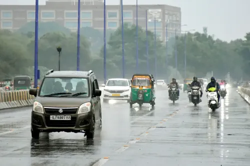
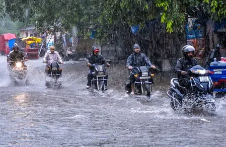
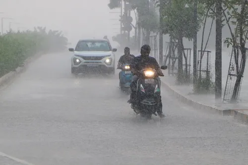
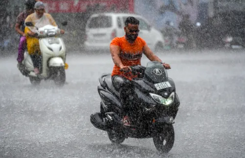
Ahmedabad, May 7 (NationPress) Gujarat is preparing for significant rainfall, thunderstorms, and powerful winds in the upcoming 24 hours, as the India Meteorological Department (IMD) has issued a red alert for various districts.
This alert comes after multiple weather systems have been activated simultaneously, impacting the region.
The latest bulletin from the IMD indicates that districts under the red alert include Bhavnagar, Amreli, Ahmedabad, Anand, Valsad, Daman, and Dadra Nagar Haveli.
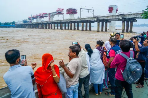
These regions are anticipated to witness severe thunderstorms, lightning, and surface winds gusting between 60-70 km/h along with heavy to very heavy rainfall at isolated locations.
An orange alert has also been released for a wider area of the state, spanning Banaskantha, Patan, Mehsana, Sabarkantha, Gandhinagar, Aravalli, Kheda, Panchmahal, Dahod, Mahisagar, Vadodara, Chhota Udepur, Narmada, Bharuch, Surat, Dang, Navsari, and Tapi.
All districts in the Saurashtra-Kutch region, including Surendranagar, Rajkot, Jamnagar, Porbandar, Jungadh, Morbi, Dwarka, Gir Somnath, Botad, Kutch, and Diu, are also under alert for moderate to heavy rainfall during this time.
As we look to May 8, the IMD has kept the orange alert active for thunderstorms and heavy rains in Sabarkantha, Aravalli, Anand, Mahisagar, Bharuch, Valsad, Daman, and Dadra Nagar Haveli, along with the Saurashtra districts of Rajkot, Amreli, Bhavnagar, Gir Somnath, and Diu.
The remainder of the state is expected to receive moderate to light showers.
The rainfall activity is anticipated to gradually diminish starting May 9, although some areas in Gujarat may continue to experience light to moderate rain until at least May 13. This current weather instability is the result of various atmospheric systems.
A cyclonic circulation is currently active over northwest Madhya Pradesh at approximately 0.9 km above mean sea level.
Additionally, a trough extends from the northeast Arabian Sea to west Madhya Pradesh across Gujarat, ranging from 3.1 to 5.8 km above sea level. Another trough, oriented east-west, stretches from southwest Rajasthan to north Jharkhand, affecting parts of Madhya Pradesh and Chhattisgarh.
Point of View
It is imperative to highlight the seriousness of the weather warnings issued by the IMD. The potential impact on communities and infrastructure cannot be underestimated, and we urge all residents to heed the alerts, stay informed, and prioritize safety during these turbulent weather conditions.
NationPress
3 Jul 2026
Frequently Asked Questions
What areas are under red alert in Gujarat?
The districts under red alert include Bhavnagar, Amreli, Ahmedabad, Anand, Valsad, Daman, and Dadra Nagar Haveli.
What weather conditions can be expected?
Severe thunderstorms, lightning, and strong winds reaching 60-70 km/h, along with heavy to very heavy rainfall at isolated locations.
How long will the rainfall last?
Rainfall activity is expected to gradually ease from May 9, but light to moderate rain may continue in some areas until at least May 13.
What should residents do to prepare?
Residents should stay informed through official channels, secure loose objects outdoors, and have an emergency plan in place.
Is there a risk of flooding?
Yes, the heavy rainfall may lead to localized flooding, especially in low-lying areas.