Heavy rain hits Patna as cyclonic system brings Bihar-wide storm alerts

Synopsis
A Bay of Bengal cyclonic circulation ended Bihar's heatwave on 29 May, drenching Patna and triggering IMD storm alerts for Katihar and Purnea. With temperatures set to drop 2-4°C and the Southwest Monsoon potentially arriving ahead of its June 12-18 window, the weather shift could have significant implications for the state's farmers.
Key Takeaways
Heavy rain lashed Patna on 29 May , triggered by a cyclonic circulation over the Bay of Bengal .
IMD has issued special alerts for heavy rainfall and strong winds in Katihar and Purnea (Seemanchal region).
Maximum temperatures are forecast to fall by 2 to 4 degrees Celsius across several Bihar districts over the next few days.
Wind speeds reached nearly 37 km/hour in Rohtas and Madhubani ; Bhabhua recorded the state's highest temperature at 39.9°C .
The Southwest Monsoon is expected to enter Bihar between 12 June and 18 June , with a possible earlier arrival if the Bay system strengthens.
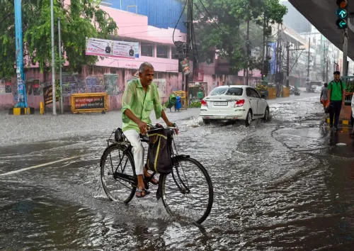
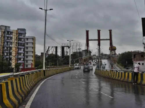
Heavy rain lashed Patna in the early hours of Thursday, 29 May, as a cyclonic circulation over the east-central and southeast Bay of Bengal triggered a sharp weather shift across Bihar, bringing cooler temperatures, gusty winds, and widespread cloud cover to the state. The downpour ended days of intense heatwave conditions and turned daylight hours unusually dark across the capital.
IMD Alerts and District-Level Warnings
The India Meteorological Department (IMD) centre in Patna has forecast partly cloudy skies, thunderstorms, lightning activity, gusty winds, and intermittent rainfall across most districts of Bihar over the next 24 hours. Special heavy-rainfall and strong-wind alerts have been issued specifically for Katihar and Purnea districts in the Seemanchal region. Scattered rainfall is expected to continue across the state for the next two to three days.
Temperature Drop and Wind Readings
Maximum temperatures fell in at least 10 districts on Thursday, with Patna recording a day temperature of 34.7 degrees Celsius. Bhabhua in Kaimur district logged the state's highest temperature at 39.9 degrees Celsius. Strong winds were recorded in Rohtas and Madhubani, reaching speeds of nearly 37 km/hour. Rainfall in the preceding 24 hours included 6.4 mm in Imamganj (Gaya), 1.4 mm in Banke Bazar, and 1 mm in Madhepura. The IMD has predicted a further fall of 2 to 4 degrees Celsius in maximum temperatures across several regions over the coming days.
Relief from Heatwave, but Humidity Persists
The cool winds sweeping Bihar have offered much-needed respite after prolonged heatwave stress. However, meteorologists have cautioned that humidity levels may remain elevated in some districts even as temperatures ease. No major temperature fluctuations are expected over the coming week, according to the department.
Monsoon Outlook for Bihar
The Southwest Monsoon is currently expected to enter Bihar between 12 June and 18 June. Notably, meteorologists have indicated that if the Bay of Bengal weather system strengthens further, the monsoon could arrive earlier than this projected window — a development that would accelerate the agricultural calendar for Bihar's farmers. This comes amid a broader pattern of pre-monsoon cyclonic activity in the Bay of Bengal influencing rainfall timelines across eastern India in recent years.
Point of View
Often outpacing IMD's short-range forecasts. The real story here is the monsoon timeline: an earlier-than-projected arrival would compress the sowing window and test state agricultural preparedness. Bihar's farmers, many of whom depend on kharif crop timing, have little buffer if weather volatility continues to override seasonal norms. The IMD's district-level alerts for Seemanchal are a step forward, but last-mile communication to vulnerable communities remains a persistent gap in India's weather warning ecosystem.
NationPress
12 Oct 2026
Frequently Asked Questions
Why did it rain heavily in Patna on 29 May?
Heavy rain in Patna on 29 May was triggered by a cyclonic circulation that formed over the east-central and southeast Bay of Bengal. This system brought widespread rainfall, cooler temperatures, and gusty winds across Bihar, ending a prolonged heatwave spell.
Which Bihar districts are on high alert for heavy rain?
The IMD has issued special alerts for heavy rainfall and strong winds in Katihar and Purnea in the Seemanchal region. Most other districts across Bihar are also forecast to experience thunderstorms, lightning, and intermittent rain over the next 24 hours.
How much will temperatures drop in Bihar?
The IMD has predicted a fall of 2 to 4 degrees Celsius in maximum temperatures across several Bihar districts over the next few days. On Thursday, temperatures already declined in at least 10 districts, with Patna recording 34.7°C.
When will the Southwest Monsoon reach Bihar?
The Southwest Monsoon is currently expected to enter Bihar between 12 June and 18 June. However, meteorologists have noted that if the Bay of Bengal weather system intensifies, the monsoon could arrive earlier than this projected window.
How long will the rain and storms last in Bihar?
According to the IMD, scattered rainfall and cloud cover are likely to continue across Bihar for the next two to three days. No major temperature fluctuations are expected over the coming week, though humidity may remain high in some districts.