Sikkim landslides: 128 evacuated in Gyalshing as heavy rain batters Rimbi, Singlitam
Synopsis
Relentless rain since 12 September has turned Sikkim's Gyalshing district into an active disaster zone — an RCC bridge has been washed away, a river has changed course, and 128 people have been forced out of their homes. With the lower-lying Rimbi Ward still at risk of fresh slope failures, the situation remains far from stable.
Key Takeaways
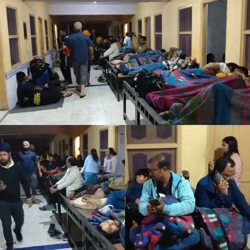
128 people from 28 houses in Rimbi , Gyalshing district, were evacuated to the Rimbi Gram Panchayat Kendra following floods on 14 September 2026 .
Landslide activity has been ongoing since 12 September , affecting both Singlitam and Rimbi .
More than 33 people , including children and the elderly, are sheltering at the Singlitam relief centre.
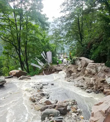
An RCC bridge has been washed away by debris surging along the NiK Kholsa stream ; the Rimbi River has altered its course.
The state government is planning a Bailey Bridge at a higher elevation; a temporary bamboo bridge is due from 15 September .
The Rimbi ICDS Centre was flooded on 14 September and may be shifted to a safer location.
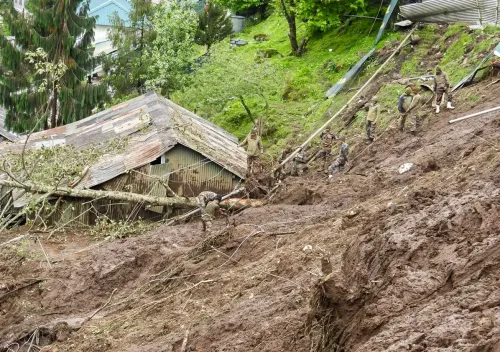
Heavy rainfall has triggered a surge in landslide activity across Sikkim's Gyalshing district, forcing authorities to evacuate 128 people from 28 houses in Rimbi as a precautionary measure, officials said on Tuesday, 15 September 2026. The Sikkim State Disaster Management Authority (SSDMA) confirmed that landslide incidents have been reported continuously since 12 September, damaging residential areas and public infrastructure across the district.
Scale of Evacuations at Rimbi and Singlitam
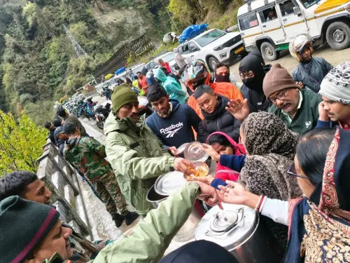
At Rimbi, an initial evacuation of four houses sheltering 18 people was carried out after the locations were identified as vulnerable. Following intensified heavy rain and flooding on 14 September, authorities expanded the operation significantly, relocating 128 residents from 28 houses to the Rimbi Gram Panchayat Kendra. Officials have identified the area around Mandir Point as the primary zone of landslide activity, with the lower-lying Rimbi Ward remaining at elevated risk of further slope failures.
At Singlitam, seven households directly hit by landslides have been moved to a relief centre at Singlitam Ward. More than 33 people, including children and elderly residents, are currently sheltering there, with the district administration providing food and other essential supplies.
Infrastructure Damage and Growing Flood Risk
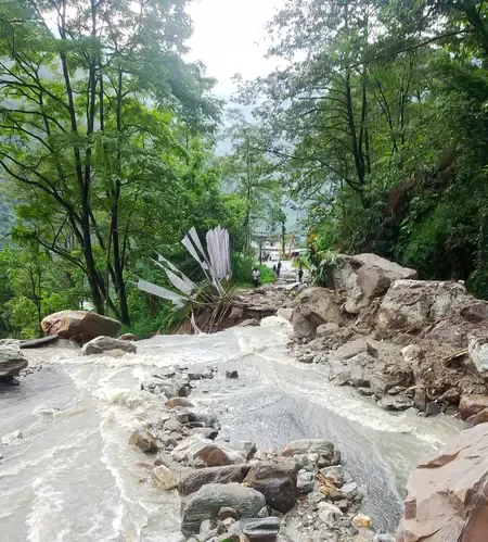
The scale of structural damage compounds the humanitarian challenge. Debris accumulating along the NiK Kholsa stream is carrying loose material toward Rimbi village, and the resulting surge has already washed away an RCC bridge, obstructing natural water flow. Authorities have raised concerns about the risk of a sudden debris-and-water release during intense rainfall episodes.
The Rimbi River has also altered its course and is now impacting the roadside flank. Notably, the main road in the area was washed away on the night of 14 May, and the state government is working on constructing a Bailey Bridge at a higher elevation as a longer-term solution. Continuous debris clearance and road restoration operations are underway.
Emergency Measures on the Ground
The district administration and multiple line departments are maintaining round-the-clock surveillance at affected sites. At Singlitam, lighting has been installed to enable monitoring during rainfall hours. A temporary bamboo bridge is scheduled for construction from 15 September to restore local movement, while water pipes are being supplied to re-establish connectivity to the Rimbi relief camp and the village water tank.
The Rimbi ICDS Centre, located below the expanding landslide zone, was flooded on 14 September. Authorities have advised the department to explore relocating the centre to a safer site as soon as possible.
Warnings to Residents
Officials have urged all residents to stay away from landslide zones, rivers, and streams during heavy rain. The public has been asked to immediately report fresh cracks, unusual ground movement, sudden changes in water flow, or any unusual sounds to local authorities. This comes amid forecasts of continued heavy rainfall across the northeastern region, raising the likelihood of further slope activity in vulnerable pockets of Gyalshing district.
Point of View
Chronic vulnerability: Sikkim's steep topography and increasingly erratic monsoon intensity make districts like this perennial disaster flashpoints, yet infrastructure — bridges, drainage channels, ICDS centres — continues to be built in high-risk zones. The washing away of an RCC bridge and the diversion of the Rimbi River are not aberrations; they are predictable consequences of inadequate land-use planning in seismically and hydrologically sensitive terrain. The real accountability question is not how fast the Bailey Bridge gets built, but why the preceding bridge was sited at a flood-vulnerable elevation in the first place. Until hazard mapping drives construction decisions, Sikkim will keep repeating this cycle every monsoon.
NationPress
15 Sept 2026
Frequently Asked Questions
How many people have been evacuated in Sikkim's Gyalshing landslide?
A total of 128 people from 28 houses in Rimbi have been evacuated to the Rimbi Gram Panchayat Kendra following floods on 14 September 2026. An earlier evacuation of 18 people from four houses had already taken place before the situation worsened.
When did the Gyalshing landslides begin?
Landslide incidents in Gyalshing district have been reported since 12 September 2026, according to the Sikkim State Disaster Management Authority (SSDMA). The situation intensified significantly after heavy rain and flooding on 14 September.
Which areas are most affected by the Sikkim landslides?
The worst-hit areas are Singlitam and Rimbi in Gyalshing district. Officials have identified the zone around Mandir Point as the primary landslide site, and the lower-lying Rimbi Ward remains at risk of further slope failures.
What infrastructure has been damaged in the Gyalshing landslide?
An RCC bridge has been washed away by debris carried along the NiK Kholsa stream, and the Rimbi River has altered its course, affecting the roadside flank. The main road was previously washed away on the night of 14 May, and the state government is planning a Bailey Bridge at a higher elevation.
What precautions are authorities advising residents in Gyalshing?
Residents have been urged to avoid landslide zones, rivers, and streams during heavy rain and to immediately report fresh cracks, unusual ground movement, changes in water flow, or unusual sounds to local authorities. Round-the-clock surveillance by district administration and line departments is in place.