Heavy rains flood Jaipur, Dholpur markets; IMD Yellow Alert for 22 Rajasthan districts

Synopsis
Rajasthan's monsoon turned ferocious on 29 July — Jaipur's iconic Walled City went underwater, Dholpur's markets flooded, and houses were damaged in Baseri and Saipau. With a Bay of Bengal deep depression energising the trough and the IMD flagging 22 districts on Yellow Alert, the state faces several more days of heavy to very heavy rain through early August.
Key Takeaways
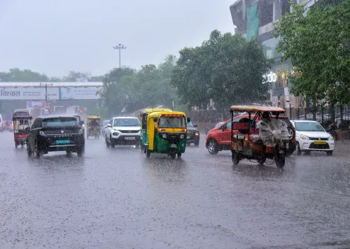
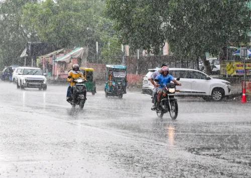
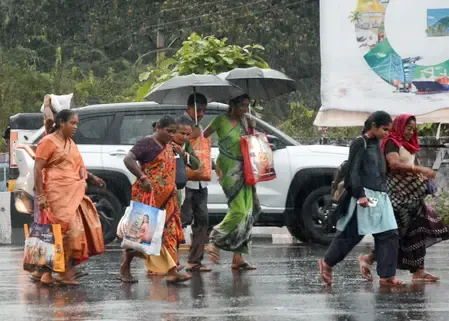
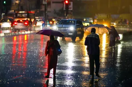
Heavy monsoon rain lashed Jaipur and Dholpur on 29 July , flooding markets, roads, and low-lying areas.
The IMD has issued a Yellow Alert for 22 Rajasthan districts ; active monsoon forecast through 2 August .
Tonk recorded the highest rainfall in 24 hours at 101 mm ; Jhalrapatan (Jhalawar) received 87 mm .
Houses were damaged in Baseri and Saipau of Dholpur; no casualties reported.
A deep depression over the Bay of Bengal off the West Bengal–Odisha coast is driving the intensified monsoon, according to IMD Jaipur Director Radheshyam Sharma .
Udaipur remains 24% below normal seasonal rainfall; Ajmer is 46.5% above normal .
Monsoon activity intensified sharply across Rajasthan on Wednesday, 29 July, as heavy rainfall lashed Jaipur and inundated markets and low-lying localities in Rajakhera town of Dholpur district. The India Meteorological Department (IMD) has issued a Yellow Alert for 22 districts and forecast that the active monsoon phase will continue through 2 August.
Waterlogging and Disruption in Jaipur
Jaipur received a sustained spell of heavy rain lasting more than 35 minutes on Wednesday afternoon, triggering waterlogging across several key stretches including Tonk Road, Rambagh, the Walled City (Chardiwari), Ajmeri Gate, 22 Godam, and C-Scheme. Commuters — particularly two-wheeler riders and pedestrians on Jagatpura Road — faced significant inconvenience, with many seeking shelter at bus stops as roads became difficult to navigate.
Dholpur Hit Hard; Houses Damaged
In Dholpur, intense rainfall flooded markets and low-lying neighbourhoods, disrupting normal life. In the Baseri and Saipau areas of the district, heavy rain damaged a few houses, though no casualties were reported, according to officials. The rainfall also brought temperatures down by 2–5 degrees Celsius across districts including Jaipur, Chittorgarh, Sikar, Pilani, Alwar, Churu, Karauli, and Dausa.
What Is Driving the Active Monsoon
Meteorological Centre Jaipur Director Radheshyam Sharma said a deep depression over the Bay of Bengal, currently positioned off the West Bengal–Odisha coast, has strengthened the monsoon. The monsoon trough has shifted toward this system, triggering an active monsoon phase across the state. Isolated areas in the Udaipur and Kota divisions are forecast to receive heavy to very heavy rainfall on 30 and 31 July.
District-Level Rainfall Data
In the 24 hours ending Tuesday, Tonk recorded the highest rainfall at 101 mm, while Jhalrapatan in Jhalawar received 87 mm. Other districts reporting significant rainfall included Bharatpur, Sikar, Bhilwara, Alwar, Chittorgarh, Nagaur, Karauli, Kota, Rajsamand, and Sawai Madhopur. On Tuesday, several districts received between 1 and 4 inches of rain. Northern Rajasthan remained relatively dry through much of the day, with Sri Ganganagar recording temperatures above 41 degrees Celsius before evening showers brought some relief.
Seasonal Deficit and Outlook
Udaipur has recorded 205 mm of rainfall against a seasonal normal of 271 mm, placing it 24 per cent below normal for the season so far. In contrast, Ajmer has received 308.7 mm since June — approximately 46.5 per cent above normal. Rainfall is expected to intensify during the first week of August, with normal monsoon conditions likely returning to the Shekhawati region. The IMD has advised residents in alert districts to exercise caution in low-lying and waterlogging-prone areas as the active spell persists.
Point of View
Not a weather anomaly — these are the same zones that flood every year, pointing to a chronic drainage infrastructure deficit that seasonal alerts cannot fix. The sharp district-level divergence — Ajmer 46.5% above normal while Udaipur sits 24% below — underscores how uneven Rajasthan's monsoon distribution has become, complicating both agricultural planning and disaster preparedness. The Bay of Bengal depression adds a variable that could push already-stressed catchments over the edge in Kota and Udaipur divisions over the next 48 hours. State authorities would do well to pre-position relief teams in Dholpur and Jhalawar rather than wait for damage reports.
NationPress
13 Sept 2026
Frequently Asked Questions
Which areas in Jaipur were waterlogged due to heavy rain on 29 July?
Waterlogging was reported on Tonk Road, Rambagh, the Walled City (Chardiwari), Ajmeri Gate, 22 Godam, C-Scheme, and Jagatpura Road after Jaipur received more than 35 minutes of heavy rain on the afternoon of 29 July.
What is the IMD forecast for Rajasthan in the coming days?
The IMD has issued a Yellow Alert for 22 Rajasthan districts and forecast that the active monsoon phase will continue through 2 August. Heavy to very heavy rainfall is expected in isolated areas of the Udaipur and Kota divisions on 30 and 31 July, with rainfall likely to increase further in the first week of August.
Were there any casualties in the Rajasthan rains?
No casualties were reported. In Baseri and Saipau areas of Dholpur district, heavy rainfall damaged a few houses, but officials confirmed no loss of life.
What is causing the heavy monsoon activity in Rajasthan?
According to Meteorological Centre Jaipur Director Radheshyam Sharma, a deep depression over the Bay of Bengal — positioned off the West Bengal–Odisha coast — has strengthened the monsoon trough and shifted it toward the system, triggering the active monsoon phase across Rajasthan.
How does Rajasthan's seasonal rainfall compare to normal levels?
Rainfall distribution is uneven across the state. Udaipur has received 205 mm against a normal of 271 mm, placing it 24 per cent below normal for the season. Ajmer, by contrast, has recorded 308.7 mm since June — approximately 46.5 per cent above normal.