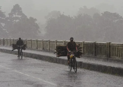
Yellow alert for Kolkata, south Bengal as heavy rains lash region

Synopsis
A Bay of Bengal low-pressure system has put all of south Bengal on yellow alert, with knee-deep waterlogging already reported in Bolpur and extremely heavy rain forecast for Jalpaiguri and Alipurduar over three consecutive days. The disruption is far from over — the RMC sees scattered showers persisting across the region until 8 September.
Key Takeaways
The RMC Kolkata issued a yellow alert for all south Bengal districts, including Kolkata , on 2 September .
Gusty winds of 30–40 km/h and moderate to heavy rainfall are expected; heavy rain warnings issued for Purulia , West Burdwan , and Birbhum .
Scattered rainfall across southern districts is forecast to continue until 8 September .
Jalpaiguri and Alipurduar face extremely heavy rain on Thursday; Jalpaiguri , Cooch Behar , and Alipurduar are on alert for three consecutive days of heavy rain.
Waterlogging submerged several wards of Bolpur in Birbhum , with water reportedly reaching knee-deep levels at Gitanjali Theatre .
Kolkata recorded a minimum temperature of 26.2°C on Wednesday and a Tuesday maximum of 28.02°C .
The Regional Meteorological Centre (RMC) in Kolkata has issued a yellow alert for all districts of south Bengal, including Kolkata, as a low-pressure system over the Bay of Bengal continues to drive heavy rainfall across the region. The warning, issued on Wednesday, 2 September, covers gusty winds of 30 to 40 km per hour and the possibility of moderate to heavy showers through the day.
Weather Forecast and Alerts
The RMC predicted light to moderate rainfall for Kolkata on Wednesday and Thursday, with scattered showers likely to continue across southern districts until 8 September. A specific heavy-rainfall warning has been issued for Purulia, West Burdwan, and Birbhum for Wednesday. Conditions are expected to ease slightly from Thursday onward, though disruptions may persist.
In north Bengal, the weather outlook remains unsettled. The Met department has forecast extremely heavy rain in Jalpaiguri and Alipurduar on Thursday, with Jalpaiguri, Cooch Behar, and Alipurduar bracing for heavy rainfall across three consecutive days.
Ground Situation: Waterlogging and Disruption
The sustained downpours have already triggered waterlogging and disruption across multiple areas. In Birbhum district, several wards of Bolpur were submerged following persistent overnight rainfall, with water accumulating on roads and in low-lying areas, hampering movement and daily life.
The situation at Gitanjali Theatre in Bolpur was reported to be particularly severe, with water reportedly reaching knee-deep levels on the premises. Residents, visitors, and several institutions and households faced considerable inconvenience as local transportation was also disrupted.
Kolkata itself recorded heavy rain from Wednesday morning, leaving several city streets waterlogged. The city logged a minimum temperature of 26.2 degrees Celsius on Wednesday, while the maximum temperature on Tuesday stood at 28.02 degrees Celsius.
The Trigger: Bay of Bengal Low-Pressure System
The rainfall has been driven by a low-pressure area over the Bay of Bengal, which brought moderate to heavy showers to nearly all districts of south Bengal — including Kolkata — on Monday and Tuesday. This comes amid the peak of the southwest monsoon season, when Bay of Bengal systems routinely intensify rainfall over West Bengal. Low-pressure systems of this nature have historically caused multi-day flooding episodes across the state's southern and northern districts alike.
What to Watch
Authorities and residents in Jalpaiguri, Alipurduar, and Cooch Behar face the most acute risk in the coming days, given the forecast of extremely heavy rain. The RMC bulletin will be monitored closely as the low-pressure system's track and intensity evolve over the next 48 hours.
Point of View
But the ground reality in Bolpur — knee-deep water at a cultural landmark — points to a drainage infrastructure that has not kept pace with intensifying Bay of Bengal systems. North Bengal's three-day heavy-rain forecast for Jalpaiguri and Alipurduar is the more serious concern: these districts are perennially flood-prone and historically under-resourced for rapid relief deployment. If the low-pressure system deepens or stalls, the state could be looking at a repeat of the multi-district inundation events that have marked recent monsoon seasons. The real test is whether district administrations have pre-positioned resources rather than responding after the fact.
NationPress
2 Sept 2026
Frequently Asked Questions
Why has a yellow alert been issued for Kolkata and south Bengal?
A yellow alert has been issued by the Regional Meteorological Centre in Kolkata because a low-pressure system over the Bay of Bengal is driving moderate to heavy rainfall across south Bengal, including Kolkata, with gusty winds of 30 to 40 km per hour also expected. The alert covers all south Bengal districts for Wednesday, 2 September.
How long will the heavy rain continue in West Bengal?
Scattered rainfall is forecast to continue across south Bengal's southern districts until 8 September, according to the RMC. Conditions are expected to ease slightly from Thursday, though north Bengal — particularly Jalpaiguri, Cooch Behar, and Alipurduar — faces heavy rain for three consecutive days.
Which districts face the most severe rainfall warnings?
Purulia, West Burdwan, and Birbhum in south Bengal have been issued heavy-rainfall warnings for Wednesday. In north Bengal, Jalpaiguri and Alipurduar are forecast to receive extremely heavy rain on Thursday, with all three northern districts on alert for multiple days.
What is the ground situation in Bolpur and Birbhum?
Several wards of Bolpur in Birbhum district have been submerged following persistent overnight rainfall. Water reportedly reached knee-deep levels at Gitanjali Theatre, and waterlogging on roads has disrupted local transportation and daily life for residents.
What caused the current spell of heavy rain in Bengal?
The rainfall has been triggered by a low-pressure area over the Bay of Bengal, which brought moderate to heavy showers to nearly all districts of south Bengal on Monday and Tuesday. Such systems are common during the peak southwest monsoon season and can sustain multi-day rainfall episodes across the state.