Are intense thunderstorms expected again in Hyderabad today?
Synopsis
As the city of Hyderabad grapples with the aftermath of heavy rains leading to flooding, residents brace for more severe weather today. With thunderstorms predicted, local authorities are urging vigilance. Stay updated on the latest weather conditions and safety measures as the situation develops.
Key Takeaways
Hyderabad is facing intense thunderstorms today, following significant rainfall.
Colonies in Meerpet have experienced flooding and disruption.
The GHMC has warned residents to stay alert for further thunderstorms.
Heavy rainfall is expected across various districts in Telangana .
Residents should take precautions during adverse weather conditions.
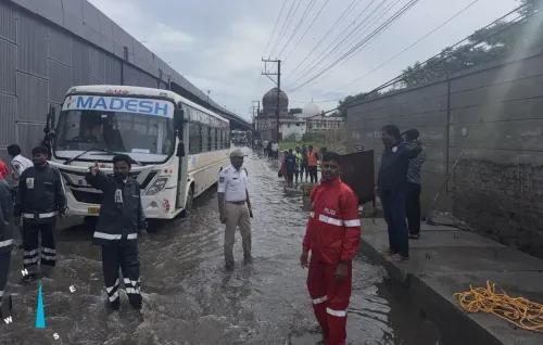
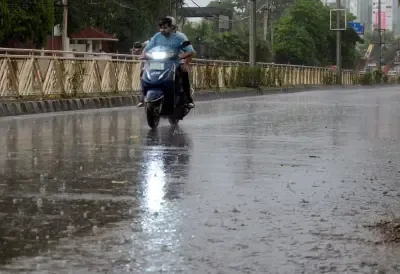
Hyderabad, Aug 10 (NationPress) Following a day of heavy rainfall that inundated numerous colonies in and around Hyderabad, intense thunderstorms are predicted for today.
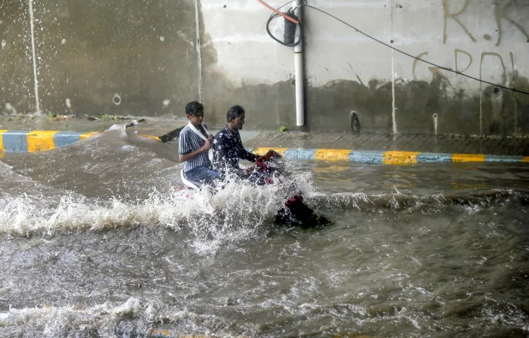
Heavy rain overnight caused water to breach homes in several colonies in Meerpet, located in the Rangareddy district.
Many roads across the city transformed into lakes due to the relentless downpour, marking the second occurrence of severe rain in just three days.
The flooding disrupted normal traffic flow, leaving commuters trapped in gridlocks for extended periods.
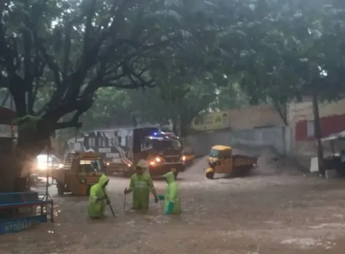
Colonies such as Mithila Nagar, Balaji Nagar, and Sathya Sai Nagar in the Meerpet region were particularly affected, with residents reporting that rainwater mixed with sewage overflow entered their homes. With streets submerged, many locals found themselves confined indoors.
A similar scenario unfolded in other low-lying areas like Vanasthalipuram, Dilsukh Nagar, and Hayat Nagar on the outskirts of the city.
The Nampally area, situated in the city center, recorded an impressive 11.75 cm of rainfall. Various areas including Charminar, Khairatabad, Hayath Nagar, Musheerabad, Himayat Nagar, Amberpet, and Bahadurpura experienced heavy rains ranging from 6.48 cm to 10.63 cm.
Weather expert T. Balaji, known for his insights on social media under the handle ‘Telangana Weatherman’, noted that this marks the third instance this month where Hyderabad has seen over 10 cm of rainfall.
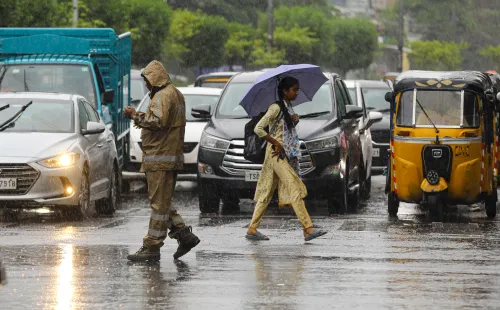
In the meantime, the Greater Hyderabad Municipal Corporation (GHMC) has warned that intense thunderstorms are anticipated again this afternoon and evening, urging residents to stay vigilant.
According to the GHMC, moderate to heavy rain and thunderstorms are expected in various city areas between 1 p.m. and 9 p.m. today, with some locales possibly receiving 30-50 mm of rainfall.
Continued rain is also affecting other regions of the state. A primary canal of the Kalwakurthy lift irrigation scheme breached near Veldanda in Nagarkurnool district, flooding nearby locales.
As a result of significant inflow from upstream, two gates of the Nagarjuna Sagar Dam over the Krishna River were opened to release water, with the dam's water level nearing the Full Reservoir Level of 590 feet as of Sunday morning.
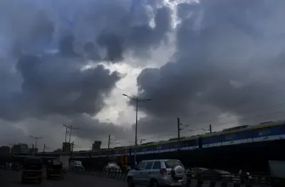
Meanwhile, the India Meteorological Department (IMD) has forecasted heavy rainfall across various parts of the state today.
Heavy rain is anticipated in isolated areas across 13 out of 33 districts, prompting the IMD to issue a yellow alert for these regions.
The IMD's bulletin indicates that heavy rainfall is likely in places such as Nirmal, Nizamabad, Jagtial, Rajanna Sirisilla, Mulugu, Bhadradri Kothagudem, Khammam, Siddipet, Vikarabad, Sangareddy, Medak, Kamareddy, and Nagarkurnool districts of Telangana. Thunderstorms accompanied by lightning and gusty winds (30-40 kmph) are also forecasted across all districts in Telangana.
Overall, light to moderate rain or thundershowers are expected to occur in most areas over Telangana in the next 24 hours.
Point of View
It’s evident that the unpredictable weather patterns in Hyderabad pose significant challenges for its residents. The authorities must prioritize timely information dissemination and preparedness strategies to mitigate the impact of such natural events. Nationally, these occurrences prompt discussions about infrastructure resilience and urban planning to better handle extreme weather.
NationPress
1 Jul 2026
Frequently Asked Questions
What areas in Hyderabad are most affected by flooding?
Colonies such as Mithila Nagar, Balaji Nagar, Sathya Sai Nagar in Meerpet, as well as low-lying regions like Vanasthalipuram, Dilsukh Nagar, and Hayat Nagar have been notably affected.
What is the expected rainfall today in Hyderabad?
The Greater Hyderabad Municipal Corporation (GHMC) predicts moderate to heavy rain with potential rainfall between 30-50 mm in certain areas today.
What precautions should residents take during thunderstorms?
Residents are advised to stay indoors, avoid unnecessary travel, and keep updated on weather alerts from local authorities.
Is there any ongoing weather advisory in Telangana?
Yes, the India Meteorological Department (IMD) has issued a yellow alert for heavy rain across 13 districts in Telangana.
What infrastructure issues have arisen due to the rains?
The heavy rains have caused flooding in homes and disrupted traffic flow. There have also been reports of a canal breach near Veldanda in Nagarkurnool district.