Are Heavy Rains Expected in Telangana Soon?
Synopsis
Heavy rainfall is on the horizon for Telangana as the IMD issues yellow alerts for multiple districts. Stay informed about the weather and prepare for potential disruptions as the state braces for severe thunderstorms and gusty winds. Discover the rainfall patterns and their impact on daily life in this informative update.
Key Takeaways
Heavy rains are forecasted for Telangana over the next six days.
Yellow alerts have been issued for multiple districts.
Thunderstorms and gusty winds are likely.
Hyderabad will experience cloudy skies and thundershowers.
Significant rainfall has already been recorded in certain districts.
Hyderabad, June 13 (NationPress) The Indian Meteorological Department (IMD) has predicted significant rainfall across various regions of Telangana for the upcoming six days.
Yellow alerts have been issued for the districts of Nizamabad, Nalgonda, Suryapet, Vikarabad, Sangareddy, Medak, Kamareddy, Mahabubnagar, Nagarkurnool, Wanaparthy, Narayanpet, and Jogulamba Gadwal for Friday and Saturday.
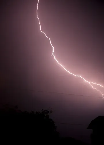
Heavy rainfall is highly likely to happen in isolated areas within these districts. The latest IMD bulletin indicates that thunderstorms, along with lightning and winds gusting up to 40-50 kmph, are expected in all districts of Telangana.
The IMD has also issued a yellow alert for Jayashankar Bhupalapally, Mulugu, Bhadradri Kothagudem, Vikarabad, Sangareddy, Medak, and Kamareddy districts on Sunday.
As per the IMD, an upper air cyclonic circulation over north coastal Andhra Pradesh and adjacent south Odisha is currently positioned over Southwest Telangana and extends up to 5.8 km above mean sea level into north interior Karnataka and neighboring Telangana and Rayalaseema.
A trough is also extending from the west-central Arabian Sea through the upper air cyclonic circulation over north interior Karnataka, passing through Telangana and Rayalaseema.
The city of Hyderabad and its neighboring areas can also expect rain and thundershowers in the next four days.
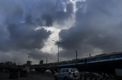
For Hyderabad, the IMD forecasts generally cloudy skies with light to moderate rain or thundershowers, including occasional intense spells, along with gusty winds of 40-50 kmph. Hazy conditions are likely to persist during the morning hours.
Yellow alerts have been issued for all zones in Hyderabad, including Charminar, Khairatabad, Kukatpally, L B Nagar, Secunderabad, and Serilingampally.
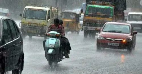
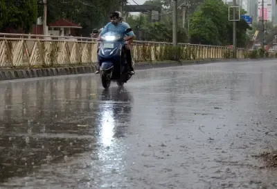
Recently, several areas in Hyderabad experienced heavy rainfall, leading to flooded roads and disrupted traffic.
For the second consecutive day, the city endured a heavy downpour, affecting core areas like Koti, Begum Bazar, Sultan Bazar, Abids, Basheerbagh, Nampally, Liberty, Himayat Nagar, Narayanguda, and Tank Bund on Friday afternoon.
This heavy rainfall resulted in waterlogging on major roads, causing significant issues for motorists.
According to the Telangana Development Planning Society, various parts of the state saw rainfall on Friday. The maximum rainfall recorded was 66.3 mm in Siddipet district between 8:30 a.m. and 4 p.m. Other notable rainfall included 39.5 mm in Adilabad and 39.3 mm in Bhadradri Kothagudem. In Hyderabad, Nampally recorded a maximum of 12.8 mm during the same timeframe.
Point of View
The weather forecast for Telangana highlights the importance of preparedness in the face of natural events. The IMD's alerts serve as a crucial resource for residents to remain informed and safe. As always, NationPress emphasizes the need for proactive measures to mitigate the effects of heavy rainfall, ensuring community safety and resilience.
NationPress
5 Jul 2026
Frequently Asked Questions
What districts in Telangana are under yellow alert?
The districts under yellow alert include Nizamabad, Nalgonda, Suryapet, Vikarabad, Sangareddy, Medak, Kamareddy, Mahabubnagar, Nagarkurnool, Wanaparthy, Narayanpet, and Jogulamba Gadwal.
What kind of weather should we expect in Hyderabad?
Hyderabad can expect generally cloudy skies with light to moderate rain or thundershowers, accompanied by gusty winds of 40-50 kmph.
How much rainfall was recorded in Siddipet?
Siddipet district recorded the highest rainfall of 66.3 mm from 8:30 a.m. to 4 p.m. on Friday.
What impacts can heavy rains have on daily life?
Heavy rains can lead to water stagnation on roads, disrupting traffic and causing inconvenience to daily commuters.
When is the expected rainfall in Telangana?
Heavy rains are expected over the next six days across various regions of Telangana.