

Kishan Reddy Flags Geospatial Push, Cites SVAMITVA and AI Drones
Synopsis
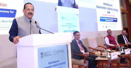
Union Coal and Mines Minister G. Kishan Reddy invoked the SVAMITVA drone-survey scheme and the National Geospatial Policy to highlight the Modi government's AI and drone-led geospatial push as a cornerstone of Digital India's data-driven governance ambitions.
Key Takeaways
Kishan Reddy posted on 15 November 2026 framing India as a leader in geospatial technology under PM Narendra Modi .
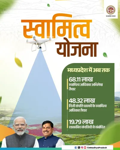
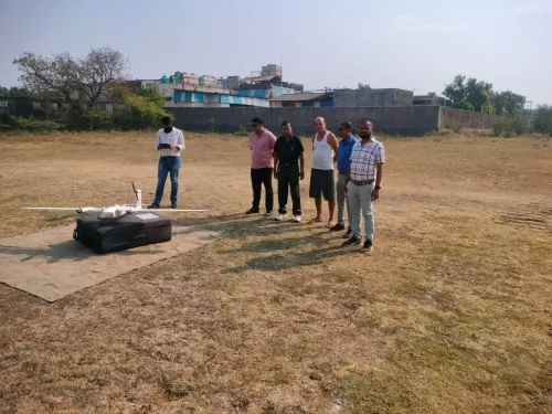
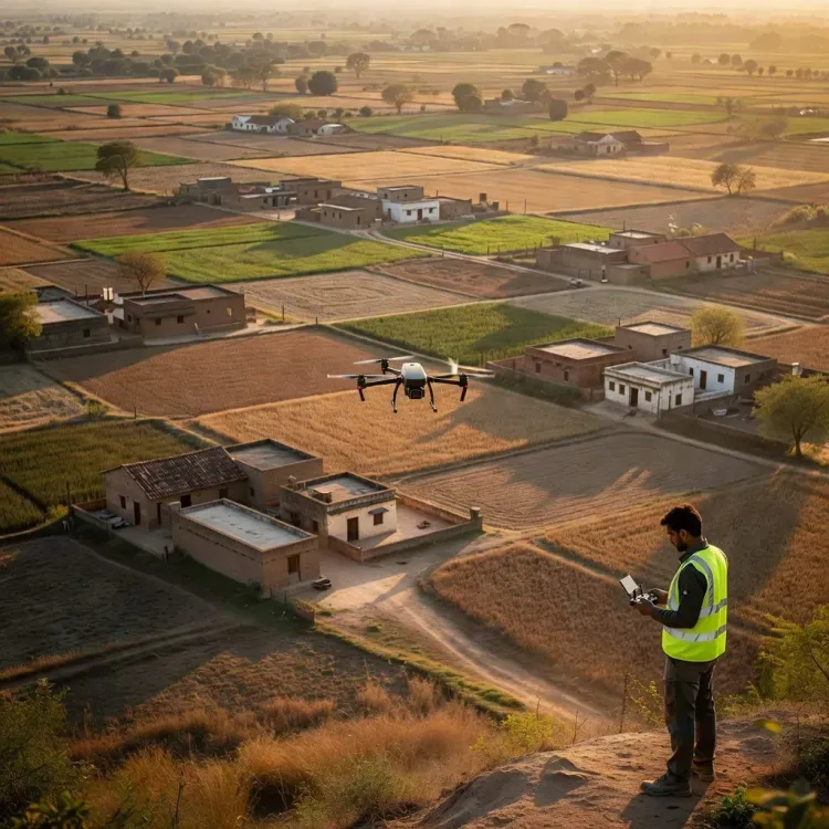
The SVAMITVA scheme , launched in April 2020 , uses drone surveys to map rural land parcels and issue property cards, aiming to reduce land disputes and improve credit access.
The National Geospatial Policy , approved in December 2022 , liberalised access to high-resolution geospatial data for government, private, and research use.
Both initiatives are part of India's broader Digital India programme to modernise land records and reduce dependence on manual surveys.
Key metrics to watch include state-wise SVAMITVA drone survey completion rates and private-sector uptake under the geospatial policy framework.
Drones mapping village land parcels. AI crunching geospatial data for governance. Union Coal and Mines Minister G. Kishan Reddy on Sunday, 15 November 2026 framed India's accelerating pivot to spatial technology as a defining feature of the Modi government's digital-governance agenda, pointing to two landmark frameworks as proof of concept.
Reddy's post describes India as 'pioneering a Geospatial Revolution, leveraging AI and drone technology for transformative governance and innovation,' anchoring that claim on two specific pillars: the National Geospatial Policy and the SVAMITVA scheme.
What SVAMITVA Actually Does on the Ground
Launched in April 2020 by the Ministry of Panchayati Raj, SVAMITVA — Survey of Villages and Mapping with Improvised Technology in Village Areas — deploys drone surveys to map rural land parcels and issue formal property cards to residents. The target is straightforward but long overdue: give village households legally recognised documentation of land they have often occupied for generations without paperwork.
The practical stakes are real. Clear property rights reduce land disputes, unlock access to institutional credit, and feed accurate data into state revenue records — three chronic pain points for rural India that manual surveys repeatedly failed to resolve at scale.
The Policy Layer: Opening Up Geospatial Data
The National Geospatial Policy, approved by the Union Cabinet in December 2022, provides the broader regulatory architecture. Before the policy, access to high-resolution geospatial and mapping data in India was tightly restricted, limiting both private innovation and public planning. The 2022 framework liberalised that access — making detailed spatial data available for companies, researchers, and government departments alike.
Together, the two initiatives represent a layered bet: collect granular ground-level data through drone surveys, then open the resulting datasets and the broader geospatial ecosystem for wide use. The ambition is a self-reinforcing loop — better data enables smarter planning, which justifies collecting even more data.
Where This Sits in the Digital India Arc
India's push to modernise property records and digitise land administration stretches back to at least 2015, when successive schemes began moving revenue departments away from manual, paper-based surveys. SVAMITVA and the National Geospatial Policy represent the drone-and-AI chapter of that longer story — one that runs directly through Prime Minister Narendra Modi's Digital India programme.
Reddy's framing — 'smart, self-reliant, and data-driven nation' — signals that the government intends to keep geospatial technology front and centre as both a governance tool and a technology-sector growth narrative. The next concrete test will be state-wise completion rates for SVAMITVA drone surveys and the depth of adoption by private geospatial firms under the liberalised policy framework.
India mapped the ambition years ago. How completely the data reaches the last village will determine whether the revolution is real.
Point of View
Widening the potential voter and investor audience simultaneously. For the geospatial technology sector, ministerial endorsement at this level reinforces the regulatory signal that the 2022 policy opened — but the gap between framework and full execution at the state level remains the story no minister's post resolves.
NationPress
15 Nov 2026
Frequently Asked Questions
What is the SVAMITVA scheme?
SVAMITVA is a central government scheme launched in April 2020 that uses drone surveys to map rural village land parcels and issue official property cards to residents, aiming to reduce land disputes and improve access to institutional credit.
What is India's National Geospatial Policy?
The National Geospatial Policy is a framework approved by the Union Cabinet in December 2022 that liberalised access to high-resolution geospatial and mapping data in India, opening it up for government departments, private companies, and researchers.
How is drone technology used in Indian governance?
India uses drones primarily under the SVAMITVA scheme to conduct aerial surveys of rural land parcels, generating accurate spatial data that feeds into property records and reduces reliance on manual, paper-based surveys.
What did G. Kishan Reddy say about India's geospatial policy?
On 15 November 2026, Union Minister G. Kishan Reddy posted that India is 'pioneering a Geospatial Revolution' under PM Modi, citing the National Geospatial Policy and SVAMITVA scheme as evidence of the government's commitment to a data-driven, self-reliant nation.
How does SVAMITVA help rural landowners?
By providing formally issued property cards based on drone-survey data, SVAMITVA gives rural residents legally recognised documentation of their land, which can be used to access bank loans and resolves long-standing property disputes.