

Are Thunderstorms and Rains Expected Across MP and Chhattisgarh?
Synopsis
Unpredictable weather has hit Madhya Pradesh and Chhattisgarh, bringing unexpected thunderstorms and rain. With warnings issued for hailstorms, residents prepare for intense weather conditions. What does this mean for the region? Discover the latest updates and forecasts.
Key Takeaways
Severe thunderstorms and rain are affecting multiple districts in MP.
A Western Disturbance is the main cause of the chaotic weather.
Winds may reach speeds of up to 70 km/h in certain areas.
Residents should prepare for potential hailstorms.
Weather conditions might stabilize after May 7.
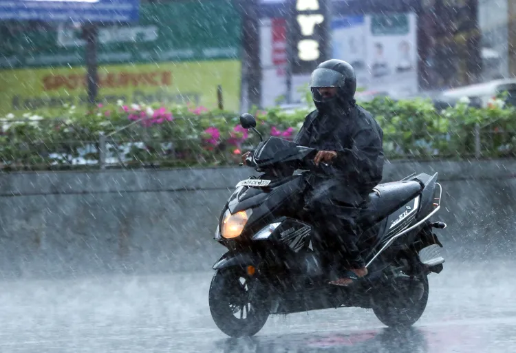
Bhopal/Raipur, May 5 (NationPress) Madhya Pradesh (MP) encountered unanticipated rainfall and tumultuous storms across numerous districts on Monday. Showers inundated Bhopal, Gwalior, and Shajapur, with fierce winds and hail battering the area, resulting in a chaotic atmosphere.
In the last twenty-four hours, precipitation has soaked fifty cities and towns, while dust storms ravaged Raisen town, further complicating the situation. The Weather Department has issued a warning for the Gwalior-Chambal division, cautioning of imminent hailstorms that could impact Morena, Guna, Vidisha, Gwalior, Shivpuri, and Panna.
Thunder and lightning are anticipated to strike with considerable force, and winds could reach speeds of up to 60 kilometres per hour across these districts.
This erratic weather pattern also affects Indore, Ujjain, Dewas, Shajapur, and others, where winds may gust up to 70 kilometres per hour, accompanied by persistent rainfall.
The origin of these disturbances is a robust Western Disturbance, taking the form of a cyclonic circulation over central Pakistan, extending towards northwest Rajasthan at notable elevations.
Additionally, upper-air circulations over northeast Rajasthan and southwest Pakistan continue to add to the atmospheric instability.
An extensive east-west trough stretches from East Rajasthan to northern Bangladesh, passing through Madhya Pradesh, southeast Uttar Pradesh, and Jharkhand, further exacerbating weather conditions.
These unsettling conditions also reach into Chhattisgarh, where thunderstorms with gusty winds are expected to persist in the coming days, although their intensity may diminish after May 7, according to the Chhattisgarh weather department.
The Bilaspur and Surguja divisions experienced moderate to severe thunderstorms on Monday and Tuesday, while isolated occurrences may be noted in Durg and Raipur.
A rise in maximum temperatures by two to three degrees Celsius is anticipated over the next three days, followed by a stabilization in temperatures.
In the previous twenty-four hours, scattered rainfall was recorded across isolated regions. Notably, the maximum temperature in the Surguja division remained significantly below normal, while other divisions experienced moderately lower temperatures than the seasonal average.
Raipur recorded the highest temperature at 37.2 degrees Celsius, while Pendra Road observed 18.8 degrees Celsius, marking the lowest minimum temperature in the region during summer.
Point of View
I emphasize the importance of staying informed about weather patterns that affect our lives. The recent thunderstorms in Madhya Pradesh and Chhattisgarh highlight the need for preparedness and adaptation in the face of changing weather conditions. Our commitment is to provide timely and accurate updates to keep our readers informed and safe.
NationPress
2 May 2026
Frequently Asked Questions
What areas are affected by the thunderstorms in MP?
The thunderstorms are impacting regions including Bhopal, Gwalior, Shajapur, and other areas in Madhya Pradesh.
What should residents do in case of severe weather?
Residents should stay indoors, avoid unnecessary travel, and keep informed through local news updates.
When is the weather expected to stabilize?
Weather conditions may stabilize after May 7, according to the Chhattisgarh weather department.
What is causing the unstable weather?
A powerful Western Disturbance and upper-air circulations are contributing to the atmospheric instability.
How are temperatures expected to change?
A rise in maximum temperatures by two to three degrees Celsius is predicted over the next three days.