Is the NISAR Satellite Mission a Testament to Global Collaboration and Innovation?
Synopsis
The NISAR satellite mission is a groundbreaking collaboration between ISRO and NASA, set to launch next week. This innovative Earth observation satellite promises to deliver crucial data for understanding environmental changes, showcasing the power of global teamwork in advancing space technology.
Key Takeaways
NISAR represents the first ISRO-NASA collaboration .
It features dual-band radar technology .
The satellite will provide vital data for climate monitoring .
NISAR will operate in a Sun-synchronous orbit .
It supports a wide range of environmental applications .
New Delhi, July 26 (NationPress) The NASA-ISRO Synthetic Aperture Radar (NISAR), scheduled for launch next week, stands as a remarkable achievement of global collaboration and advanced technology, as highlighted by the Indian space agency.
NISAR marks the inaugural joint satellite mission between the Indian Space Research Organisation (ISRO) and NASA.
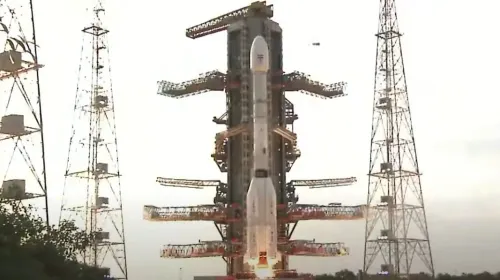
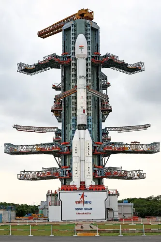
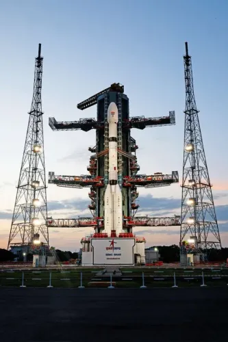
This satellite will be deployed by ISRO’s GSLV-F16 from the Satish Dhawan Space Centre (SDSC SHAR) located in Sriharikota, Andhra Pradesh at 5.40 pm. It will represent the GSLV’s first venture into a Sun-Synchronous Orbit (SSO).
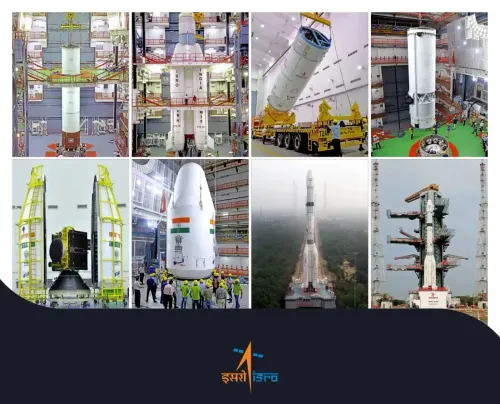
The launch of NISAR is the culmination of over a decade of robust technical cooperation between the ISRO and NASA/JPL technical teams.
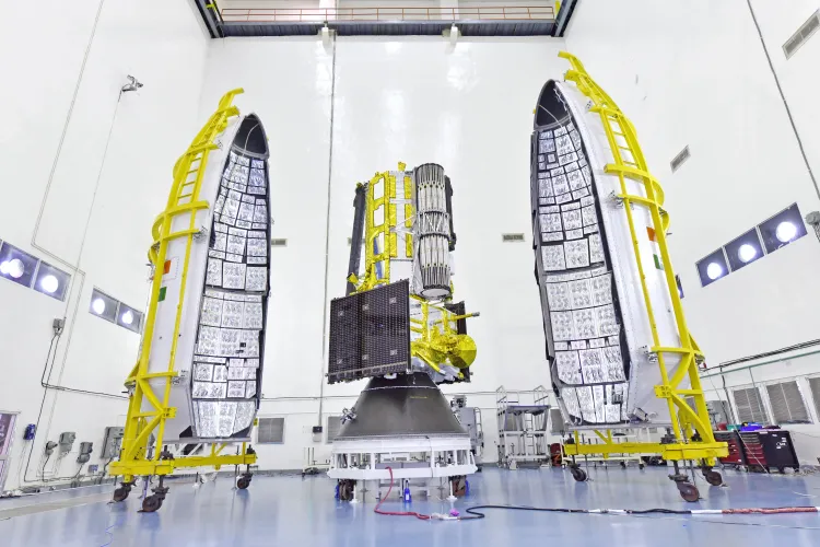
“Constructed in phases across continents, NISAR embodies global teamwork and cutting-edge technology. The satellite was developed through extensive integration and testing,” ISRO noted in a recent post on social media platform X.
ISRO emphasized that NISAR has achieved numerous significant milestones.
NISAR is recognized as the first dual-band radar satellite, the first GSLV to reach SSO, and the first ISRO-NASA Earth observation initiative.
The GSLV-F16 will place the NISAR satellite into a 743 km Sun-synchronous orbit with an inclination of 98.4 degrees.
“Two space agencies. One significant accomplishment for Earth. NISAR is the first instance where @NASA and @ISRO collaborated on Earth science hardware. This advanced satellite will monitor changes in land and ice, including regions susceptible to landslides and earthquakes, as well as shifting glaciers and ice sheets,” NASA Earth stated in a post on X.
With a mass of 2,392 kg, NISAR is a distinctive Earth observation satellite, equipped with a dual-frequency Synthetic Aperture Radar (utilizing both NASA’s L-band and ISRO’s S-band) and employing NASA’s 12m unfurlable mesh reflector antenna, integrated with ISRO’s modified I3K satellite bus.
NISAR is set to observe the Earth with a swath of 242 km and high spatial resolution, utilizing SweepSAR technology for the first time.
The satellite will comprehensively scan the globe, providing all-weather, day-and-night data every 12 days, supporting an extensive array of applications.
NISAR has the capability to detect minute changes in the Earth’s surface, including ground deformation, ice sheet movement, and vegetation dynamics,” according to ISRO.
The mission will facilitate numerous critical applications, such as monitoring sea ice, detecting ships, tracking storms, mapping soil moisture changes, surface water mapping, and enhancing disaster response.
Point of View
I view the NISAR mission as a significant leap for international collaboration in space exploration. The successful launch of this satellite not only exemplifies the synergy between ISRO and NASA but also represents a collective effort towards addressing global environmental challenges.
NationPress
28 Jun 2026
Frequently Asked Questions
What is the NISAR satellite?
The NISAR satellite is a joint venture between NASA and ISRO designed for Earth observation using dual-frequency Synthetic Aperture Radar technology.
When is the NISAR satellite launching?
NISAR is scheduled to launch next week from the Satish Dhawan Space Centre in Sriharikota, Andhra Pradesh.
What are the key features of NISAR?
NISAR is the first dual-band radar satellite and the first ISRO-NASA Earth observing mission, equipped to provide all-weather, day-and-night data.
What applications will NISAR support?
NISAR will support critical applications such as sea ice monitoring, ship detection, storm tracking, and disaster response.
How will NISAR benefit scientific research?
NISAR will enable scientists to track changes in land and ice, monitor ground deformation, and study vegetation dynamics, enhancing our understanding of environmental changes.