Is Andhra Pradesh Prepared for Heavy Rain as Red Alert Issued?
Synopsis
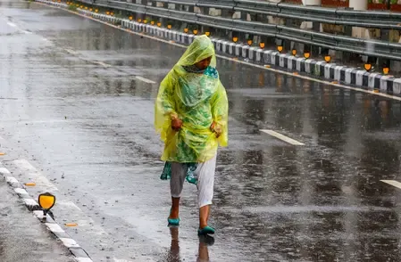
As heavy rains threaten Andhra Pradesh, the government is on high alert following a red alert from the IMD. Emergency services are prepared for potential cyclonic activity. Find out how local authorities are ensuring safety and readiness in the affected districts.
Key Takeaways
Red alert issued for several districts in Andhra Pradesh.
Emergency services are on high alert for potential rescue operations.
Residents are advised to stay informed through control rooms.
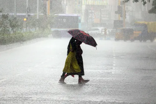
Heavy rainfall exceeding 204.5 mm is expected in isolated areas.
Contact numbers for assistance are available for the public.
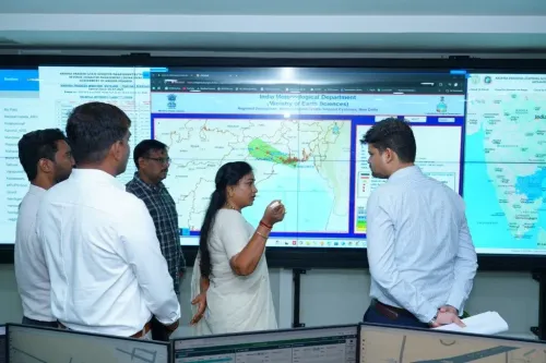
Amaravati, Oct 22 (NationPress) The government of Andhra Pradesh has activated its emergency response system as the India Meteorological Department (IMD) has declared a red alert for several districts due to a low-pressure area forming in the Bay of Bengal, which may develop into a cyclonic storm.
Minister for Home and Disaster Management V. Anitha has convened a review meeting with officials from the Disaster Management Authority. She has instructed that teams from the NDRF, SDRF, police, and fire services be on standby for potential rescue and relief operations.
The Home Minister emphasized the need for control rooms in affected districts to maintain a continuous state of readiness. She also directed officials to implement measures to avert loss of life and minimize public inconvenience.
Regular weather updates should be communicated to the public, she added.
Residents requiring assistance can reach out via the 24-hour toll-free numbers: 112, 1070, 18004250101.
The IMD has issued a red alert particularly for the districts of SPSR Nellore, Prakasam, YSR Kadapa, Annamayya, Tirupati, and Chittoor, predicting extremely heavy rainfall (over 204.5 mm) in isolated locations within these areas.
Additionally, an orange alert has been issued for Kurnool, Nandyal, Anantapur, Sri Sathya Sai, and Bapatla.
Since Tuesday, parts of Rayalaseema and South Coastal Andhra Pradesh have experienced significant rainfall due to one depression over the southeast Arabian Sea and another developing in the Bay of Bengal.
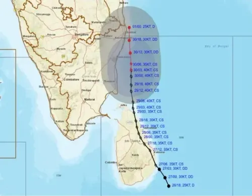
The IMD's bulletin noted that the well-defined low-pressure area over the southeast Arabian Sea intensified into a depression and was located at 5:30 a.m. on Wednesday (October 22). It is expected to slowly move north-northwestward over the next 24 hours.
Meanwhile, the low-pressure system over the Bay of Bengal has shifted northwest and was situated over the southwest Bay of Bengal at the same time. It is forecasted to strengthen into a depression near the Tamil Nadu and southern Andhra Pradesh coasts within the next 12 hours.
This system may also unleash strong winds, thunderstorms, and lightning across the districts of Rayalaseema and South Coastal Andhra Pradesh.
According to the State Disaster Management Authority, numerous locations in these regions received moderate to heavy rainfall between Tuesday morning and Wednesday morning.
In the Tirupati district, Srikalahasti and Thottambedu mandals recorded rainfall of 184.6 mm and 176.8 mm, respectively. Kodur mandal in Annamayya district reported 151.3 mm during the same timeframe. Seven other mandals in Tirupati received rainfall between 109.2 mm and 149.4 mm.
Point of View
I must emphasize the importance of preparedness in the face of natural disasters. The proactive measures taken by the Andhra Pradesh government reflect a commitment to safeguarding citizens' lives and property. It is crucial for state authorities to remain vigilant and responsive to emerging weather threats, ensuring that timely information is communicated effectively.
NationPress
3 Jul 2026
Frequently Asked Questions
What precautions is the Andhra Pradesh government taking against the heavy rain?
The Andhra Pradesh government has placed the state machinery on high alert, coordinating with emergency services and maintaining control rooms to ensure public safety.
Which districts are under red alert due to the expected heavy rainfall?
The districts under red alert include SPSR Nellore, Prakasam, YSR Kadapa, Annamayya, Tirupati, and Chittoor.
How can residents seek assistance during this weather emergency?
Residents can contact the 24-hour toll-free numbers 112, 1070, and 18004250101 for assistance.
What weather conditions are expected in Andhra Pradesh in the coming days?
Extremely heavy rainfall, thunderstorms, and lightning are expected across Rayalaseema and South Coastal Andhra Pradesh due to the influence of low-pressure systems.
What should residents do to stay safe during heavy rain warnings?
Residents should stay informed about weather updates, avoid unnecessary travel, and follow instructions from local authorities.