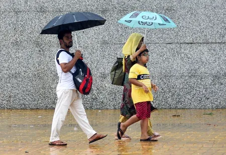
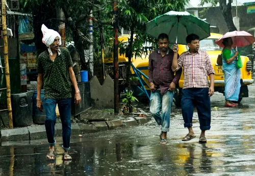
Bay of Bengal low pressure to lash south Bengal with heavy rain for 3 days
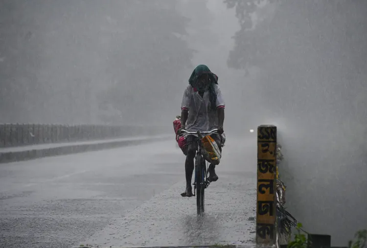
Synopsis
A consolidating low pressure area in the Bay of Bengal is about to turn the monsoon dial up sharply for coastal and southern West Bengal. With very heavy rain flagged for East Midnapore, Howrah, and both 24 Parganas districts, and fishermen ordered off the sea for three days, this is the most significant weather alert for the region since the current monsoon season intensified.
Key Takeaways
A cyclonic circulation over the north Bay of Bengal is expected to form into a low pressure area near the Bengal-Odisha coast on Saturday, 29 August .
Heavy to very heavy rain is forecast for East Midnapore , South 24 Parganas , Howrah , North 24 Parganas , Hooghly , Jhargram , and Bankura over the next three days.
Kolkata city faces light to moderate rain and thunderstorms on Saturday and Sunday.
Gusty winds, thunderclouds, and lightning risk flagged along the West Bengal , Bangladesh , and Odisha coastlines.
Fishermen advised not to venture into the deep sea for the next three days from Saturday.
North Bengal rain activity expected to be comparatively lighter and to ease over the next two to three days.
A fresh low pressure area forming over the Bay of Bengal is set to bring heavy to very heavy rainfall across several districts of south Bengal over the next three days, the Regional Meteorological Centre (RMC), Kolkata warned on Saturday, 29 August. Coastal districts face the sharpest impact, with fishermen advised to stay off the deep sea through the period.
Weather System Taking Shape
According to Habibur Rahman Biswas, Eastern Regional Director of the RMC, Kolkata, a cyclonic circulation is currently active over the north Bay of Bengal, in the zone adjacent to the coastlines of Bangladesh and West Bengal. The system is expected to consolidate into a low pressure area near the Bengal and Odisha coastal belt by Saturday. Such formations at this time of year are consistent with the active phase of the southwest monsoon, which has kept Bengal under intermittent heavy spells since July.
District-by-District Rain Forecast
North 24 Parganas and South 24 Parganas are likely to receive heavy rain with thundershowers at one or two places in the next 24 hours. Kolkata, Hooghly, Howrah, and East Midnapore also face heavy rain probability in the same window.
On Sunday, the RMC projects very heavy to heavy rain in East Midnapore, South 24 Parganas, and Howrah, with heavy rain continuing in South 24 Parganas, Jhargram, and Bankura. Gusty winds are also expected along the north Bay of Bengal coast, accompanied by thunderclouds and the risk of lightning.
'Heavy rain with thundershowers is likely at one or two places in North 24 Parganas and South 24 Parganas districts in the next 24 hours. There is a possibility of heavy rain in Kolkata, Hooghly, Howrah and East Midnapore districts. Very heavy to heavy rain is expected in East Midnapore, South 24 Parganas and Howrah districts tomorrow and heavy rain in South 24 Parganas, Jhargram, Bankura districts,' said the RMC official.
North Bengal and Kolkata City Outlook
In contrast, north Bengal is expected to see lighter activity. Light to moderate rain is forecast at many places, with Jalpaiguri and Alipurduar seeing isolated showers on Saturday. Rain activity in north Bengal is projected to ease over the next two to three days.
For Kolkata city and its surrounding areas, light to moderate rain and thunderstorms are likely on both Saturday and Sunday. On Friday, the city recorded a maximum temperature of 32.6 degrees Celsius — 0.1 degrees below normal — and a minimum of 27.2 degrees Celsius, which is 0.6 degrees above normal. Relative humidity ranged between 69% and 94%.
Advisory for Fishermen
The meteorological department has issued a clear advisory asking fishermen not to venture into the deep sea for the next three days from Saturday, citing the risk of gusty winds, rough seas, and lightning associated with the developing low pressure system. This is a standard precautionary measure that the RMC issues whenever a significant weather system organises over the Bay.
Point of View
But the district-specific alerts — particularly the very heavy rain warning for the densely populated coastal districts — deserve closer attention than routine weather advisories typically receive. South Bengal's flood-prone stretches, including parts of East Midnapore and the Sundarbans fringe in South 24 Parganas, have repeatedly suffered infrastructure damage from similar systems in recent years, often worsened by inadequate drainage. The three-day fishermen advisory is the right call, but the broader question of whether district administrations have pre-positioned relief assets remains unanswered in the official communication.
NationPress
13 Oct 2026
Frequently Asked Questions
Why is heavy rain expected in south Bengal from 29 August?
A cyclonic circulation over the north Bay of Bengal is consolidating into a low pressure area near the Bengal and Odisha coast, which will drive heavy to very heavy rainfall across south Bengal districts for up to three days from Saturday, 29 August, according to the Regional Meteorological Centre, Kolkata.
Which districts in West Bengal will be worst affected?
East Midnapore, South 24 Parganas, and Howrah face very heavy to heavy rain, while North 24 Parganas, Hooghly, Kolkata, Jhargram, and Bankura are also under a heavy rain forecast. Coastal districts carry the highest risk given their proximity to the forming low pressure system.
Is there a warning for fishermen in West Bengal?
Yes. The meteorological department has advised fishermen not to venture into the deep sea for three days from Saturday, 29 August, due to gusty winds, rough seas, and lightning risk associated with the developing low pressure area over the Bay of Bengal.
What is the weather forecast for Kolkata city?
Kolkata and surrounding areas can expect light to moderate rain and thunderstorms on Saturday and Sunday. On Friday, the city recorded a maximum temperature of 32.6 degrees Celsius and a minimum of 27.2 degrees Celsius, with humidity ranging between 69% and 94%.
How will north Bengal be affected compared to south Bengal?
North Bengal will see comparatively lighter rainfall — light to moderate rain at many places, with isolated showers in Jalpaiguri and Alipurduar on Saturday. Rain activity in north Bengal is expected to ease over the next two to three days, unlike the sustained heavy spell forecast for south Bengal.