Cyclone Arnab: 21 NDRF-SDRF teams deployed as Andhra Pradesh braces for Oct 28 landfall

Synopsis
Cyclone Arnab is tracking toward the Andhra Pradesh coast with landfall projected for 28 October between Bapatla and Visakhapatnam — packing gusts up to 140 kmph and potentially dumping nearly 293 mm of rain in Anakapalli alone. With 21 NDRF-SDRF teams already in the field and CM Naidu personally reviewing preparations, this is the state's most serious cyclone alert in recent years.
Key Takeaways
21 disaster response teams — 10 NDRF and 11 SDRF — have been deployed across Andhra Pradesh ahead of Cyclone Arnab .
The storm is forecast to make landfall on 28 October between Bapatla and Visakhapatnam , with the Konaseema–Kakinada belt in the crosshairs.
Wind speeds at landfall are projected at 115–125 kmph , with gusts up to 140 kmph .
Anakapalli district faces the highest projected rainfall at 292.55 mm ; the state average over five days is 95 mm .
Chandrababu Naidu chaired a preparedness review on Sunday with top officials across all key departments.
Fishermen have been ordered not to venture out to sea; all boats at sea directed to return to shore immediately.
Andhra Pradesh has deployed 21 disaster response teams — 10 from the National Disaster Response Force (NDRF) and 11 from the State Disaster Response Force (SDRF) — as the state prepares for severe cyclonic storm 'Arnab', which is forecast to make landfall along the coast on 28 October. The storm is expected to cross between Bapatla and Visakhapatnam, with current projections pointing to the coastal belt spanning Konaseema, Yanam, and Kakinada as the most likely impact zone.
CM Naidu's Preparedness Review
Chief Minister N. Chandrababu Naidu on Sunday chaired a high-level review meeting with senior officials to assess evacuation plans, relief centre readiness, and the supply of food, drinking water, medical care, and power restoration infrastructure. He directed all government departments to coordinate closely and maintain the highest level of vigilance ahead of the storm's arrival.
The review meeting was attended by Chief Secretary Sai Prasad, Director General of Police Harish Gupta, District Collectors, Real-Time Governance (RTG) officials, and departmental representatives from Agriculture, Power, Irrigation, Home, Health, Civil Supplies, Municipal Administration, and Panchayat Raj. Naidu specifically directed that all fishing vessels currently at sea return to shore immediately, and instructed officials to harness floodwaters from heavy rains to replenish reservoirs.
Storm Track and Intensity Forecast
The deep depression currently centred over the Bay of Bengal is located approximately 850 km east-southeast of Visakhapatnam and about 930 km from Kakinada. According to the Meteorological Department, the system is expected to intensify into a cyclonic storm by the morning of 26 October, escalate to a severe cyclonic storm by that night, and reach very severe cyclonic storm status by 27 October.
At landfall, wind speeds are projected to range between 115 and 125 kmph, with gusts potentially peaking at 140 kmph. Coastal areas are expected to experience strong winds from as early as the morning of 27 October.
Rainfall Projections and Districts at Risk
Heavy to very heavy rainfall is forecast across North Andhra and the central coastal districts on 27 and 28 October, with isolated pockets expected to record extremely heavy precipitation. Districts including Kakinada, Anakapalli, Visakhapatnam, Konaseema, and East Godavari are among the most vulnerable.
Anakapalli district is projected to record the highest average rainfall at 292.55 mm, followed by Alluri Sitarama Raju district at 281.17 mm, Visakhapatnam at 253.87 mm, and Srikakulam at 249.18 mm. The average total rainfall across the state over the five-day period is estimated at 95 mm, with an average of 22–29 cm expected across the affected districts.
Fishermen Advisory and Sea Conditions
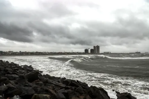
Authorities have advised all fishermen to refrain from venturing into the sea, as conditions are expected to turn extremely rough in the coming days. This advisory is in force across all coastal districts of Andhra Pradesh. The focus on early compliance aims to prevent maritime casualties — a recurring risk during Bay of Bengal cyclone events.
With landfall now less than two weeks away, state machinery is racing to complete evacuations from vulnerable low-lying areas and shore up relief infrastructure before the storm makes its approach.
Point of View
Where fishing communities have historically resisted early displacement. The rainfall projections — nearly 293 mm in Anakapalli in five days — rival figures from Cyclone Michaung in 2023, which exposed serious gaps in last-mile relief delivery. The question is whether the Real-Time Governance infrastructure Naidu has championed can translate dashboard-level coordination into on-ground execution before the storm arrives.
NationPress
25 Oct 2026
Frequently Asked Questions
When and where is Cyclone Arnab expected to make landfall in Andhra Pradesh?
Cyclone Arnab is expected to make landfall on 28 October, somewhere between Bapatla and Visakhapatnam. Current projections indicate the coastal region spanning Konaseema, Yanam, and Kakinada as the most likely impact zone.
How many NDRF and SDRF teams have been deployed for Cyclone Arnab?
A total of 21 teams have been deployed — 10 from the National Disaster Response Force (NDRF) and 11 from the State Disaster Response Force (SDRF) — across vulnerable districts of Andhra Pradesh.
What wind speeds are expected when Cyclone Arnab makes landfall?
At the time of landfall, sustained wind speeds are projected to range between 115 and 125 kmph, with gusts potentially reaching up to 140 kmph. Strong winds are expected to begin affecting coastal areas from the morning of 27 October.
Which districts in Andhra Pradesh are most at risk from Cyclone Arnab?
Kakinada, Anakapalli, Visakhapatnam, Konaseema, and East Godavari are among the districts most at risk. Anakapalli faces the highest projected rainfall at 292.55 mm over the five-day period.
What precautions has the Andhra Pradesh government announced ahead of Cyclone Arnab?
Chief Minister N. Chandrababu Naidu has directed all departments to coordinate on evacuations, relief centres, food, water, medical care, and power restoration. Fishermen have been advised not to venture out to sea, and all boats at sea have been ordered to return to shore.