What is Causing the Heavy Flooding in Delhi?
Synopsis
The Yamuna River in Delhi has reached alarming levels, leading to widespread flooding. With thousands evacuated and relief efforts underway, the city grapples with one of its worst flooding crises in years. This situation raises concerns for public safety and health amidst ongoing rescue operations.
Key Takeaways
The Yamuna River level reached 207.41 metres, causing severe flooding.
Over 14,000 people have been evacuated from affected regions.
Relief camps are operational in various locations, providing essential services.
Authorities are working to prevent public health risks related to flooding.
Ongoing monitoring is crucial as water levels are expected to fluctuate.
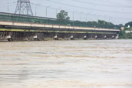
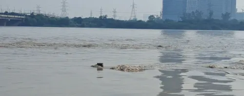
New Delhi, Sep 3 (NationPress) The water level of the Yamuna River in Delhi surged to 207.41 metres at 9 PM on Wednesday, marking it the third-highest level ever documented in the capital. This escalating water situation has caused extensive flooding in numerous low-lying areas along the riverbanks, significantly affecting both residential and commercial zones.
Officials have reported that this level is only marginally below the historic peaks of 208.66 metres in 2023 and 207.49 metres in 1978. Projections indicate that the river may further rise to 207.48 metres by 8 AM on September 4. A slight decrease is anticipated afterward, yet the conditions remain uncertain.
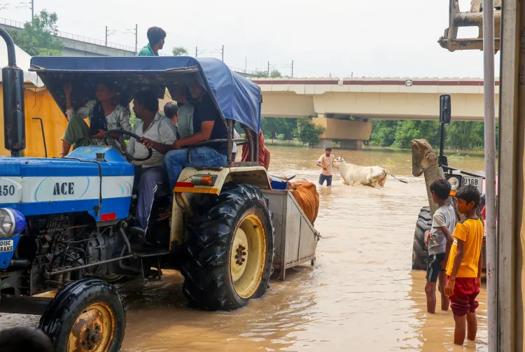
To date, over 14,000 people have been evacuated from at-risk areas as rescue and relief efforts persist. Various parts of the national capital, including Yamuna Bazar, Geeta Colony, Majnu Ka Tila, Kashmiri Gate, Garhi Mandu, and Mayur Vihar, are already submerged.
Relief camps have been established in ITO, Geeta Colony, and Mayur Vihar, providing shelter, food, and medical assistance to those affected.
In the meantime, Delhi's civic authorities have instructed the public health department to spray insecticides in relief areas to avert potential outbreaks of mosquito-borne illnesses.
Floodwaters have covered essential roads and landmarks, causing significant disruptions on the Outer Ring Road, with the route from ITO to Ring Road becoming impassable. Authorities have also closed Vasudev Ghat, Monastery Market, and the Old Delhi Railway Bridge due to safety concerns linked to rising water levels.
The situation escalated as floodwater began to encroach upon Nigambodh Ghat, which is known as Delhi's oldest and busiest cremation ground.
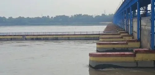
The primary cause for the increase in water levels is the ongoing release of significant volumes of water from the Wazirabad and Hathnikund barrages, as noted by officials. The Central Flood Control Room has reported that monitoring is taking place in conjunction with the Uttar Pradesh Irrigation Department, particularly concerning the Okhla Barrage, where higher discharge levels are being permitted to ensure smooth water outflow from the capital.
Areas identified as most vulnerable to flooding include North, North East, Shahdara, East, Central, and South East Delhi, according to officials.
With water levels expected to slightly increase by Monday morning, residents in at-risk zones are being cautioned to remain vigilant, adhere to evacuation protocols, and avoid low-lying areas. Civic agencies are tirelessly working to minimize damage, provide assistance, and ensure public safety as Delhi faces one of its most severe flooding crises in recent times.
Point of View
It is imperative to inform our readers of the urgency surrounding the heavy flooding in Delhi. The situation remains critical, with thousands displaced and ongoing rescue operations. Our responsibility is to ensure that the public remains aware and safe while providing accurate updates on the efforts being made to combat this crisis.
NationPress
30 Jun 2026
Frequently Asked Questions
What areas are most affected by the flooding in Delhi?
The most affected areas include North, North East, Shahdara, East, Central, and South East Delhi.
How many people have been evacuated due to the flooding?
More than 14,000 individuals have been evacuated from vulnerable areas.
What measures are being taken to prevent disease outbreaks?
Authorities are spraying insecticides in relief zones to prevent mosquito-borne illnesses.
What is the current status of key roads in Delhi?
Significant road disruptions are reported, especially on the Outer Ring Road, with certain routes rendered impassable.
What is the forecast for the Yamuna River levels?
The water level may rise to 207.48 metres by the morning of September 4, with slight decreases expected after.