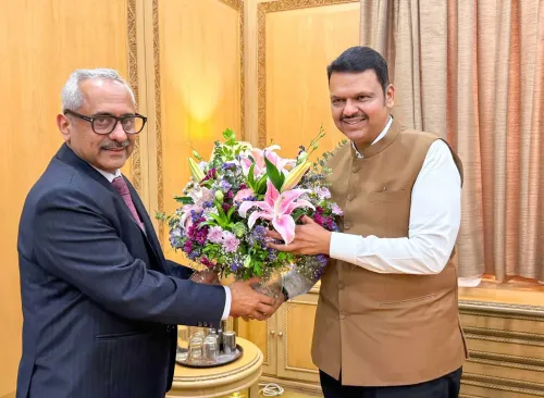
Maharashtra Land Bank digital system to fast-track infra projects: CM Fadnavis

Synopsis
Maharashtra has gone live with a unified digital land bank that pulls fragmented government land records into a single GIS-enabled dashboard — a move CM Fadnavis says will unblock infrastructure projects and end delays in compensatory afforestation compliance. The real test is whether real-time data population keeps pace with the platform's ambition.
Key Takeaways
CM Devendra Fadnavis launched the Maharashtra Land Bank digital system on 2 September , following a Cabinet meeting .
The platform consolidates land data from multiple state departments into a single unified dashboard.
Key features include GIS-based analytics , real-time GPS-tagged site inspections , taluka-level Tehsildar access , and an end-to-end digital requisition workflow .
The system addresses longstanding bottlenecks caused by fragmented land records across administrative levels.
It will help guarantee land availability for compensatory afforestation — a critical compliance requirement for infrastructure clearances.
Senior officials Vikas Kharge , Milind Mhaiskar , and Shailesh Naval briefed the Cabinet on the dashboard's capabilities.
Maharashtra Chief Minister Devendra Fadnavis on Wednesday, 2 September said the newly launched Maharashtra Land Bank digital system will accelerate infrastructure development across the state and guarantee land availability for compensatory afforestation. The unified dashboard, formally launched after Tuesday's Cabinet meeting, consolidates land ownership data from multiple state government departments onto a single platform.
What the System Does
The Maharashtra Land Bank is designed to streamline land searching, verification, and allocation — functions that were previously scattered across fragmented records at various administrative levels. According to the government statement, the platform integrates land records, physical site inspections, GIS analysis, and MIS reporting to make state land governance faster, more transparent, and more efficient.
'The system supports optimal land utilisation, rapid department-specific land mapping, reduced decision-making delays, and enhanced administrative transparency. Furthermore, it enables comprehensive performance reviews via department-, district-, taluka-, and village-wise data aggregation and progress tracking,' Chief Minister Fadnavis said.
Key Operational Features
The platform's core capabilities include record verification based on e-Pherphat (electronic mutation records), on-site inspection and validation, an integrated data repository, taluka-level access for Tehsildars, GIS-based spatial analytics, and an end-to-end digital land requisition process. Dedicated portal logins will allow Tehsildars to update allocation statuses and log condition breaches for government lands and Occupant Class-II (Bhogwatdar Varg-2) lands.
The system also features real-time site inspection logging with GPS coordinates, timestamps, and date stamps, enabling location-aware mapping of available land parcels and pending allocation matters.
Why Fragmented Records Were a Problem
Previously, land records spread across multiple administrative tiers created significant delays in accessing timely information on land availability, current status, area, usage, and allocation-condition violations. The Land Bank was specifically engineered to eliminate these bottlenecks through a single, continuously updated repository — a structural shift from the earlier siloed approach.
This comes amid Maharashtra's push to accelerate large-scale infrastructure projects, where land acquisition and compensatory afforestation compliance have historically been among the most time-consuming regulatory hurdles.
Officials Who Briefed the Cabinet
Additional Chief Secretary (Revenue) Vikas Kharge, Additional Chief Secretary (Forest) Milind Mhaiskar, and Settlement Commissioner Shailesh Naval presented a detailed briefing on the dashboard at the Cabinet meeting, according to the government statement.
With the system now live, the next phase will involve department-level onboarding and real-time data population — the true test of whether the platform delivers on its promise of administrative efficiency.
Point of View
But the critical gap will be whether Tehsildars at the taluka level have the bandwidth and training to keep records current. Compensatory afforestation compliance has long been a chokepoint for infrastructure clearances in the state; if the Land Bank can credibly resolve that, it has real economic value. The harder question is accountability: the system promises transparency, but who audits the auditors when allocation violations are logged?
NationPress
17 Oct 2026
Frequently Asked Questions
What is the Maharashtra Land Bank digital system?
The Maharashtra Land Bank is a unified digital dashboard that consolidates land ownership data from multiple state government departments onto a single platform. Launched after the Cabinet meeting on 2 September, it integrates land records, GIS analysis, site inspections, and MIS reporting to make land governance faster and more transparent.
Why was the Maharashtra Land Bank created?
Fragmented land records spread across multiple administrative levels had been causing significant delays in identifying available land, verifying its status, and processing allocations. The Land Bank was built specifically to resolve these bottlenecks by offering a single, continuously updated repository.
How does the system help infrastructure projects?
By streamlining land search, verification, and allocation, the platform is expected to reduce decision-making delays that have historically slowed infrastructure clearances in Maharashtra. It also guarantees land availability for compensatory afforestation, a mandatory compliance step for many large projects.
What are the key features of the Land Bank portal?
The portal offers record verification via e-Pherphat (electronic mutation records), on-site inspection logging with GPS coordinates and timestamps, GIS-based spatial analytics, taluka-level Tehsildar access, and end-to-end digital land requisition workflows for government departments.
Who briefed the Cabinet on the Maharashtra Land Bank?
Additional Chief Secretary (Revenue) Vikas Kharge, Additional Chief Secretary (Forest) Milind Mhaiskar, and Settlement Commissioner Shailesh Naval presented a detailed briefing on the dashboard at the Cabinet meeting, according to the official government statement.