Western Ghats, north coastal Tamil Nadu brace for moderate rain, thunderstorms on August 11

Synopsis
A persistent low-level coastal trough is keeping Tamil Nadu's Western Ghats and north coastal belt unsettled, with moderate rain and thunderstorms forecast through 16 August. While coastal areas get relief, interior Tamil Nadu faces a counter-intuitive heat spike of up to 3 degrees Celsius — a split weather story worth watching.
Key Takeaways
The RMC Chennai has forecast moderate rain, thunderstorms, and lightning over the Western Ghats and north coastal Tamil Nadu on 11 August .
The wet spell over Western Ghats districts is expected to continue until 16 August .
North interior Tamil Nadu may see maximum temperatures rise by up to 3 degrees Celsius until 14 August .
Vedhiyarendal in Sivaganga recorded the highest rainfall of 5 cm in the 24 hours ending 8:30 am Monday .
Chennai is likely to see partly cloudy skies during the day, with rain and thunderstorms possible by evening or night.
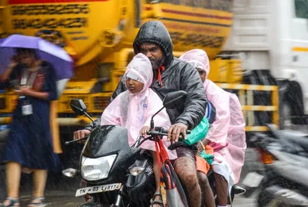
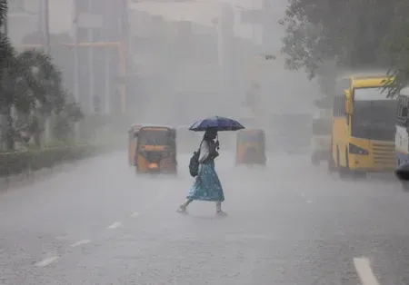
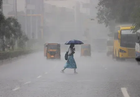
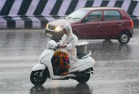
The Regional Meteorological Centre (RMC) in Chennai has forecast moderate rainfall accompanied by thunderstorms, lightning, and gusty winds over districts along the Western Ghats and parts of north coastal Tamil Nadu on Tuesday, 11 August. A lower-level atmospheric trough persisting over the Tamil Nadu coastline is driving the unsettled weather pattern across the state.
Weather Forecast for Key Regions
Under the influence of the coastal trough, districts along the Western Ghats and north coastal Tamil Nadu are expected to receive moderate rain at isolated places through the day. Strong surface winds, thunderstorms, and lightning are also likely in several areas. The RMC has advised residents in lightning-prone zones to exercise caution during active spells.
For Chennai and its suburbs, skies will remain partly cloudy during the day, with conditions turning favourable for rain by evening or night. Moderate rain with thunderstorms and lightning is likely across parts of the city and surrounding areas.
Wet Spell to Persist Through August 16
The RMC noted that the wet spell over Western Ghats districts is expected to continue for several more days, with moderate rainfall at isolated places forecast until 16 August. This extended period of rainfall is expected to offer some respite from the warm conditions prevailing in coastal and southern parts of the state.
However, north interior Tamil Nadu may not see the same relief — maximum temperatures in the region could rise by up to 3 degrees Celsius until 14 August, according to the weather office.
Previous 24-Hour Rainfall Observations
Several locations across Tamil Nadu recorded significant rainfall in the 24 hours ending at 8:30 am on Monday. Vedhiyarendal in Sivaganga district topped the list with 5 cm of rainfall. Tiruchendur in Thoothukudi district, Aruppukottai in Virudhunagar district, and Sholavandan in Madurai district each recorded 4 cm during the same period.
What to Watch
Weather conditions across the Western Ghats belt are expected to remain unsettled as the lower-level atmospheric trough continues to influence Tamil Nadu. Interior districts, by contrast, face the prospect of hotter daytime temperatures over the coming days. Residents along the coast and in hill districts should stay alert to local weather advisories through the week.
Point of View
But rising temperatures in the interior — underscores how unevenly monsoon troughs distribute relief across Tamil Nadu. The RMC's extended outlook to 16 August is useful, but the simultaneous heat advisory for interior districts is the detail most likely to affect daily life for the largest number of people. Local administrations in Sivaganga, Madurai, and Virudhunagar, where recent rainfall has already been significant, should be monitoring drainage and flood-prone zones closely. The absence of a red or orange alert in the current forecast should not breed complacency in low-lying coastal and ghat-adjacent areas.
NationPress
25 Sept 2026
Frequently Asked Questions
Which areas in Tamil Nadu are likely to receive rain on 11 August 2025?
Districts along the Western Ghats and parts of north coastal Tamil Nadu are forecast to receive moderate rain at isolated places on 11 August, according to the RMC Chennai. Chennai and its suburbs may also see rain by evening or night.
How long will the wet spell over the Western Ghats last?
The RMC has forecast that the wet spell over Western Ghats districts will continue for several days, with moderate rainfall at isolated places expected until 16 August.
Will temperatures rise in Tamil Nadu despite the rain?
Yes, in north interior Tamil Nadu, maximum temperatures could increase by up to 3 degrees Celsius until 14 August, even as coastal and ghat districts receive rainfall.
Which place recorded the highest rainfall in Tamil Nadu recently?
Vedhiyarendal in Sivaganga district recorded the highest rainfall of 5 cm in the 24 hours ending at 8:30 am on Monday. Tiruchendur, Aruppukottai, and Sholavandan each recorded 4 cm during the same period.
What is causing the rain in Tamil Nadu right now?
A lower-level atmospheric trough persisting over the coastal areas of Tamil Nadu is creating favourable conditions for rainfall, thunderstorms, and gusty winds across the state, according to the RMC.