Bharat Bhukti Dibas Aug 18: Why Bengal marks a second Independence Day
Synopsis
On 15 August 1947, parts of West Bengal were not celebrating — they had been handed to East Pakistan by a cartographic error. Within days, Lord Mountbatten ordered a correction, and 18 August became 'Bharat Bhukti Dibas.' Decades later, the National Flag still goes up twice in these districts — a ritual that carries more historical weight than most Independence Day ceremonies.
Key Takeaways
A boundary error by Sir Cyril Radcliffe placed parts of Nadia , Murshidabad , Malda , Dinajpur , and North 24 Parganas inside East Pakistan from 14 August 1947 .
Residents of the affected areas did not celebrate Independence Day on 15 August ; reports describe blackouts and protests instead.
Lord Mountbatten ordered a correction; on 17 August 1947 , a revised boundary restored most of the disputed areas to India.
Ashok Sen , District Magistrate of Malda , raised the Indian National Flag on 18 August 1947 to mark the district's return to India.
The date is now observed as Bharat Bhukti Dibas (India Inclusion Day), with the National Flag raised on both 15 August and 18 August across affected districts.
The Chittagong Hill Tracts , dominated by Buddhist tribals, were never restored to India despite protests — a partition error that remains uncorrected.
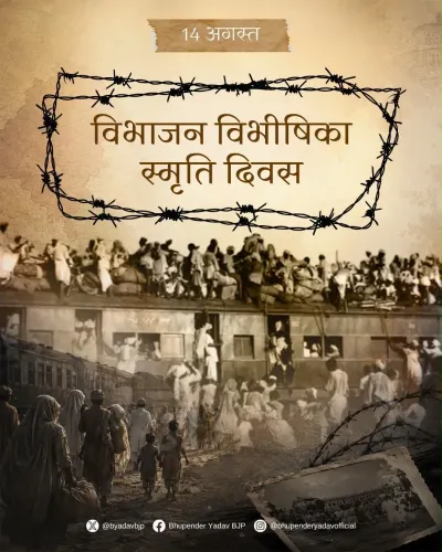
Every year on 18 August, residents across several districts of West Bengal raise the National Flag a second time — not out of ceremony, but out of memory. The occasion is Bharat Bhukti Dibas, or India Inclusion Day, commemorating the date in 1947 when parts of the state were restored to India after a cartographic blunder nearly handed them to East Pakistan, now Bangladesh.
The Radcliffe Blunder That Redrew Bengal Twice
Sir Cyril Radcliffe, the British lawyer tasked with drawing the Partition boundary, was mandated to assign Hindu-majority areas to India and Muslim-majority areas to Pakistan. In the map he finalised, however, Radcliffe erroneously placed parts of Nadia district — along with the whole of Murshidabad and large portions of Malda, Dinajpur, and North 24 Parganas — within East Pakistan's borders. These areas went beyond the Indian frontier even as the rest of the country celebrated its first Independence Day on 15 August 1947.
Residents of the affected districts did not celebrate. Reports from the time describe complete blackouts in some areas and women refusing to cook for two days as a mark of protest. Pakistani flags were hoisted at prominent public buildings, including the Malda district collector's office and the District Library at Krishnanagar, the headquarters of Nadia district. The royal family of Krishnanagar led demonstrations against the boundary decision, and prominent public figures travelled to Kolkata to register their opposition.
Muslim League leaders and workers, meanwhile, reportedly moved through the districts hoisting Pakistani flags. According to accounts from the period, Hindu families kept pots of boiling water in their homes in anticipation of possible attacks — a detail that underscores the communal tension that gripped the region in those hours.
Mountbatten Orders a Correction
Lord Louis Mountbatten, the last British Governor-General of India, directed Radcliffe to correct the error. On the night of 17 August 1947, a revised boundary was announced: only parts of Malda, Dinajpur, and Jalpaiguri districts, along with the three Muslim-majority subdivisions of Meherpur, Chuadanga, and Kustia in Nadia, would transfer to East Pakistan. The rest — including the entirety of Murshidabad — was confirmed as Indian territory.
The correction prompted scenes of relief and celebration. Ashok Sen, then District Magistrate of Malda, raised the Indian National Flag at the district's administrative building, formally signifying its return to India. The date — 18 August 1947 — was thereafter observed as Bharat Bhukti Dibas.
How the Day Is Observed Today
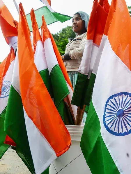
Decades on, the tradition endures. The National Flag is raised at multiple locations across the affected districts on both 15 August and 18 August each year. The dual observance is a living reminder that Independence, for these communities, arrived in two instalments — first as a declaration, and then as a correction.
The Blunder That Was Never Fixed: Chittagong Hill Tracts
Not every error was corrected. The Chittagong Hill Tracts, dominated by Buddhist tribal communities, remained with Pakistan despite widespread protests at the time. The region, now part of Bangladesh, has seen its residents face documented oppression on account of their religion and ethnicity. Unlike the Bengal districts that were restored, the Chittagong Hill Tracts never received a comparable correction — a partition wound that, according to historians and human rights groups, remains unhealed.
The story of Bharat Bhukti Dibas is, at its core, a reminder that the cartography of Partition was neither clean nor final — and that for millions, the map of 1947 was drawn in haste, corrected under pressure, and in some places, never corrected at all.
Point of View
Corrected within 72 hours under political pressure. That Murshidabad — with its Muslim-majority population and Hindu zamindari heritage — ended up in India, while the Buddhist-majority Chittagong Hill Tracts did not, reveals how arbitrary and inconsistent the Radcliffe logic was. The dual flag-raising that continues in these Bengal districts is not nostalgia; it is institutional memory of a near-miss that most Indians outside the region have never heard of. The Chittagong Hill Tracts dimension, still unresolved and still generating documented human rights concerns in Bangladesh, deserves far more sustained attention than it receives in mainstream Indian discourse.
NationPress
30 Sept 2026
Frequently Asked Questions
What is Bharat Bhukti Dibas and why is it observed on 18 August?
Bharat Bhukti Dibas, meaning India Inclusion Day, is observed on 18 August to mark the 1947 correction of a boundary error that had placed several West Bengal districts inside East Pakistan. On the night of 17 August 1947, a revised boundary was announced restoring most of the affected areas to India, and residents began celebrating 18 August as the day they formally returned to Indian territory.
What error did Sir Cyril Radcliffe make in the Partition boundary?
Radcliffe's boundary map incorrectly assigned parts of Nadia district, the whole of Murshidabad, and large portions of Malda, Dinajpur, and North 24 Parganas to East Pakistan, despite many of these areas having significant Hindu populations. The error was identified almost immediately after Partition and was partially corrected on 17 August 1947 on the orders of Lord Mountbatten.
Which areas were restored to India and which were not?
Following the correction, India retained Murshidabad and most of the disputed Bengal districts. Only parts of Malda, Dinajpur, and Jalpaiguri, along with the Nadia subdivisions of Meherpur, Chuadanga, and Kustia, were transferred to East Pakistan. The Chittagong Hill Tracts, however, were never corrected and remained with Pakistan despite protests from its Buddhist tribal population.
How do communities in West Bengal observe Bharat Bhukti Dibas today?
In several districts of West Bengal, the National Flag is raised twice — on 15 August (Independence Day) and again on 18 August (Bharat Bhukti Dibas). The dual observance has continued for decades as a community-led tradition marking the date these areas were confirmed as Indian territory.
What happened to the Chittagong Hill Tracts after Partition?
The Chittagong Hill Tracts, home to Buddhist tribal communities, were assigned to East Pakistan despite widespread protests at the time. Unlike the Bengal districts that were partially corrected, the Chittagong Hill Tracts remained with Pakistan and are now part of Bangladesh, where residents have reportedly continued to face oppression related to their religion and ethnicity.