IMD forecasts heat wave relief for northwest India from May 28
Synopsis
After Sriganganagar hit 48.2°C, the IMD is calling time on northwest India's brutal heat wave — a 6–8 degree temperature drop is forecast between 28 and 30 May, driven by a Western Disturbance and advancing monsoon. But the relief comes with a sting: thunderstorms, 100 kmph gusts, and hail are on the way before cooler, calmer conditions settle in.
Key Takeaways
The IMD forecasts a 6–8 degree Celsius drop in maximum temperatures across northwest India between 28 and 30 May .
Sriganganagar , Rajasthan, recorded 48.2 degrees Celsius in the preceding 24 hours — among the highest in the country.
Thunderstorms with gusty winds reaching 60–80 kmph , and gusts up to 100 kmph , are expected over Punjab , Haryana , Delhi , UP , and Rajasthan on 28–29 May .
Delhi-NCR temperatures are forecast to fall from 44–46°C to 34–37°C by 30 May .
The Southwest Monsoon has advanced into the Arabian Sea , Bay of Bengal , and Lakshadweep , with further progress expected in 2–3 days .
The IMD has advised citizens to stay indoors during thunderstorms and urged farmers to secure crops and harvested produce.
The India Meteorological Department (IMD) has forecast a significant easing of heat wave and severe heat wave conditions across large parts of northwest India beginning Thursday, 28 May, as a Western Disturbance and active monsoon systems drive a major weather shift. Maximum temperatures are expected to fall by 6–8 degrees Celsius over the region between 28 and 30 May, before a slight rise thereafter.
Extreme Heat Recorded Before the Break
In the 24 hours preceding the forecast, several stations logged dangerous heat. Sriganganagar in Rajasthan recorded a peak of 48.2 degrees Celsius, among the highest in the country. Heat wave conditions were observed at many places in west Rajasthan and in isolated pockets across Uttar Pradesh, Haryana, Delhi, and east Madhya Pradesh.
Some pockets in Rajasthan, Vidarbha, and east Madhya Pradesh are likely to continue experiencing hot conditions for a few more days before temperatures drop notably from Friday, 30 May.
Thunderstorms, Gusty Winds, and Hail on the Way
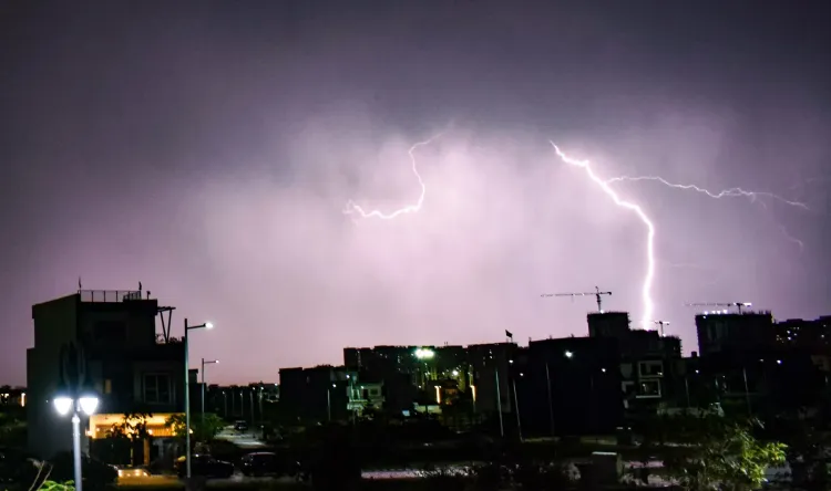
Moderate to severe thunderstorm activity, accompanied by squally winds, is forecast over northwest, central, and east India from 28 to 31 May. Gusty winds reaching 60–80 kmph — with gusts touching up to 100 kmph in some areas — along with lightning and hailstorms, are expected particularly over Punjab, Haryana, Delhi, Uttar Pradesh, and Rajasthan on 28 and 29 May.
Isolated heavy rainfall is also forecast over Northeast India, Odisha, Gangetic West Bengal, Bihar, and parts of South Peninsular India — including Tamil Nadu, Kerala, and Karnataka — in the coming days.
Delhi-NCR Outlook
The national capital is likely to see partly cloudy skies turning generally overcast by evening on 28 May, with a spell of light rain and thunderstorms. Strong winds gusting to 70 kmph are expected during the evening and night. A sharp temperature drop is predicted, with maximums falling to 35–37 degrees Celsius on 29 May and 34–36 degrees Celsius on 30 May — a marked relief after days of scorching 44–46 degrees Celsius heat.
Monsoon Advance and Safety Advisories
The Southwest Monsoon has further advanced into parts of the Arabian Sea, Bay of Bengal, and Lakshadweep, with conditions favourable for more progress in the next 2–3 days. The IMD has issued warnings for thunderstorms, lightning, and strong winds that could damage trees, power lines, and vulnerable structures.
Citizens have been advised to stay indoors during peak thunderstorm activity, avoid sheltering under trees, and unplug electrical appliances. Farmers have been urged to secure standing crops and harvested produce. Authorities have cautioned against complacency given risks of localised flooding, hail, and gusty winds as the transition unfolds.
Point of View
But the transition itself carries risk. A 6–8 degree temperature swing driven by a Western Disturbance and pre-monsoon convection is exactly the kind of rapid shift that produces the most damaging weather events — 100 kmph gusts, flash hail, and localised flooding that urban drainage systems in Delhi and Jaipur are poorly equipped to handle. The heat wave narrative will quickly flip to storm-damage headlines. More broadly, the pattern of extreme heat followed by violent convective breaks is becoming the north Indian summer's new normal, and the gap between IMD's early warning capability and last-mile public response remains the country's most urgent climate-adaptation blind spot.
NationPress
25 Sept 2026
Frequently Asked Questions
When will the heat wave end in northwest India?
The IMD forecasts a significant easing of heat wave conditions across northwest India starting Thursday, 28 May, with maximum temperatures expected to fall by 6–8 degrees Celsius between 28 and 30 May. Some pockets in Rajasthan, Vidarbha, and east Madhya Pradesh may continue experiencing hot conditions for a few more days.
What is the weather forecast for Delhi on 28–30 May?
Delhi is expected to see thunderstorms and light rain by the evening of 28 May, with gusty winds reaching 70 kmph. Temperatures are forecast to drop sharply to 35–37°C on 29 May and 34–36°C on 30 May, down from recent highs of 44–46°C.
Which areas face thunderstorm warnings from the IMD?
The IMD has issued thunderstorm and strong wind warnings for Punjab, Haryana, Delhi, Uttar Pradesh, and Rajasthan on 28 and 29 May. Gusts of 60–80 kmph, with isolated peaks up to 100 kmph, along with lightning and hailstorms, are expected across these states.
How far has the Southwest Monsoon advanced?
As of 28 May, the Southwest Monsoon has advanced into parts of the Arabian Sea, Bay of Bengal, and Lakshadweep. The IMD says conditions are favourable for further progress over the next 2–3 days.
What safety precautions has the IMD advised?
The IMD has advised citizens to stay indoors during peak thunderstorm activity, avoid sheltering under trees, and unplug electrical appliances. Farmers have been urged to secure standing crops and harvested produce ahead of the incoming storms.