Australia on High Alert as Severe Tropical Cyclone Narelle Approaches
Synopsis
Severe Tropical Cyclone Narelle is poised to impact Australia's Queensland coast, prompting emergency alerts for thousands. With winds expected to exceed 250 km/h and heavy rainfall forecasted, residents are urged to prepare for significant disruptions.
Key Takeaways
Cyclone Narelle is a serious threat with potential for Category 5 strength.
Wind gusts may exceed 250 km/h .
Heavy rainfall could lead to flash flooding.
Emergency preparations are crucial for residents in the affected areas.
The cyclone may impact the Northern Territory over the weekend.
Sydney, March 19 (NationPress) Emergency alerts have been issued for thousands as Severe Tropical Cyclone Narelle approaches the northeast coastline of Queensland, Australia.
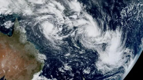
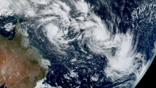
The Bureau of Meteorology (BoM) reported at 7 a.m. Australian Eastern Standard Time on Thursday (2100 GMT on Wednesday) that Tropical Cyclone Narelle had escalated to Category 4 and might further strengthen into a Category 5 storm before making landfall early Friday morning.
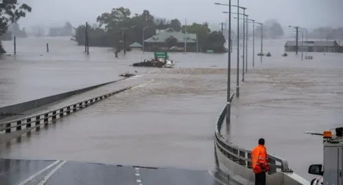
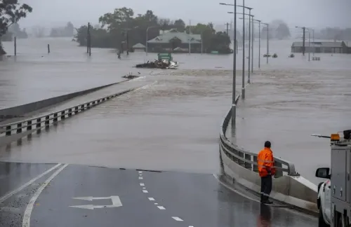
The BoM warned that extremely damaging wind gusts exceeding 250 km/h could occur near the cyclone's center upon landfall, along with heavy rains that may lead to flash flooding starting Thursday evening.
"A significant impact is probable," they stated.
The cyclone was located approximately 440 km off the east coast of Queensland's Cape York Peninsula on Thursday morning, moving westward at a pace of 25 km/h.
An emergency alert has been issued for a 600-km stretch along the peninsula's east coast, affecting Cooktown, which has a population of around 1,800, as well as the Aboriginal community of Lockhart River, consisting of about 500 residents.
Queensland Premier David Crisafulli urged those in the warning area to stockpile emergency provisions.
"We are asking people to take this seriously as it is a substantial system," he informed Australian Broadcasting Corporation television.
The BoM anticipates that the cyclone will temporarily weaken as it traverses a 220-km wide section of the Cape York Peninsula before reaching the Gulf of Carpentaria and intensifying again, potentially affecting the Northern Territory (NT) over the weekend, according to reports from Xinhua News Agency.
Officials in the NT announced on Wednesday night that approximately 500 individuals from the remote community of Numbulwar would be evacuated in the coming days as a precautionary measure.
Point of View
It is crucial to remain informed and prepared. The impending impact of Cyclone Narelle highlights the importance of community readiness and government response in safeguarding lives.
NationPress
7 Oct 2026
Frequently Asked Questions
What category is Cyclone Narelle currently?
Cyclone Narelle is currently categorized as a Category 4 storm.
What areas are under emergency warnings?
Emergency warnings have been issued for a 600-km stretch of the east coast of Queensland, including Cooktown and the Aboriginal community of Lockhart River.
What precautions should residents take?
Residents in the warning area should stock up on emergency supplies and take the warnings seriously.
How fast is Cyclone Narelle moving?
Cyclone Narelle is moving west at a speed of 25 km/h.
Will the cyclone weaken before landfall?
Yes, the BoM expects the cyclone to temporarily weaken as it crosses Cape York Peninsula.