

CM Chandrababu Reviews Bay of Bengal Storm Threat from RTGS

Synopsis
CM Chandrababu Naidu on November 16 reviewed a Bay of Bengal low-pressure system from the RTGS centre at the AP secretariat. Officials warned it could intensify into a cyclone by evening, putting Konaseema, Kakinada, Godavari, Krishna and Guntur districts on alert.
Key Takeaways
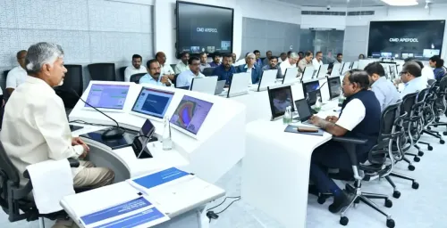
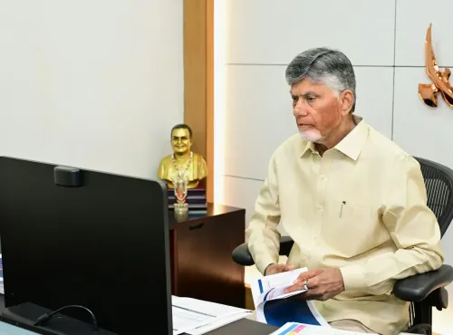
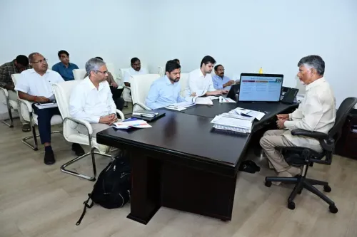
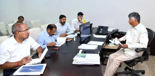
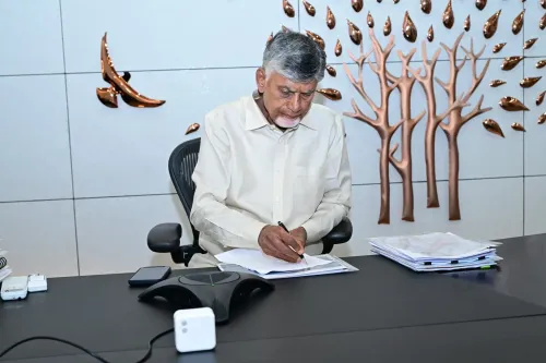
CM Nara Chandrababu Naidu chaired a live review of the Bay of Bengal low-pressure system from the RTGS centre at the Andhra Pradesh state secretariat on November 16, 2026 .
Officials indicated the system could intensify into a depression and then a cyclonic storm by evening of November 16.
Districts placed on alert include Konaseema, Kakinada, East Godavari, West Godavari, Krishna, NTR district, and Guntur .
CM Naidu directed all district administrations to undertake continuous real-time assessment and take preemptive precautions.
Andhra Pradesh's RTGS disaster-monitoring infrastructure was significantly expanded after Cyclone Hudhud (2014) , which caused over ₹21,000 crore in damage.
Coastal communities including fishermen along the state's roughly 1,000 km coastline face the highest immediate risk.
A low-pressure system churning in the Bay of Bengal is on track to intensify into a cyclonic storm by evening — and Chief Minister Nara Chandrababu Naidu is not waiting for it to arrive. On Monday, November 16, the Chief Minister's Office of Andhra Pradesh announced that CM Naidu personally chaired a review of the developing weather system from the Real Time Governance Society (RTGS) centre at the state secretariat in Amaravati.
Districts on Alert as System Eyes the Coast
Officials briefing CM Naidu warned that the low-pressure area is showing signs of strengthening into a depression and subsequently a full cyclone by this evening. The districts squarely in its projected path include Konaseema, Kakinada, East Godavari, West Godavari, Krishna, NTR district, and Guntur — a stretch of coastal and near-coastal Andhra Pradesh that has borne the brunt of Bay of Bengal storms before.
The CM directed district administrations to continuously assess the evolving situation and take preemptive precautions. Fishermen and coastal residents — the most exposed communities when any Bay of Bengal system makes landfall — face the greatest immediate risk.
RTGS War Room: Andhra's Real-Time Eye on the Storm
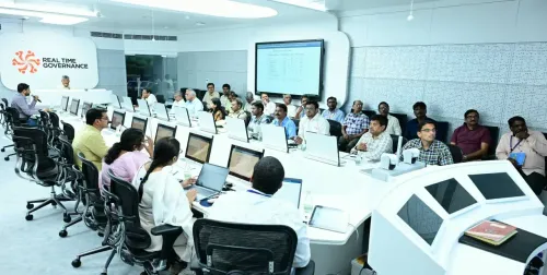
The choice of venue is deliberate. The RTGS centre at the state secretariat functions as a live nerve centre, pulling in real-time data feeds from district collectors, weather agencies, and emergency response units. Andhra Pradesh built out this infrastructure after the devastating Cyclone Hudhud in 2014, which killed over 60 people and caused an estimated ₹21,000 crore in damage to the Visakhapatnam region. The lesson from Hudhud was blunt: early coordination from the top saves lives.
Chandrababu Naidu, who served as Chief Minister during Hudhud and oversaw the state's recovery, has since institutionalised CM-level reviews for any significant Bay of Bengal formation. The RTGS model allows the Chief Minister's office to loop in district-level officials simultaneously, compressing the response chain.
A 1,000-km Coastline That Cannot Afford to Blink
Andhra Pradesh's roughly 1,000-kilometre coastline is one of the longest — and most cyclone-exposed — in India. The Bay of Bengal, warmer and shallower than the Arabian Sea, generates a disproportionate share of the world's tropical cyclones, and Andhra's coastal belt sits directly in their most common tracks. Districts like Konaseema — itself carved out of the old East Godavari district precisely because of its unique administrative and disaster-management needs — have experienced repeated inundation and storm surge damage in recent years.
With the system still intensifying as of the review, the next few hours are critical. The CM's instruction to stay ahead of the curve — continuous assessment, pre-emptive action — signals that the state machinery is treating this not as a drill, but as a live emergency already in motion.
The Bay of Bengal does not give second warnings. Andhra Pradesh's command centre is watching.
Point of View
Not a bureaucratic checkbox. Andhra Pradesh's investment in real-time command infrastructure since 2014 has become a template other Indian coastal states study. The fact that a low-pressure review triggers a CM-level response signals how post-Hudhud trauma reshaped institutional behaviour in the state. How quickly district machinery translates the top-level alert into on-ground precaution — evacuations, fishing bans, shelter readiness — will be the real test.
NationPress
16 Nov 2026
Frequently Asked Questions
Which districts in Andhra Pradesh are on cyclone alert in November 2026?
Konaseema, Kakinada, East Godavari, West Godavari, Krishna, NTR district, and Guntur districts have been flagged by officials as likely to be affected by the Bay of Bengal low-pressure system forming in November 2026.
What is the RTGS centre in Andhra Pradesh and what does it do?
The Real Time Governance Society (RTGS) centre at the Andhra Pradesh state secretariat is a live monitoring hub that connects the Chief Minister's office with district administrations for real-time tracking of emergencies, scheme implementation, and disaster response.
How did Cyclone Hudhud change Andhra Pradesh's disaster response systems?
Cyclone Hudhud in 2014 caused over ₹21,000 crore in damage, prompting Andhra Pradesh to significantly expand its early-warning systems, real-time control rooms, and CM-level review protocols for Bay of Bengal weather formations.
Is the Bay of Bengal low pressure area in November 2026 expected to become a cyclone?
Officials reviewing the situation with CM Chandrababu Naidu on November 16 indicated the system is likely to intensify into a cyclonic storm by evening of that day, though exact trajectory details remain subject to further meteorological assessment.
Why is Andhra Pradesh particularly vulnerable to Bay of Bengal cyclones?
Andhra Pradesh has roughly a 1,000-kilometre coastline directly exposed to the Bay of Bengal, which generates a high proportion of the world's tropical cyclones. Districts like Konaseema and Kakinada sit in the most common storm-track corridors.