Arunachal Governor pushes drone-based GIS mapping for border development
Synopsis
Arunachal Pradesh's Governor isn't just talking technology — he's laying out a blueprint. At the Geo Vision Itanagar seminar, Lt Gen K.T. Parnaik called for a unified State Geospatial Platform, drone-based land surveys, GeoAI-driven disaster warnings and GIS tools for crop planning, framing geospatial governance as the key to unlocking the state's border-region potential.
Key Takeaways
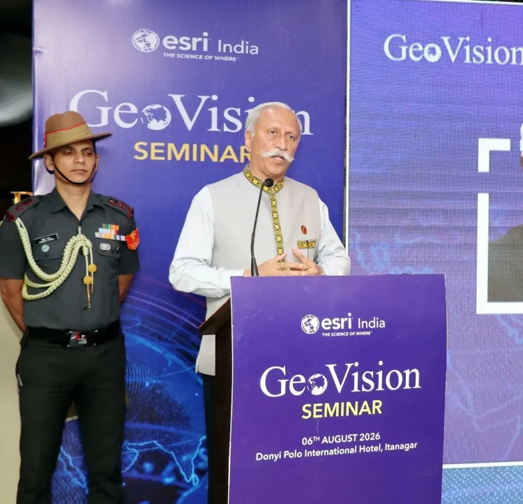
Parnaik (Retd) , Governor of Arunachal Pradesh , spoke at the 'Geo Vision Itanagar' seminar on 6 August .
He advocated drone-based GIS mapping for roads, bridges, schools, healthcare facilities and power networks across the state.
He proposed a State Geospatial Governance Platform integrating data from eight departments including Revenue, Forest and Disaster Management.
He called for GIS-based cadastral surveys and implementation of the ULPIN system to resolve land disputes and attract investment.
Collaboration between APSAC , disaster agencies and district administrations was urged to build hazard maps and early warning systems for floods, landslides and glacial lake outburst floods.
GIS suitability analysis was recommended to identify zones for high-value crops including kiwi, apple, walnut and cardamom to improve farmer livelihoods.
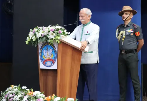
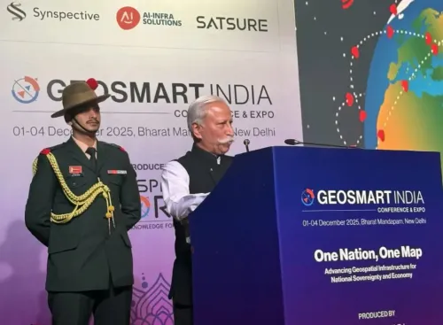
Arunachal Pradesh Governor Lt Gen K.T. Parnaik (Retd) on Thursday, 6 August called for the large-scale deployment of drone-based Geographic Information System (GIS) technology to accelerate infrastructure development and strengthen planning in the state's border regions. He made the remarks while participating in the 'Geo Vision Itanagar' seminar in Itanagar.
Key Developments at the Seminar
Governor Parnaik stressed that GIS technology must be deployed across planning, monitoring and management of roads, bridges, schools, healthcare facilities, power networks and other strategic infrastructure. He said real-time geospatial monitoring would improve project execution, strengthen accountability and support frontier initiatives such as the Vibrant Village Programme.
He underscored that Arunachal Pradesh's rugged terrain, dense forests, dispersed settlements and extensive international borders make technology-driven solutions not optional but essential.
Proposed State Geospatial Governance Platform
Outlining a strategic roadmap, the Governor advocated the creation of a State Geospatial Governance Platform that would integrate data from departments including Revenue, Planning, Rural Development, Public Works, Forest, Agriculture, Disaster Management and Power. A unified geospatial ecosystem, he argued, would enable seamless data sharing, eliminate duplication and promote evidence-based policymaking across the state administration.
He also identified land survey as a critical priority, calling for accelerated GIS-based cadastral surveys, digitisation of land records and implementation of the Unique Land Parcel Identification Number (ULPIN) system. Reliable land information, he said, would help resolve disputes, expedite projects and create an investment-friendly environment.
Disaster Preparedness and Climate Resilience
Governor Parnaik called for collaboration among the Arunachal Pradesh State Application Centre (APSAC), disaster management agencies and district administrations to develop hazard mapping and early warning systems. The focus areas include floods, landslides, earthquakes and glacial lake outburst floods — hazards that pose recurring threats to the state's communities and infrastructure.
He highlighted emerging technologies including GeoAI, Digital Twins, drone analytics and mobile GIS as tools that enable predictive analysis and real-time decision support, making governance more proactive and citizen-centric.
Agriculture, Livelihoods and Social Initiatives
The Governor noted that geospatial technology can extend benefits to agriculture, horticulture, forestry, biodiversity conservation and urban planning. GIS-based suitability analysis, he said, can identify optimal locations for high-value crops such as kiwi, apple, orange, walnut and cardamom, directly improving farmers' livelihoods.
He also pointed to GIS's potential in supporting social campaigns, including the 'Nasha Mukt Yuva for Viksit Bharat' initiative, through identification of vulnerable areas and targeted interventions. GIS-enabled dashboards, he added, can provide transparent, real-time insights into developmental projects, ensuring better utilisation of public resources.
The seminar signals a broader push to embed geospatial governance into Arunachal Pradesh's administrative framework, with the state's strategic border position adding urgency to the agenda.
Point of View
And the push for drone-based mapping and a unified geospatial platform carries strategic weight beyond administrative efficiency. Yet the gap between visionary roadmaps and ground-level implementation in India's northeastern states has historically been wide. The ULPIN system, for instance, has been in national rollout for years with uneven adoption. Whether Itanagar can build the institutional capacity to operationalise GeoAI and Digital Twins — in terrain that defeats conventional surveying — is the real question this seminar left unanswered.
NationPress
21 Sept 2026
Frequently Asked Questions
What did Arunachal Pradesh Governor Lt Gen K.T. Parnaik say at the Geo Vision Itanagar seminar?
Governor Lt Gen K.T. Parnaik called for large-scale deployment of drone-based GIS technology to accelerate infrastructure development and border area planning in Arunachal Pradesh. He proposed a State Geospatial Governance Platform integrating data from multiple departments and highlighted uses in disaster management, agriculture and land records.
What is the proposed State Geospatial Governance Platform for Arunachal Pradesh?
It is a unified digital platform proposed by Governor Parnaik that would integrate geospatial data from departments including Revenue, Planning, Rural Development, Public Works, Forest, Agriculture, Disaster Management and Power. The platform aims to enable seamless data sharing, eliminate duplication and support evidence-based policymaking across the state.
How does GIS technology help with disaster preparedness in Arunachal Pradesh?
Governor Parnaik called for collaboration between APSAC, disaster management agencies and district administrations to develop hazard mapping and early warning systems. The focus is on threats including floods, landslides, earthquakes and glacial lake outburst floods, which pose recurring risks to the state.
What is the ULPIN system and why is it relevant to Arunachal Pradesh?
The Unique Land Parcel Identification Number (ULPIN) is a national system for digitising and uniquely identifying land parcels. Governor Parnaik stressed its implementation in Arunachal Pradesh to resolve land disputes, expedite infrastructure projects and create an investment-friendly environment in the state.
How can GIS technology benefit farmers in Arunachal Pradesh?
GIS-based suitability analysis can identify optimal locations for high-value crops such as kiwi, apple, orange, walnut and cardamom, according to Governor Parnaik. This targeted approach to agricultural planning can directly improve farmer livelihoods in the state's diverse terrain.