Bihar floods worsen: Ganga nears HFL at Patna, 1 lakh hit in Madhepura
Synopsis
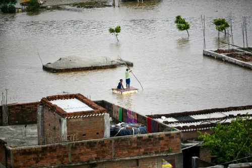
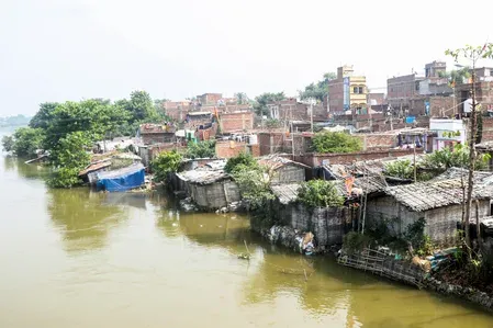
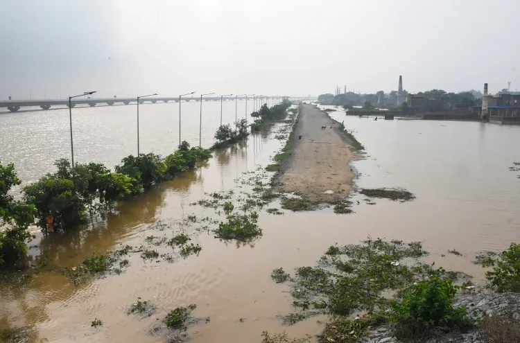
Bihar's flood crisis deepened on 4 September as the Ganga hurtled toward its Highest Flood Level at Patna's Gandhi Ghat and Hathidah, with the Dardha River already 3.07 metres above the danger mark. Nearly one lakh people are displaced in Madhepura alone, road links have snapped across 20 panchayats in Vaishali, and a railway line in Raghopur is at risk — signalling a multi-district emergency still far from its peak.
Key Takeaways
The Ganga is expected to breach its Highest Flood Level (HFL) at Gandhi Ghat, Patna and Hathidah, Mokama by Friday night, 4 September .
The Dardha River at Kolhachak is flowing 3.07 metres above the danger mark — the highest exceedance reported in the state.
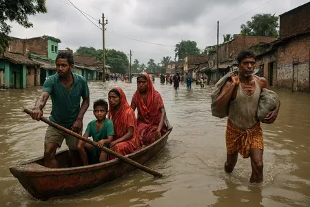
Nearly one lakh people are affected in Madhepura ; authorities have deployed 35 boats for rescue operations.
The Disaster Management Department has issued alerts for 8 districts : Bhojpur, Patna, Saran, Vaishali, Nalanda, Begusarai, Lakhisarai, and Jehanabad.
Nearly 20 panchayats in Raghopur block, Vaishali have lost road connectivity, hampering relief movement.
A railway line in Raghopur is at risk after a marginal embankment was nearly fully eroded by the Ganga.
The flood situation in Bihar deteriorated sharply on Friday, 4 September, as water levels of major rivers — including the Ganga, Gandak, Punpun, and Dardha — continued to surge, inundating fresh areas across the state. According to the Water Resources Department, the Ganga is expected to breach its Highest Flood Level (HFL) at Patna's Gandhi Ghat and at Hathidah in Mokama by Friday night.
River Levels and Danger Marks
In Patna, the Ganga was recorded 1.17 metres above the danger mark at Digha, 1.67 metres above at Gandhi Ghat, and 1.32 metres above at Hathidah. The Punpun River at Shripalpur was flowing 2.29 metres above the danger mark, while the Dardha River at Kolhachak was a critical 3.07 metres above the danger level. In Munger, the Ganga rose by 36 cm in a single 24-hour period. In Khagaria, the Ganga was flowing 1.01 metres above the danger mark, with the Kosi, Bagmati, and Burhi Gandak rivers also running significantly above danger levels.
Districts on Alert, Relief Operations Under Way
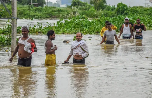
The state Disaster Management Department has issued alerts for residents living along riverbanks and in low-lying areas of Bhojpur, Patna, Saran, Vaishali, Nalanda, Begusarai, Lakhisarai, and Jehanabad, urging them to remain vigilant and take precautionary measures. In Madhepura district's Alamnagar and Chausa blocks, nearly one lakh people have been affected, prompting authorities to deploy 35 boats for rescue and relief operations.
Agricultural Damage and Infrastructure Hit
In Bhagalpur, the Ganga rose by 15 cm in 24 hours, pushing floodwaters back into diara areas of Nathnagar, Naugachia, and Pirpainti. Vast tracts of agricultural land, standing crops, and fodder have been submerged. In Banka district, a diversion road near Barsanda village built for an under-construction bridge was washed away by the Mirchni River. Several villages in Saharsa have also been inundated.
Road Connectivity Severed Across Multiple Districts
Floodwaters have cut road links across several districts. In West Champaran, traffic has come to a standstill on the Yogapatti-Chhota Chaumukha-Siswa Mangalpur road, with water flowing two to three feet above the roadway. Around two dozen villages in Samastipur have been affected, and traffic movement on the Kachchi Dargah-Bidupur six-lane bridge in Patna has been disrupted. In Raghopur block of Vaishali district, all panchayats have been impacted, with nearly 20 panchayats losing road connectivity to the main network, severely hampering relief operations.
Railway Line at Risk in Raghopur
In Raghopur, severe erosion and land subsidence have been reported along a railway line after the near-complete erosion of a marginal embankment. The main channel of the Ganga has reportedly shifted dangerously close to the tracks, affecting areas within a two-to-three-kilometre radius. This raises fresh concerns about rail disruptions in an already connectivity-starved region. With river levels still rising, authorities warn that the situation could worsen further before any relief is in sight.
Point of View
Who was responsible, and what was rebuilt. Without that accountability loop, Bihar will issue the same district alerts next September.
NationPress
4 Sept 2026
Frequently Asked Questions
How bad is the Bihar flood situation on 4 September?
The flood situation in Bihar worsened significantly on 4 September, with the Ganga, Gandak, Punpun, Dardha, Kosi, Bagmati, and Burhi Gandak rivers all flowing above danger levels. The Ganga is expected to breach its Highest Flood Level at Patna's Gandhi Ghat and at Hathidah in Mokama by Friday night, and nearly one lakh people have been affected in Madhepura district alone.
Which districts in Bihar are on flood alert?
The Bihar Disaster Management Department has issued alerts for eight districts: Bhojpur, Patna, Saran, Vaishali, Nalanda, Begusarai, Lakhisarai, and Jehanabad. Residents in riverbank and low-lying areas have been urged to stay vigilant and take precautionary measures.
What is the Ganga's water level at Patna right now?
As of 4 September, the Ganga was flowing 1.67 metres above the danger mark at Gandhi Ghat, 1.17 metres above at Digha, and 1.32 metres above at Hathidah — and is expected to cross the Highest Flood Level (HFL) at Gandhi Ghat and Hathidah by Friday night, according to the Water Resources Department.
How many people have been affected by the Bihar floods?
In Madhepura district's Alamnagar and Chausa blocks alone, nearly one lakh people have been affected. Dozens of villages across Saharsa, Samastipur, West Champaran, and Banka have also been inundated, with the total state-wide figure expected to rise as river levels continue to climb.
Is the railway network affected by Bihar floods?
Yes. In Raghopur, a railway line is at risk after severe erosion and land subsidence were reported following the near-complete erosion of a marginal embankment. The main channel of the Ganga has reportedly shifted dangerously close to the tracks, affecting an area within a two-to-three-kilometre radius.