CMFRI Vembanad cruise maps 15 islands, century-old mangroves and Pokkali fields
Synopsis
CMFRI took researchers, students, and tourism professionals on a backwater cruise across 15 Vembanad islands on World Tourism Day, revealing century-old mangroves at Korangot and the ancient Pokkali rice-fish rotation at Pizhala — a rare firsthand encounter with an ecosystem that is both scientifically significant and under mounting pressure from plastic pollution and coastal development.
Key Takeaways
CMFRI conducted a backwater cruise on 29 September 2026 through Kerala's Vembanad lake as part of the Swachhata Hi Seva 2026 campaign.
The cruise covered 15 islands , travelling from Marine Drive Jetty, Kochi to Kadamakkudy .
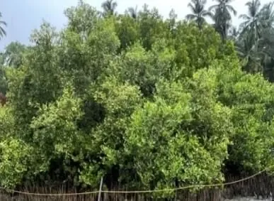
Participants observed nearly century-old mangroves at Korangot , which serve as storm barriers, fish nurseries, and carbon stores.
The traditional Pokkali farming system at Pizhala integrates salt-tolerant rice cultivation and fish-prawn farming within the same fields across seasons.
A clean-up drive highlighted plastic and waste pollution threatening the fragile Vembanad wetland ecosystem.
The cruise is part of CMFRI's Fish Walk initiative, led by coordinator Dr Mirium Paul Sreeram , aimed at taking conservation science to wider audiences experientially.
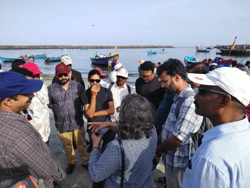
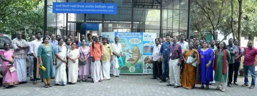
The ICAR-Central Marine Fisheries Research Institute (CMFRI), a national institute under the Indian Council of Agricultural Research (ICAR), on 29 September 2026 conducted a backwater cruise through the ecological landscape of Kerala's Vembanad lake, taking students, researchers, and conservation professionals across 15 islands, nearly century-old mangrove stands, and traditional Pokkali farming fields. The cruise was organised as part of the nationwide Swachhata Hi Seva 2026 campaign and timed to coincide with World Tourism Day.
The Route and What Participants Witnessed
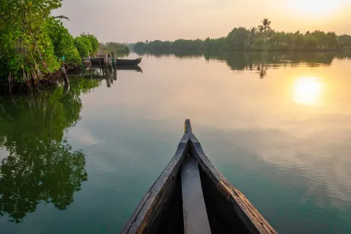
The vessel departed from Marine Drive Jetty in Kochi and made its way to Kadamakkudy, passing through island clusters that are seldom seen on a standard tourist itinerary. The familiar open-water image of Vembanad quickly gave way to a layered landscape of inlets, vegetation corridors, and inhabited islands whose communities have long depended on the backwaters for their livelihoods.
At Korangot, participants came face to face with mangroves whose large trunks and interlocking root systems indicated decades — in some cases close to a century — of undisturbed growth. CMFRI scientists explained that these forests perform multiple ecological functions: they act as natural barriers against storm surges and coastal flooding, serve as breeding and nursery grounds for fish and aquatic organisms, and sequester carbon, helping buffer coastal ecosystems from the accelerating effects of climate change.
The Pokkali System: Farming and Fishing in One Field
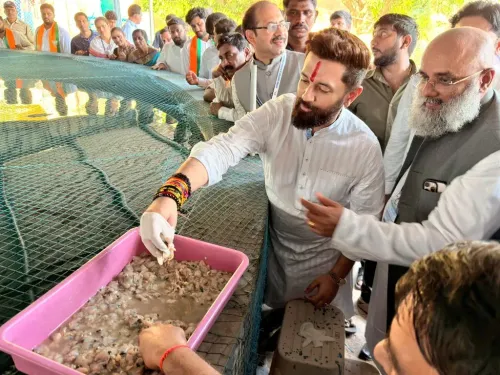
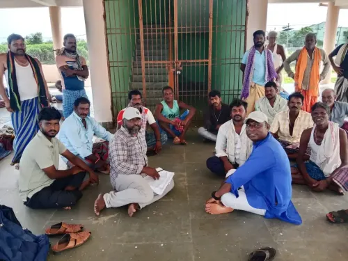
At Pizhala, the cruise spotlighted the Pokkali farming system — a centuries-old practice shaped entirely by the changing salinity of the estuary. Salt-tolerant rice varieties are cultivated during one season; when the tide turns and salinity rises, the same fields convert to fish and prawn farming. Agriculture and aquaculture thus follow the natural rhythm of Vembanad, with no artificial inputs needed to switch between cycles. For many participants, witnessing this integration firsthand offered a sharper understanding than any classroom account could provide.
Pollution and Conservation Pressures
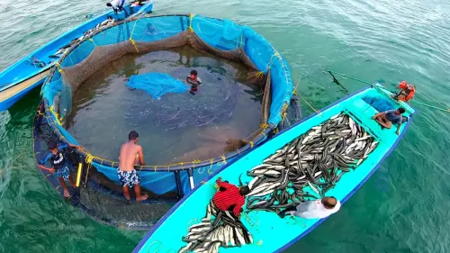
The cruise was not only observational. A clean-up drive along the backwaters drew direct attention to the presence of plastic waste and other pollutants threatening the fragile ecosystem. Onboard discussions covered wetland conservation, aquatic biodiversity, cage fish farming practices, and the sustainable management of natural resources. The Vembanad ecosystem, scientists noted, sustains island communities, traditional livelihoods, and cultural practices that have evolved around the water over generations — pressures on any one element ripple through the whole.
CMFRI's Fish Walk Initiative
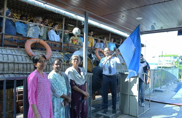
CMFRI Director Dr Grinson George flagged off the cruise from Marine Drive Jetty. MLA Tony Chammany interacted with participants at the Kadamakkudy Pokkali fields. The cruise is part of CMFRI's broader Fish Walk programme, which takes scientific research out of laboratories and into the natural habitats under study. Dr Mirium Paul Sreeram, coordinator of the initiative, described its purpose: 'CMFRI's Fish Walk is designed as a series of innovative ways of exploring aquatic life and biodiversity, aimed at taking the message of conservation to a wider audience through engaging and experiential approaches.'
As climate pressures and urbanisation continue to encroach on India's coastal wetlands, initiatives that connect communities, policymakers, and researchers to these ecosystems in experiential ways may prove as important as any laboratory finding.
Point of View
One of India's largest Ramsar wetlands, continues to receive plastic and effluent at a rate that no number of awareness cruises can offset without regulatory enforcement. The real measure of CMFRI's outreach will be whether it translates into pressure on state agencies to strengthen pollution controls and wetland buffer zones before the mangroves that took a century to grow are lost in a decade.
NationPress
29 Sept 2026
Frequently Asked Questions
What is the CMFRI Vembanad cruise and why was it organised?
The CMFRI Vembanad cruise was a backwater expedition organised by the ICAR-Central Marine Fisheries Research Institute on 29 September 2026, as part of the nationwide Swachhata Hi Seva 2026 campaign and World Tourism Day. It took students, researchers, teachers, and tourism professionals across 15 islands of Vembanad lake to showcase its mangroves, Pokkali farming system, and wetland biodiversity.
What is the Pokkali farming system seen during the cruise?
The Pokkali system is a traditional land-use practice in Kerala's coastal wetlands where salt-tolerant rice is cultivated in one season and the same fields convert to fish and prawn farming when salinity rises in the other. It represents one of the few agricultural systems in the world that integrates crop farming and aquaculture within a single piece of land across annual cycles, guided entirely by the estuary's natural rhythms.
Why are the Vembanad mangroves ecologically significant?
The mangroves at Korangot, some nearly a century old, act as natural barriers against storm surges and coastal flooding, provide breeding and nursery grounds for fish and aquatic organisms, and sequester carbon. CMFRI scientists highlighted their role in protecting coastal ecosystems from the effects of climate change — functions that are increasingly critical as extreme weather events intensify.
What threats does the Vembanad ecosystem currently face?
A clean-up drive during the cruise revealed the presence of plastic waste and other pollutants in the backwaters. Broader threats discussed included pollution, wetland encroachment, loss of aquatic biodiversity, and unsustainable resource use — all of which risk disrupting the interconnected relationship between Vembanad's mangroves, fisheries, Pokkali fields, and island communities.
What is CMFRI's Fish Walk initiative?
Fish Walk is an outreach programme by CMFRI designed to take marine and aquatic science out of laboratories and into natural habitats through experiential field engagements. Coordinated by Dr Mirium Paul Sreeram, it aims to bring the conservation message to a wider audience — including students, tourism professionals, and the general public — through direct encounters with the ecosystems being studied.